MyTopo
Skaar NW Montana US Topo Map
Couldn't load pickup availability
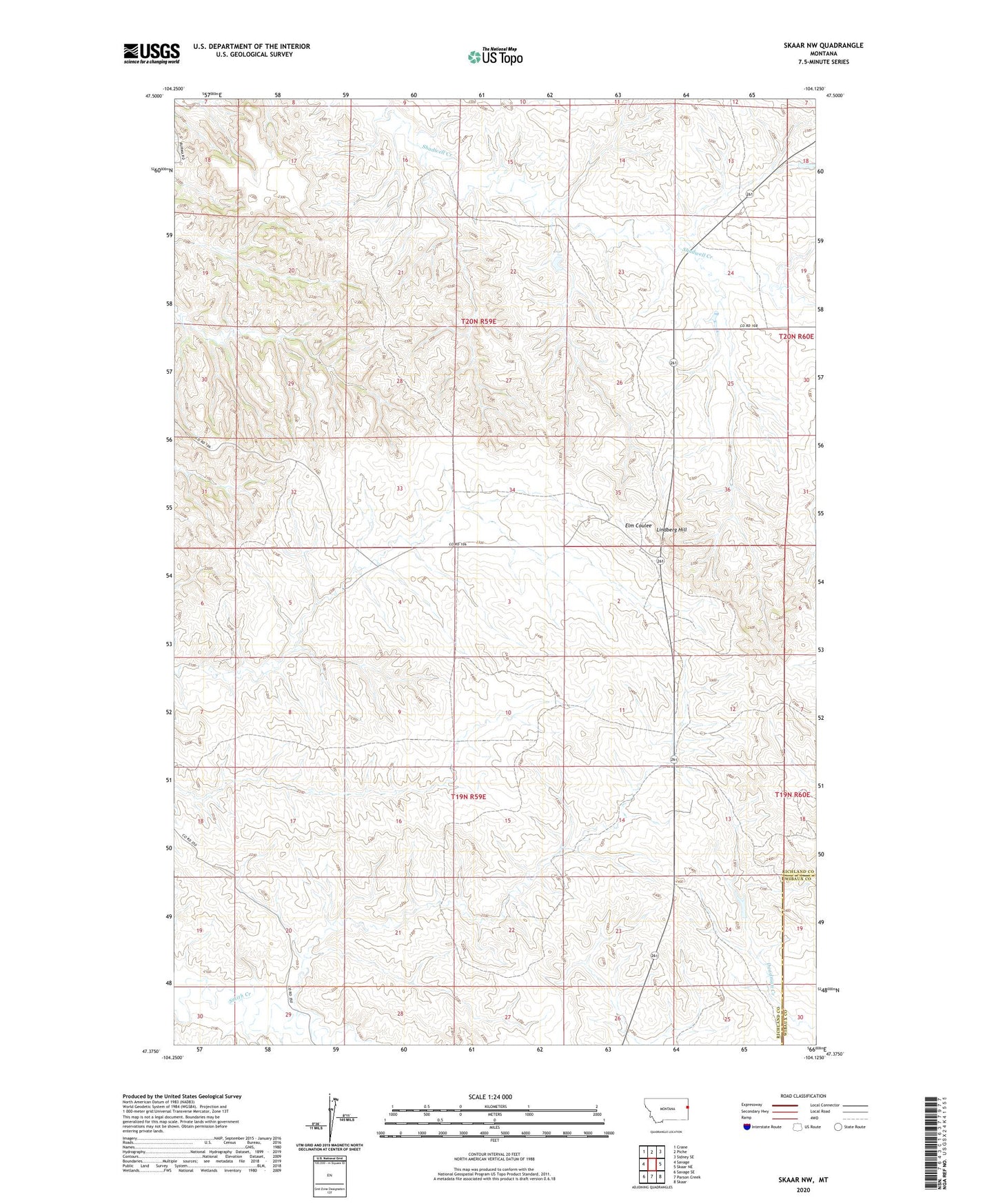
2024 topographic map quadrangle Skaar NW in the state of Montana. Scale: 1:24000. Based on the newly updated USGS 7.5' US Topo map series, this map is in the following counties: Richland, Wibaux. The map contains contour data, water features, and other items you are used to seeing on USGS maps, but also has updated roads and other features. This is the next generation of topographic maps. Printed on high-quality waterproof paper with UV fade-resistant inks.
Quads adjacent to this one:
West: Savage
Northwest: Crane
North: Piche
Northeast: Sidney SE
East: Skaar NE
Southeast: Skaar
South: Parson Creek
Southwest: Savage SE
This map covers the same area as the classic USGS quad with code o47104d2.
Contains the following named places: 19N59E02ACDD01 Well, 19N59E05DCDB01 Well, 19N59E07AAD_01 Well, 19N59E10CCBC01 Well, 19N59E12BCCA01 Well, 19N59E13BDAD01 Well, 19N59E25ABAB01 Well, 20N59E13ABBA01 Well, 20N59E35CBAC01 Well, 20N60E19CCCB01 Well, Born Free Dam, Clark School, Lindberg Hill, The Ox Dam