MyTopo
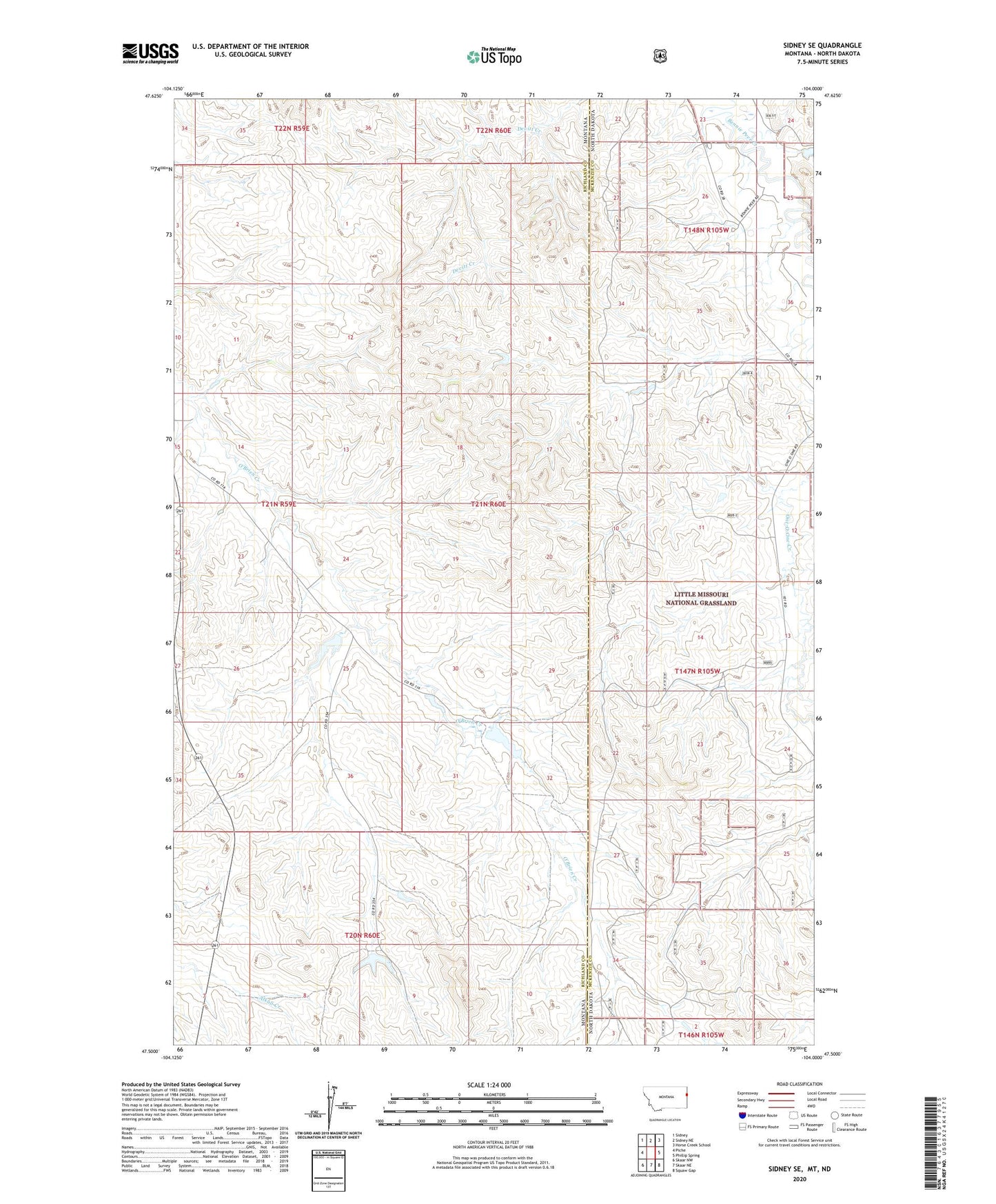
Sidney SE Montana US Topo Map
Couldn't load pickup availability
Also explore the Sidney SE Forest Service Topo of this same quad for updated USFS data
2024 topographic map quadrangle Sidney SE in the states of Montana, North Dakota. Scale: 1:24000. Based on the newly updated USGS 7.5' US Topo map series, this map is in the following counties: Richland, McKenzie. The map contains contour data, water features, and other items you are used to seeing on USGS maps, but also has updated roads and other features. This is the next generation of topographic maps. Printed on high-quality waterproof paper with UV fade-resistant inks.
Quads adjacent to this one:
West: Piche
Northwest: Sidney
North: Sidney NE
Northeast: Horse Creek School
East: Phillip Spring
Southeast: Squaw Gap
South: Skaar NE
Southwest: Skaar NW
Contains the following named places: 20N60E04BAAD01 Well, 20N60E10BDBC01 Well, 21N59E13CDC_01 Well, 21N59E14BCA_01 Well, 21N59E23DBAA01 Well, 21N59E35CCAA01 Well, 21N60E05BADC01 Well, 21N60E18DCBC01 Well, 21N60E29BABA01 Well, 59270, Buxbaum Number 2 Dam, Folkoord Dam, Klandi Ranch, Klandl Headquarters Flowing Water Well, Olson Dam