MyTopo
Crane NE Montana US Topo Map
Couldn't load pickup availability
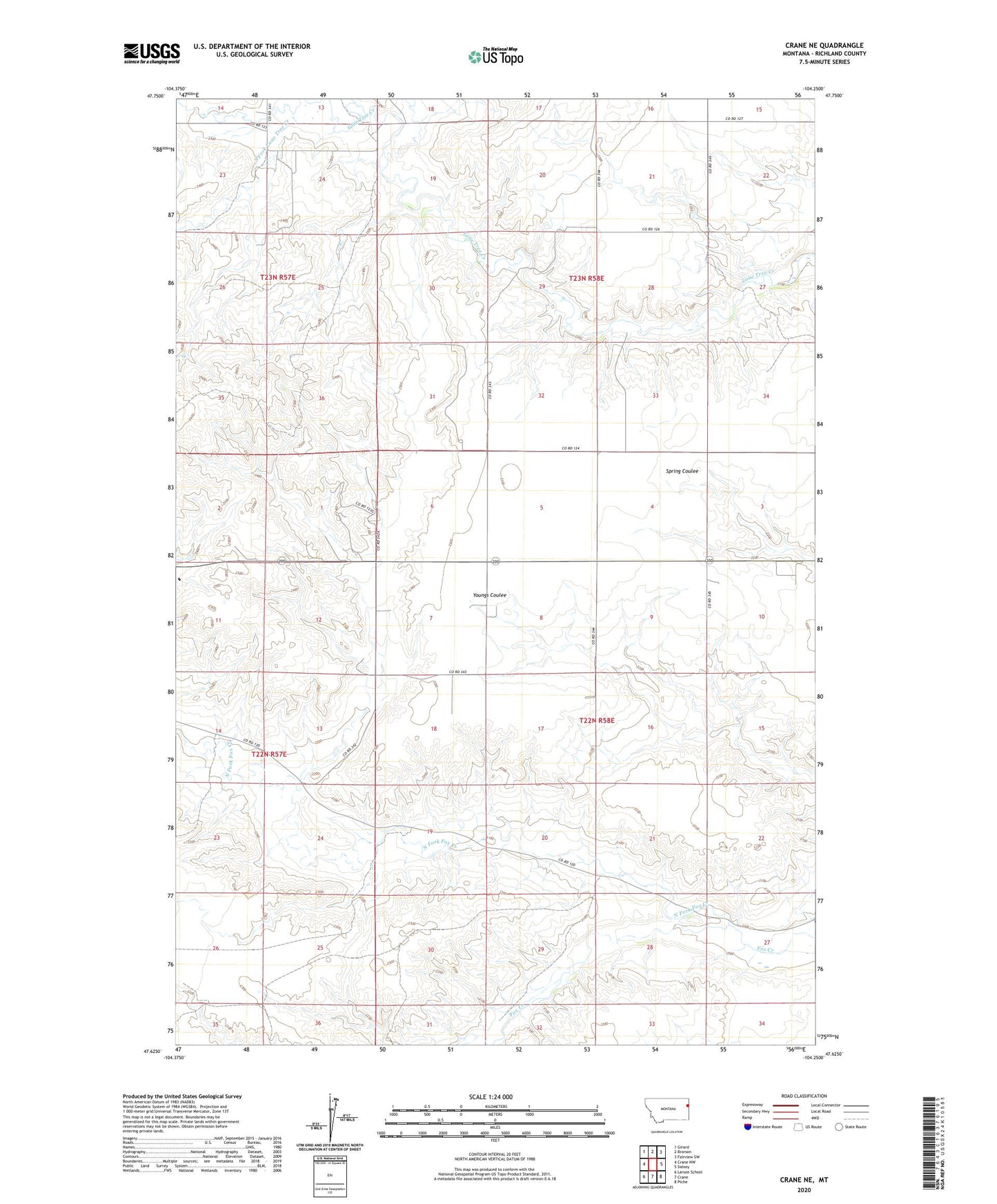
2024 topographic map quadrangle Crane NE in the state of Montana. Scale: 1:24000. Based on the newly updated USGS 7.5' US Topo map series, this map is in the following counties: Richland. The map contains contour data, water features, and other items you are used to seeing on USGS maps, but also has updated roads and other features. This is the next generation of topographic maps. Printed on high-quality waterproof paper with UV fade-resistant inks.
Quads adjacent to this one:
West: Crane NW
Northwest: Girard
North: Brorson
Northeast: Fairview SW
East: Sidney
Southeast: Piche
South: Crane
Southwest: Larson School
This map covers the same area as the classic USGS quad with code o47104f3.
Contains the following named places: 22N58E06BABD01 Well, 22N58E07DCCD01 Well, 22N58E10CCCC01 Well, 22N58E19BDCB01 Well, 23N58E19BABB01 Well, 23N58E22CC__01 Well, 23N58E33ADAC01 Well, North Fork Fox Creek, North Fork Lone Tree Creek, South Fork Lone Tree Creek