MyTopo
Pigtail Coulee Montana US Topo Map
Couldn't load pickup availability
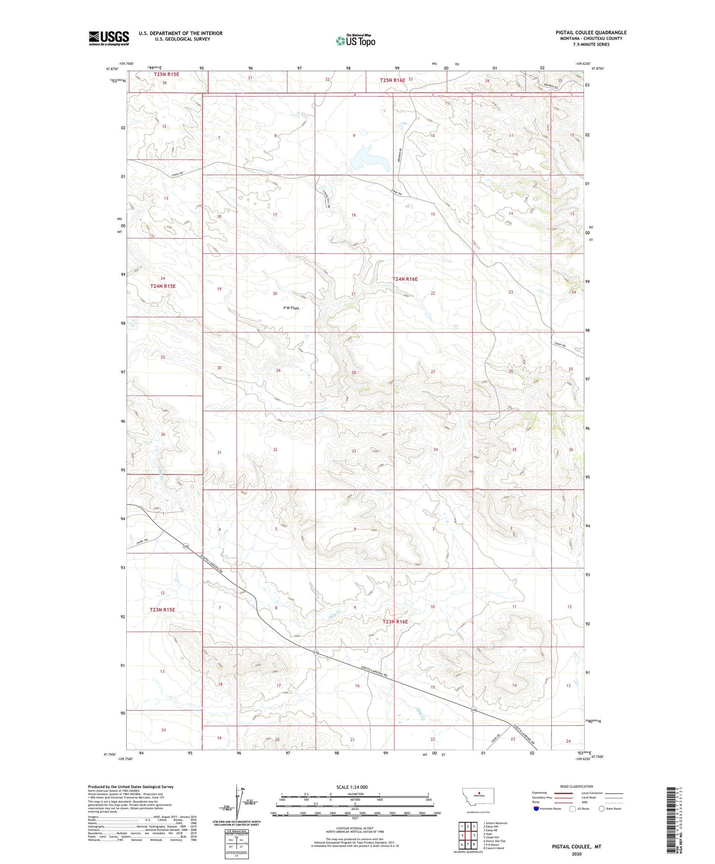
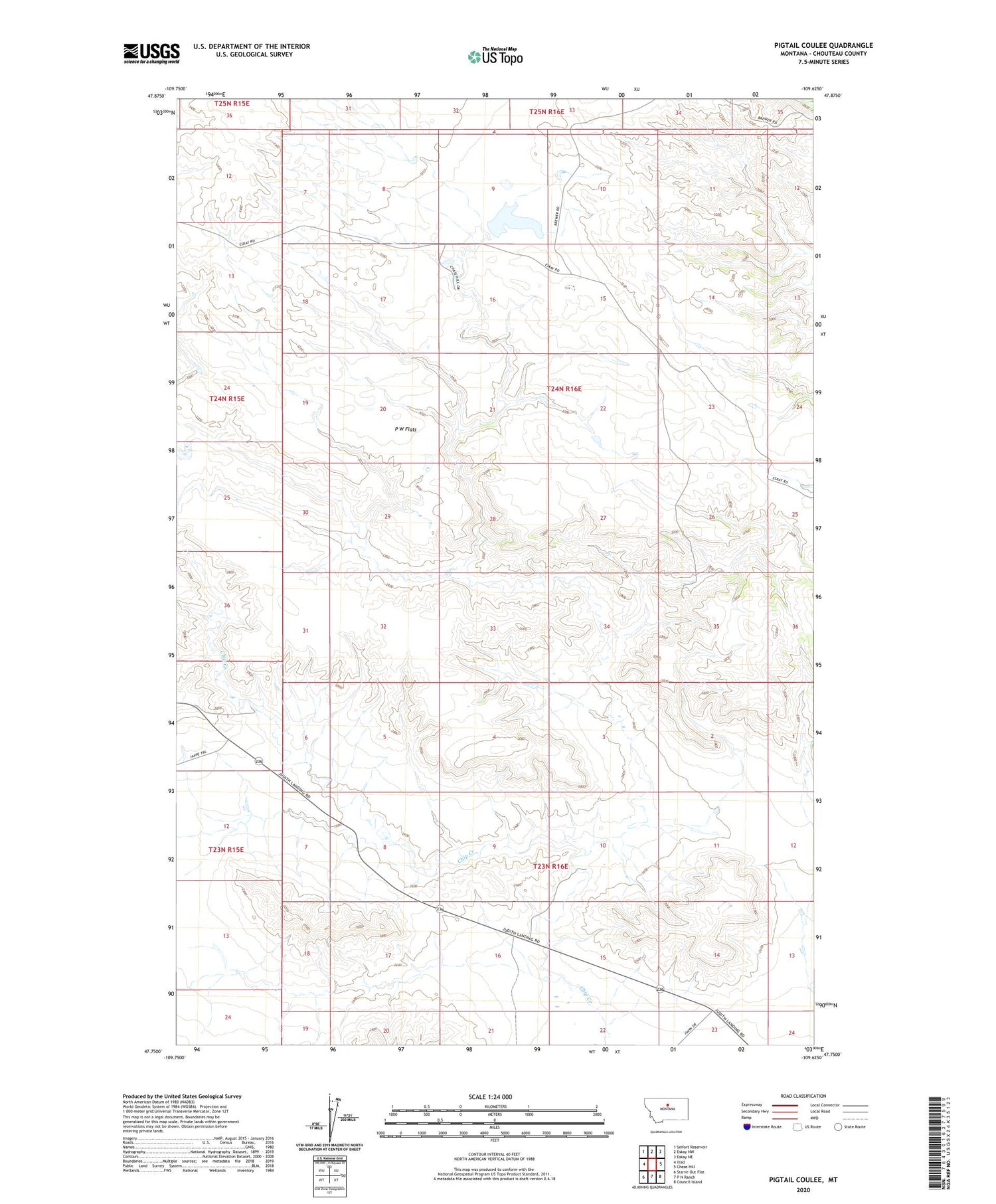
2020 topographic map quadrangle Pigtail Coulee in the state of Montana. Scale: 1:24000. Based on the newly updated USGS 7.5' US Topo map series, this map is in the following counties: Chouteau. The map contains contour data, water features, and other items you are used to seeing on USGS maps, but also has updated roads and other features. This is the next generation of topographic maps. Printed on high-quality waterproof paper with UV fade-resistant inks.
Quads adjacent to this one:
West: Iliad
Northwest: Seifort Reservoir
North: Eskay NW
Northeast: Eskay NE
East: Chase Hill
Southeast: Council Island
South: P N Ranch
Southwest: Starve Out Flat
Contains the following named places: Chip Dipper Dam, Clinard Coulee, Clutchbaugh Coulee, Delilah Dam, Eightmile Coulee, Eskay, Eskay Post Office, Eskay School, Fourmile Hill, Holden Coulee, Johns Coulee, Johnson Hill, Kabo School, Kings Coulee, Lidstone Hill, P W Flats, P W Ridge, Pigtail Coulee, PW Coulee, Taylor Coulee, Tox Hill