MyTopo
Eskay NW Montana US Topo Map
Couldn't load pickup availability
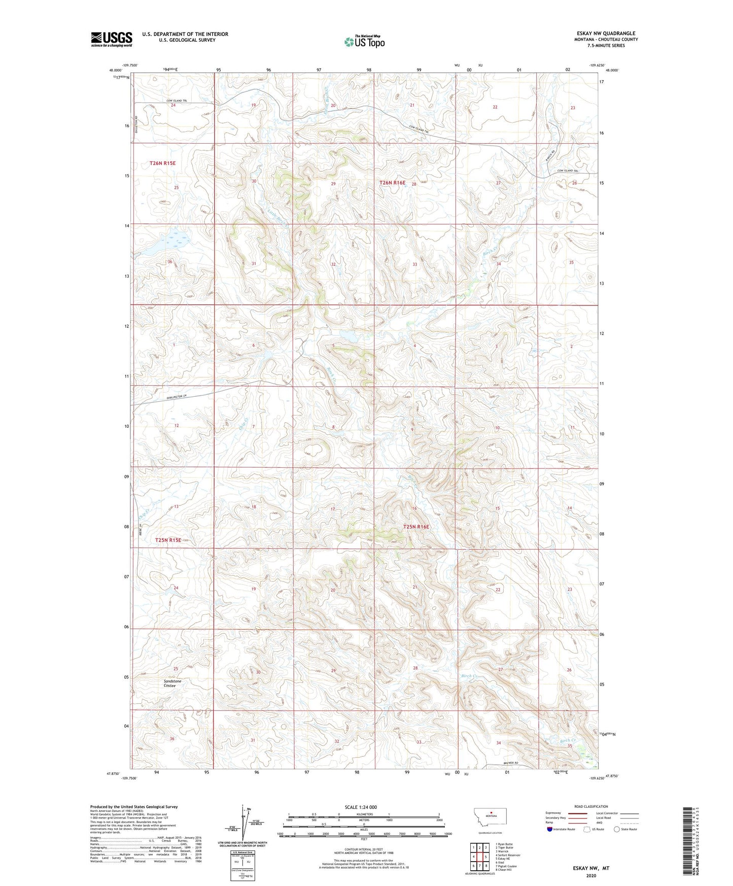
2024 topographic map quadrangle Eskay NW in the state of Montana. Scale: 1:24000. Based on the newly updated USGS 7.5' US Topo map series, this map is in the following counties: Chouteau. The map contains contour data, water features, and other items you are used to seeing on USGS maps, but also has updated roads and other features. This is the next generation of topographic maps. Printed on high-quality waterproof paper with UV fade-resistant inks.
Quads adjacent to this one:
West: Seifort Reservoir
Northwest: Ryan Butte
North: Tiger Butte
Northeast: Warrick
East: Eskay NE
Southeast: Chase Hill
South: Pigtail Coulee
Southwest: Iliad
This map covers the same area as the classic USGS quad with code o47109h6.
Contains the following named places: Little Birch Creek