MyTopo
P N Ranch Montana US Topo Map
Couldn't load pickup availability
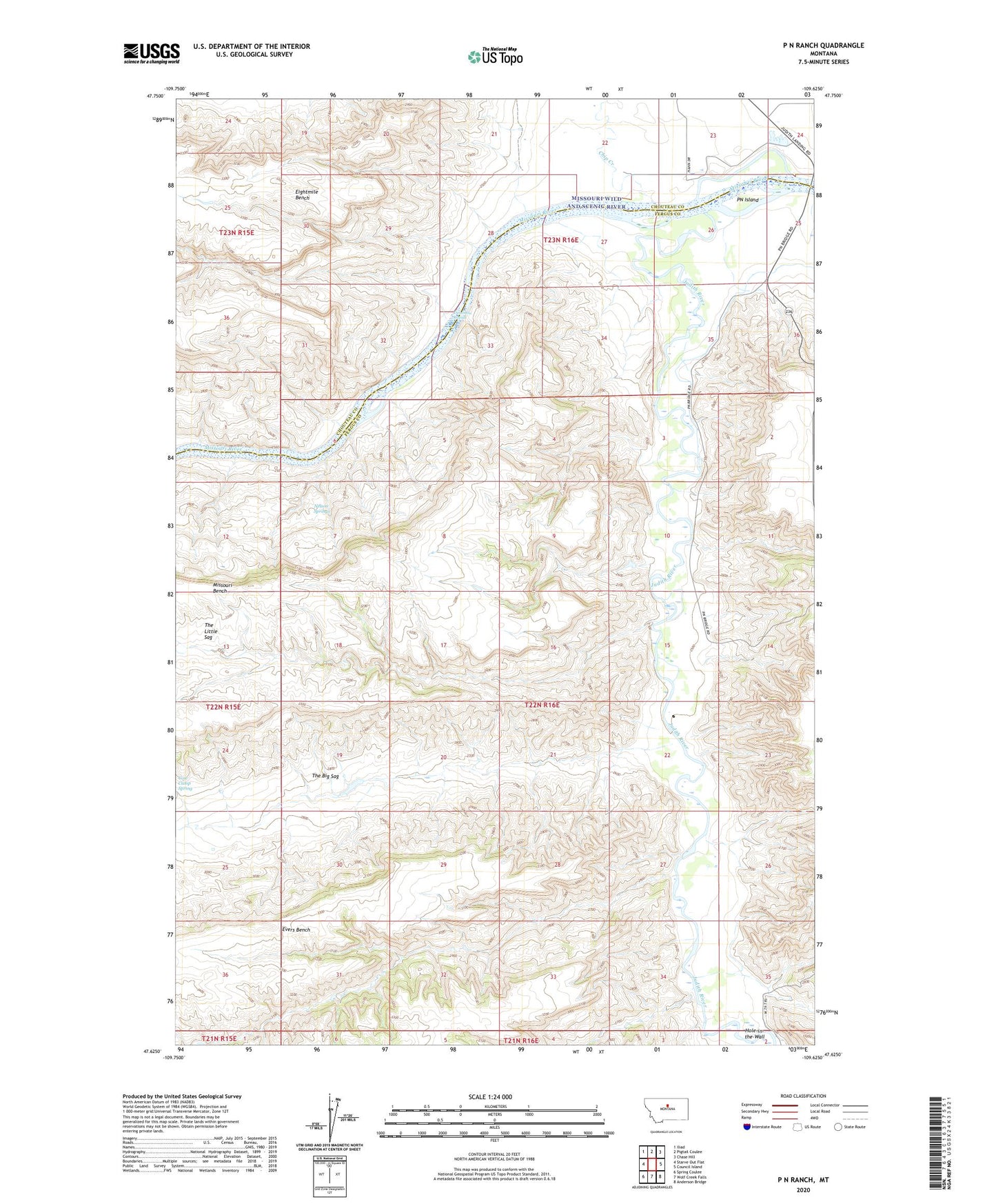
2024 topographic map quadrangle P N Ranch in the state of Montana. Scale: 1:24000. Based on the newly updated USGS 7.5' US Topo map series, this map is in the following counties: Fergus, Chouteau. The map contains contour data, water features, and other items you are used to seeing on USGS maps, but also has updated roads and other features. This is the next generation of topographic maps. Printed on high-quality waterproof paper with UV fade-resistant inks.
Quads adjacent to this one:
West: Starve Out Flat
Northwest: Iliad
North: Pigtail Coulee
Northeast: Chase Hill
East: Council Island
Southeast: Anderson Bridge
South: Wolf Creek Falls
Southwest: Spring Coulee
This map covers the same area as the classic USGS quad with code o47109f6.
Contains the following named places: Camp Cooke, Chip Creek, Clagget Hill, Deadman Rapids, Evers Bench, Evers Coulee, Fort Chardon, Fort Chardon Historical Marker, Hole-in-the-Wall, Judith, Judith Landing Campground, Judith Landing Historical Marker, Judith Landing Recreation Area, Judith Post Office, Judith River, King Coulee, Missouri Bench, Missouri Wild and Scenic River, Moes Dam, Mutton Coulee, Nelson Springs, Old Fort Clagget, P N Ranch School, PN Grazing Association Number 1 Dam, PN Island, PN Ranch, Reed Hill, Seventy Nine Coulee, Seventynine Hill, Seventynine Ranch, The Peak, Wagon Wheel Trail