MyTopo
Pine Grove School Montana US Topo Map
Couldn't load pickup availability
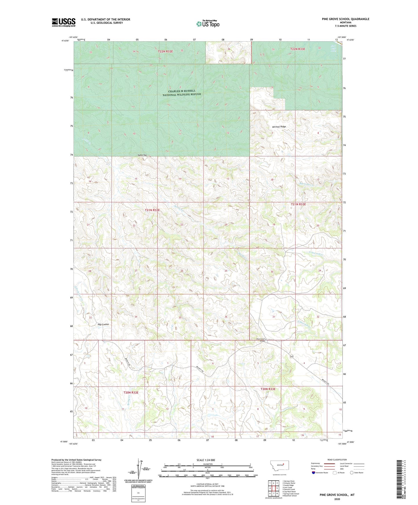
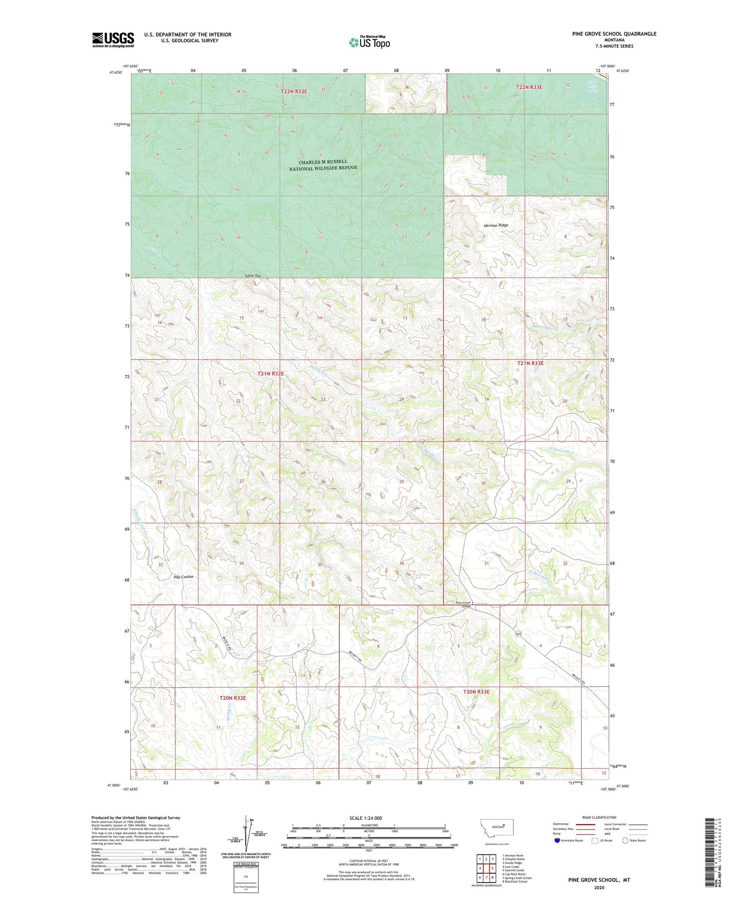
2020 topographic map quadrangle Pine Grove School in the state of Montana. Scale: 1:24000. Based on the newly updated USGS 7.5' US Topo map series, this map is in the following counties: Garfield, Phillips. The map contains contour data, water features, and other items you are used to seeing on USGS maps, but also has updated roads and other features. This is the next generation of topographic maps. Printed on high-quality waterproof paper with UV fade-resistant inks.
Quads adjacent to this one:
West: Lost Creek
Northwest: Herman Point
North: Schuyler Butte
Northeast: Swede Ridge
East: Sawmill Creek
Southeast: Blackfoot School
South: Spring Creek School
Southwest: Cap Rock Butte
Contains the following named places: Herman Ridge, Jones Creek Dam, Mable Number 1 Dam, Pine Grove School, Table Top, ZIP Code: 59318