MyTopo
Spring Creek School Montana US Topo Map
Couldn't load pickup availability
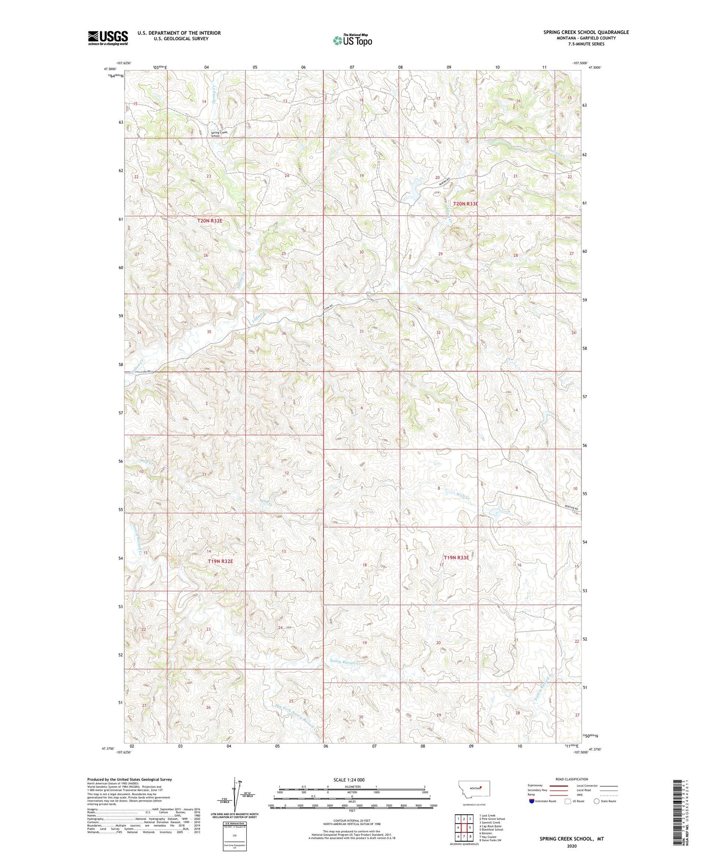
2024 topographic map quadrangle Spring Creek School in the state of Montana. Scale: 1:24000. Based on the newly updated USGS 7.5' US Topo map series, this map is in the following counties: Garfield. The map contains contour data, water features, and other items you are used to seeing on USGS maps, but also has updated roads and other features. This is the next generation of topographic maps. Printed on high-quality waterproof paper with UV fade-resistant inks.
Quads adjacent to this one:
West: Cap Rock Butte
Northwest: Lost Creek
North: Pine Grove School
Northeast: Sawmill Creek
East: Blackfoot School
Southeast: Steve Forks SW
South: Hay Coulee
Southwest: Benzien
This map covers the same area as the classic USGS quad with code o47107d5.
Contains the following named places: 19N33E09CBAD01 Well, 7-B Reservoir Dam, Dry Fork Nancy Russell Creek, Hazney School, Hazny, Hazny Post Office, Metersville, Ryan Dam, Spring Creek, Spring Creek School, Squaw Creek School