MyTopo
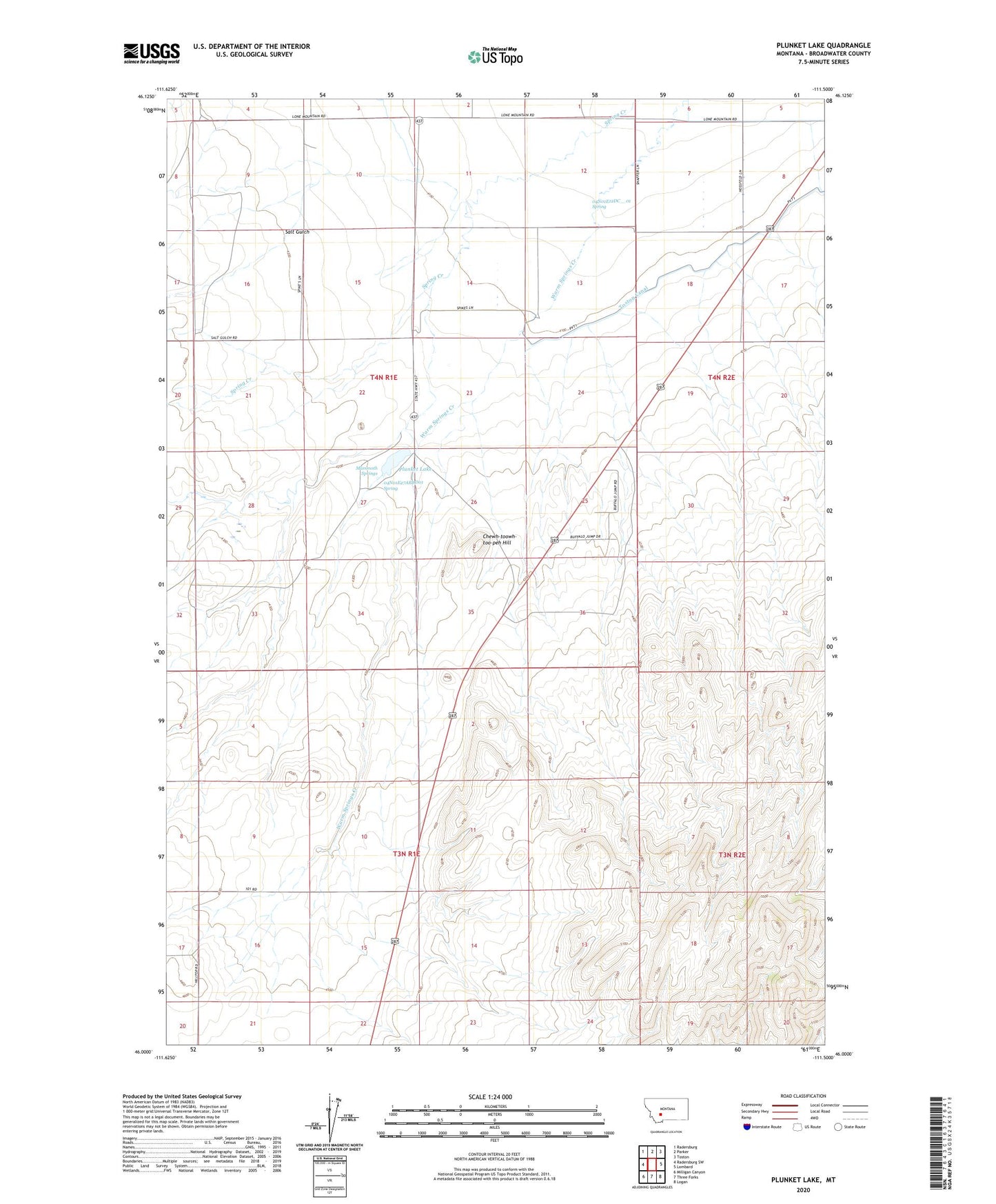
Plunket Lake Montana US Topo Map
Couldn't load pickup availability
2020 topographic map quadrangle Plunket Lake in the state of Montana. Scale: 1:24000. Based on the newly updated USGS 7.5' US Topo map series, this map is in the following counties: Broadwater. The map contains contour data, water features, and other items you are used to seeing on USGS maps, but also has updated roads and other features. This is the next generation of topographic maps. Printed on high-quality waterproof paper with UV fade-resistant inks.
Quads adjacent to this one:
West: Radersburg SW
Northwest: Radersburg
North: Parker
Northeast: Toston
East: Lombard
Southeast: Logan
South: Three Forks
Southwest: Milligan Canyon
Contains the following named places: 04N01E02CCCB01 Well, 04N01E02DD__01 Well, 04N01E02DD__02 Well, 04N01E02DD__03 Well, 04N01E09ADB_01 Well, 04N01E09CAB_01 Well, 04N01E10AA__01 Well, 04N01E10BBCB01 Well, 04N01E10BCCC01 Well, 04N01E10CB__01 Well, 04N01E11AB__01 Well, 04N01E11BCCB01 Well, 04N01E11CBDD01 Well, 04N01E12AA__01 Well, 04N01E12BADD01 Well, 04N01E12BD__01 Well, 04N01E12DC__01 Spring, 04N01E13BCBC01 Well, 04N01E13CC__01 Well, 04N01E14CC__01 Well, 04N01E15BCBB01 Well, 04N01E15CDBA01 Well, 04N01E16DA__01 Well, 04N01E22CB__01 Well, 04N01E23BAC_01 Well, 04N01E23BBB_01 Well, 04N01E27ABDD01 Spring, 04N02E05CC__01 Well, 04N02E05CDDC01 Well, 04N02E06CC__01 Well, 04N02E06CD__01 Well, 04N02E06DD__01 Well, 04N02E08BB__01 Well, 04N02E08BB__02 Well, 04N02E18ACAC01 Well, Chewh-toowh-too-peh Hill, Mammoth Springs, McIntire Post Office, Plunket Lake, Plunket Lake Dam, Salt Gulch