MyTopo
Lombard Montana US Topo Map
Couldn't load pickup availability
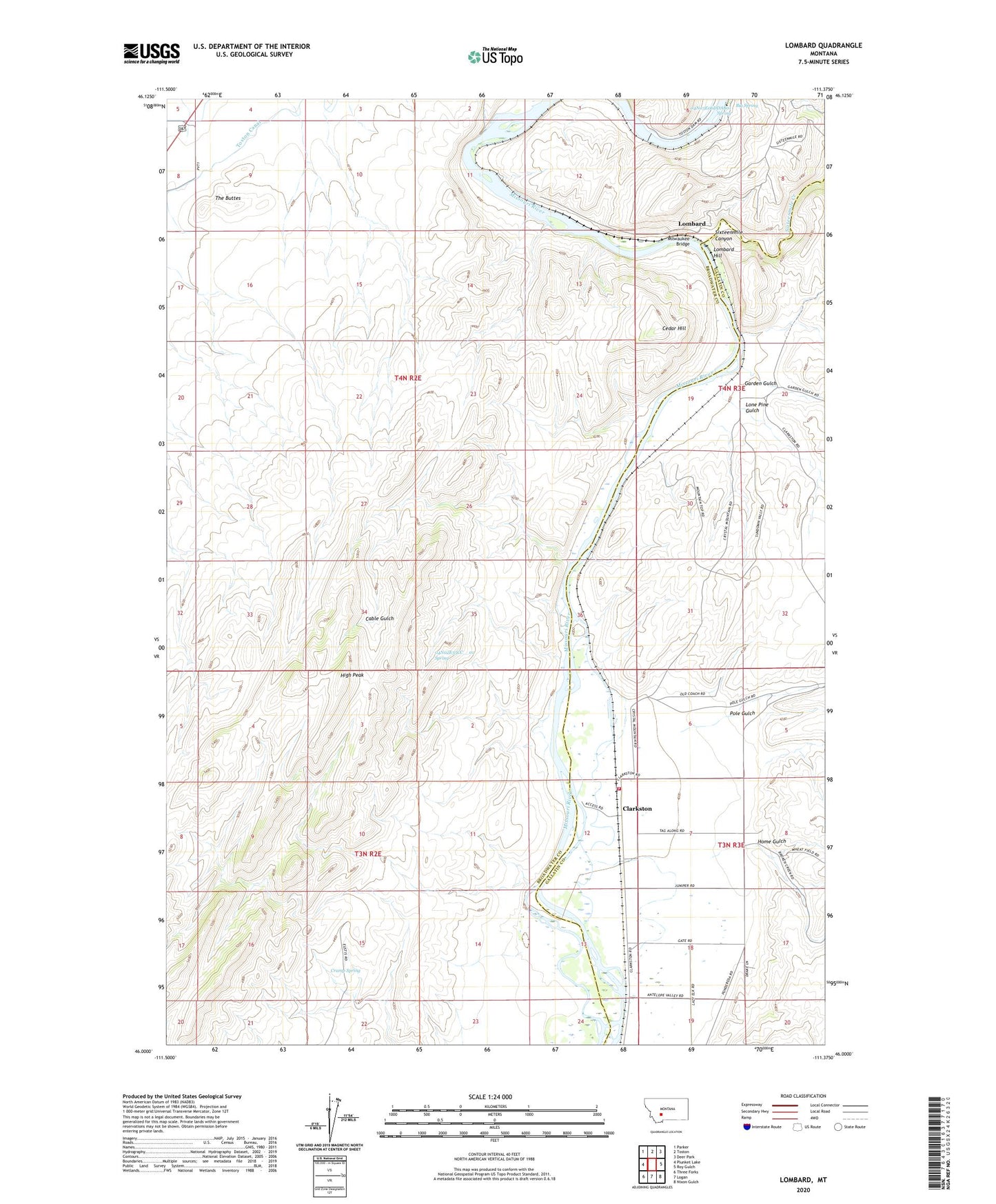
2024 topographic map quadrangle Lombard in the state of Montana. Scale: 1:24000. Based on the newly updated USGS 7.5' US Topo map series, this map is in the following counties: Broadwater, Gallatin. The map contains contour data, water features, and other items you are used to seeing on USGS maps, but also has updated roads and other features. This is the next generation of topographic maps. Printed on high-quality waterproof paper with UV fade-resistant inks.
Quads adjacent to this one:
West: Plunket Lake
Northwest: Parker
North: Toston
Northeast: Deer Park
East: Roy Gulch
Southeast: Nixon Gulch
South: Logan
Southwest: Three Forks
This map covers the same area as the classic USGS quad with code o46111a4.
Contains the following named places: 04N02E10BB__01 Well, 04N02E16AA__01 Well, 04N02E16AAA_01 Well, 04N02E35CC__01 Spring, 04N03E06DDAB01 Spring, Barron, Big Spring, Cable Gulch, Cedar Hill, Clarkston, Clarkston Fire Service Area Station, Clarkston Post Office, Clarkston School, Cramp Spring, Fairweather Campground, Fairweather Fishing Access Site, Garden Gulch, High Peak, Home Gulch, Lombard, Lombard Hill, Lone Pine Gulch, Milwaukee Bridge, Pole Gulch, Shaft Near Lombard Mine, Sixteenmile Canyon, Sixteenmile Creek, Small Adit Mine, Stanley, The Buttes, Toston Canal, Toston Dam, Toston Dam Campground