
MyTopo
Poverty Flat West Montana US Topo Map
Couldn't load pickup availability
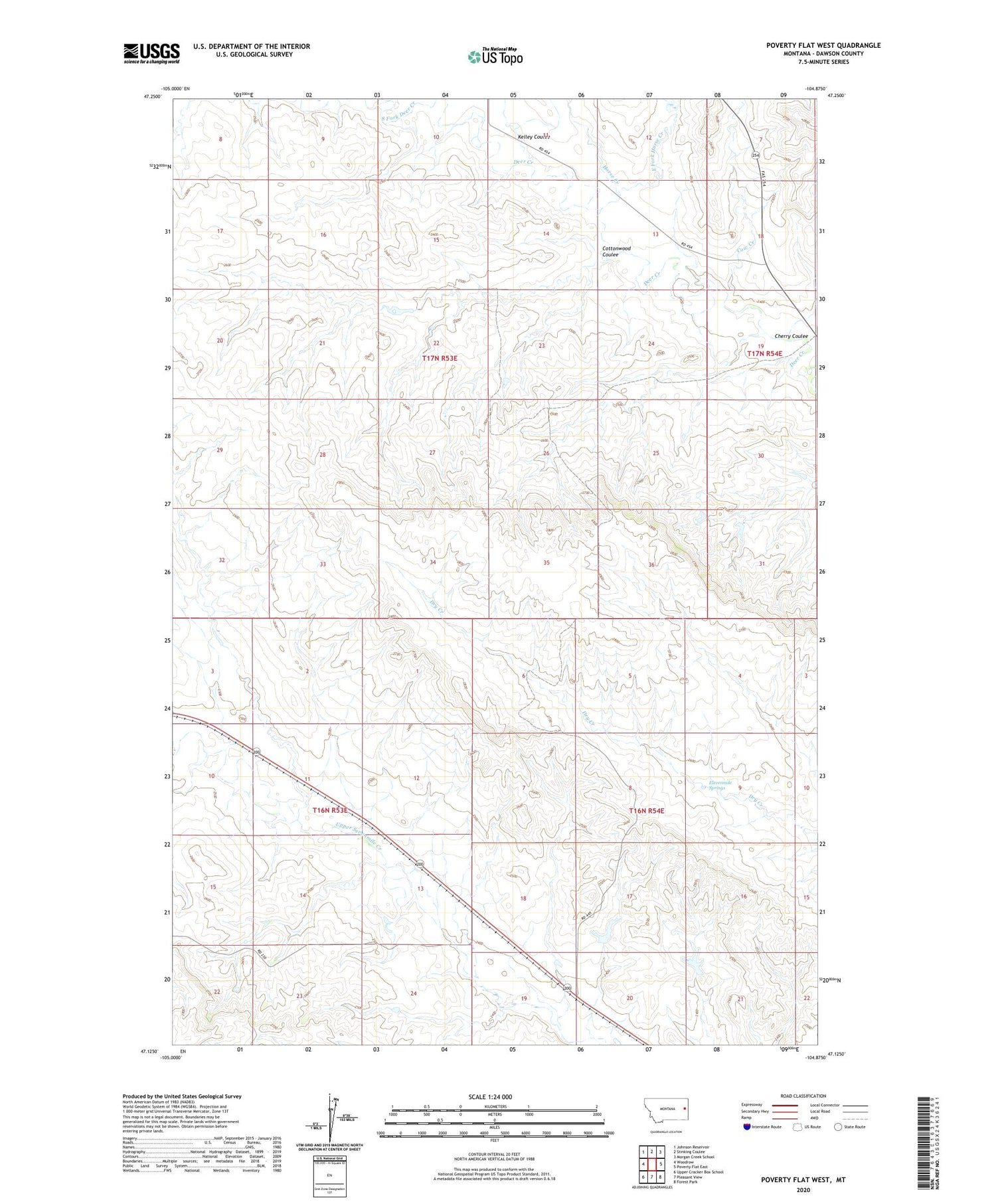
2020 topographic map quadrangle Poverty Flat West in the state of Montana. Scale: 1:24000. Based on the newly updated USGS 7.5' US Topo map series, this map is in the following counties: Dawson. The map contains contour data, water features, and other items you are used to seeing on USGS maps, but also has updated roads and other features. This is the next generation of topographic maps. Printed on high-quality waterproof paper with UV fade-resistant inks.
Quads adjacent to this one:
West: Woodrow
Northwest: Johnson Reservoir
North: Stinking Coulee
Northeast: Morgan Creek School
East: Poverty Flat East
Southeast: Forest Park
South: Pleasant View
Southwest: Upper Cracker Box School
Contains the following named places: 16N53E10DABA01 Well, 16N53E13CCDB01 Well, 16N53E14CC__01 Well, 16N54E04DDCB01 Well, 17N53E13BACB01 Well, 17N53E13BBAC01 Well, 17N53E14AABB01 Well, 17N53E28CCAA01 Well, 17N53E36BCAB01 Well, 17N54E19DAAD01 Well, Cherry Coulee, Cottonwood Coulee, Cow Creek, Downy Dam, East Fork Horse Creek, Eleven Mile Spring School, Elevenmile Springs, Golden Valley School, Green, Green School, Horse Creek, Kelley Coulee, Newton Number 1 Dam, Quaker Dam, V Dam


