MyTopo
Johnson Reservoir Montana US Topo Map
Couldn't load pickup availability
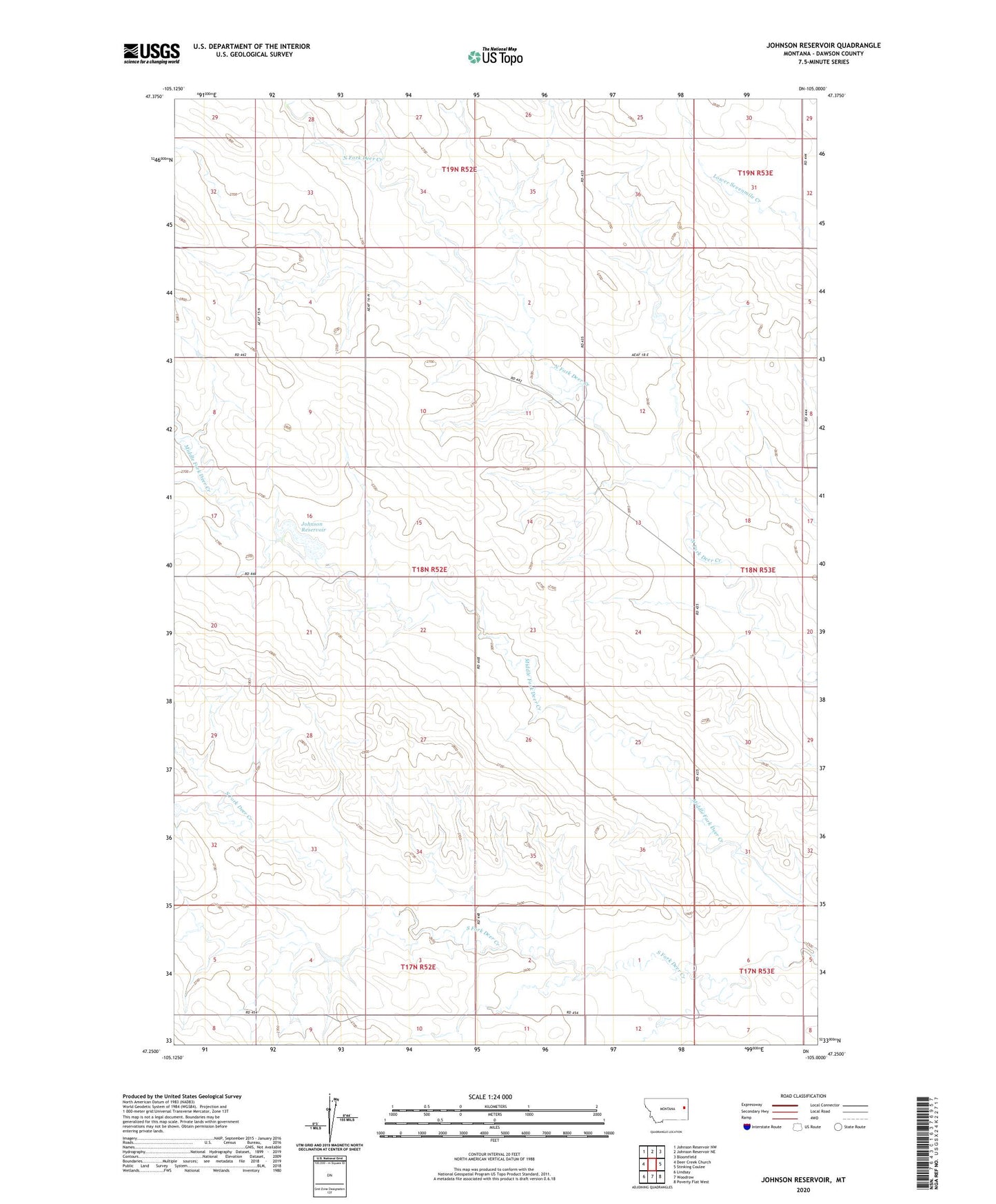
2024 topographic map quadrangle Johnson Reservoir in the state of Montana. Scale: 1:24000. Based on the newly updated USGS 7.5' US Topo map series, this map is in the following counties: Dawson. The map contains contour data, water features, and other items you are used to seeing on USGS maps, but also has updated roads and other features. This is the next generation of topographic maps. Printed on high-quality waterproof paper with UV fade-resistant inks.
Quads adjacent to this one:
West: Deer Creek Church
Northwest: Johnson Reservoir NW
North: Johnson Reservoir NE
Northeast: Bloomfield
East: Stinking Coulee
Southeast: Poverty Flat West
South: Woodrow
Southwest: Lindsay
This map covers the same area as the classic USGS quad with code o47105c1.
Contains the following named places: 17N52E01DDD_01 Well, 17N52E01DDD_02 Well, 17N52E10AAA_01 Well, 18N52E04CCC_01 Well, 18N52E10DCB_01 Well, 18N52E12BBB_01 Well, 18N52E14BBC_01 Well, 18N52E14DBD_01 Well, 18N53E18CCC_01 Well, 19N53E18DDDB01 Well, Johnson Reservoir, Johnson Reservoir Dam, Lervold School, Lewis School, Lincoln School, Middle Fork Deer Creek, Tillman Number 1 Dam, Wilson School, Wold Post Office