MyTopo
Pleasant View Montana US Topo Map
Couldn't load pickup availability
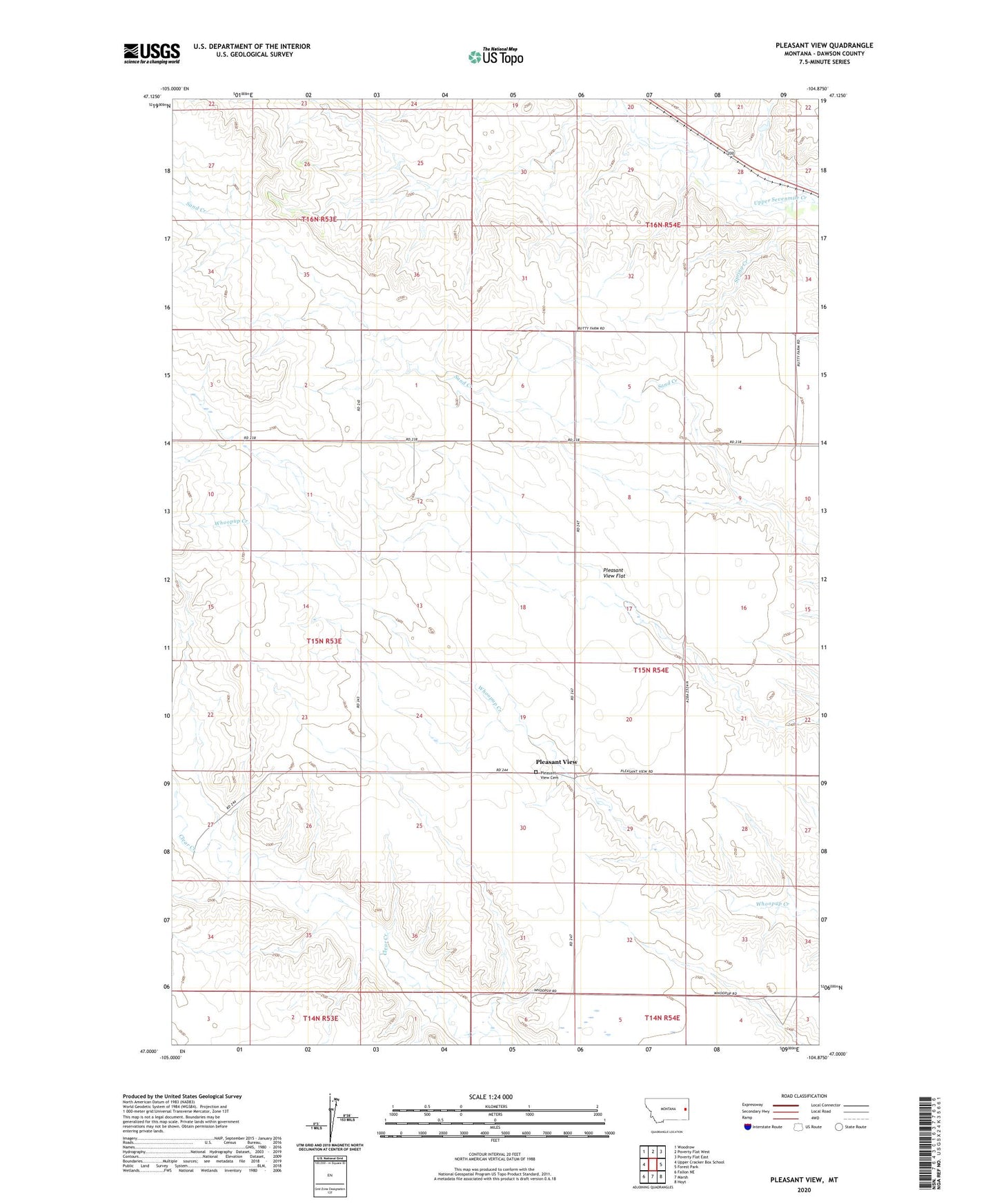
2024 topographic map quadrangle Pleasant View in the state of Montana. Scale: 1:24000. Based on the newly updated USGS 7.5' US Topo map series, this map is in the following counties: Dawson. The map contains contour data, water features, and other items you are used to seeing on USGS maps, but also has updated roads and other features. This is the next generation of topographic maps. Printed on high-quality waterproof paper with UV fade-resistant inks.
Quads adjacent to this one:
West: Upper Cracker Box School
Northwest: Woodrow
North: Poverty Flat West
Northeast: Poverty Flat East
East: Forest Park
Southeast: Hoyt
South: Marsh
Southwest: Fallon NE
This map covers the same area as the classic USGS quad with code o47104a8.
Contains the following named places: 14N54E04ADBA01 Well, 15N53E10AAAB01 Well, 15N53E12ABAB01 Well, 15N53E12ABAB02 Well, 15N53E12ABAB03 Well, 15N53E12ACDA01 Well, 15N53E26CABC01 Well, 15N53E26DABC01 Well, 15N53E34AABA01 Well, 15N53E34DBAD01 Well, 15N54E07DAAB01 Well, 15N54E20AACC01 Well, 16N53E27CADD01 Well, 16N53E27CADD02 Well, 16N54E06CDAA01 Well, 16N54E32CDDA01 Well, Foster School, Pleasant View, Pleasant View Cemetery, Pleasant View Flat, Pleasant View School, Spring Creek