MyTopo
Rabbit Hills Montana US Topo Map
Couldn't load pickup availability
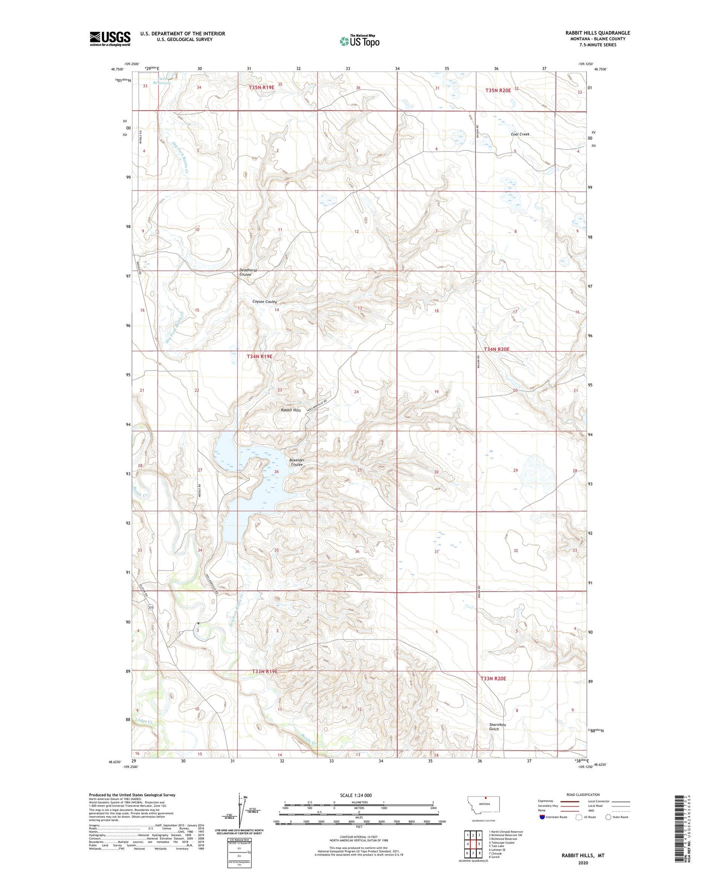
2024 topographic map quadrangle Rabbit Hills in the state of Montana. Scale: 1:24000. Based on the newly updated USGS 7.5' US Topo map series, this map is in the following counties: Blaine. The map contains contour data, water features, and other items you are used to seeing on USGS maps, but also has updated roads and other features. This is the next generation of topographic maps. Printed on high-quality waterproof paper with UV fade-resistant inks.
Quads adjacent to this one:
West: Telescope Coulee
Northwest: North Chinook Reservoir
North: Richmond Reservoir SW
Northeast: Richmond Reservoir
East: Tule Lake
Southeast: Zurich
South: Chinook
Southwest: Lohman SE
This map covers the same area as the classic USGS quad with code o48109f2.
Contains the following named places: A J Tillman Number 1 Dam, A J Tillman Number 2 Dam, Boxelder Coulee, B'Rer Rabbit Dam, Coyote Coulee, Deadhorse Coulee, Dry Fork Battle Creek, Hollandville, Hollandville Church, Hollandville Post Office, Hollandville School, Rabbit Hills, Siversten Dam