MyTopo
Zurich Montana US Topo Map
Couldn't load pickup availability
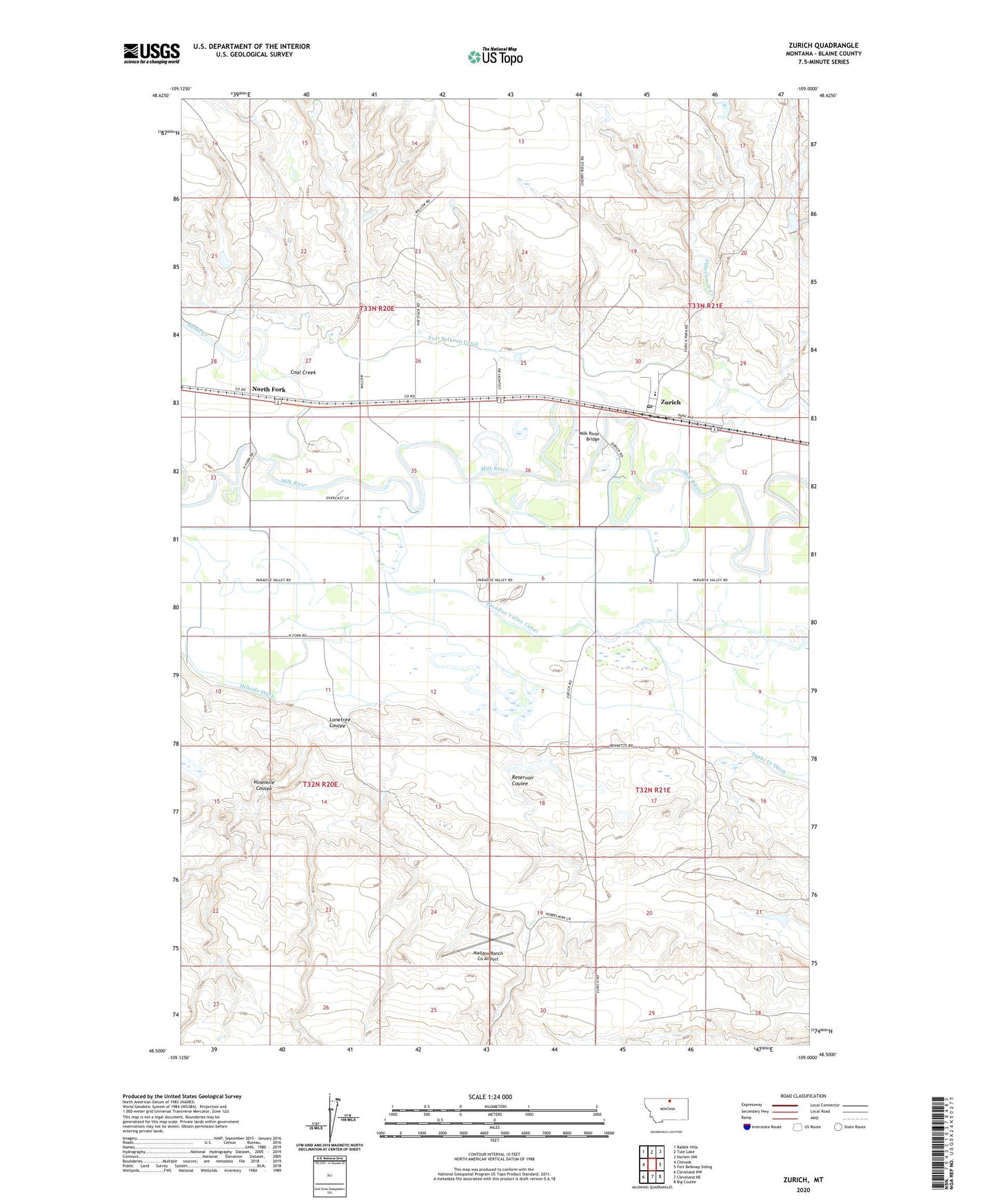
2024 topographic map quadrangle Zurich in the state of Montana. Scale: 1:24000. Based on the newly updated USGS 7.5' US Topo map series, this map is in the following counties: Blaine. The map contains contour data, water features, and other items you are used to seeing on USGS maps, but also has updated roads and other features. This is the next generation of topographic maps. Printed on high-quality waterproof paper with UV fade-resistant inks.
Quads adjacent to this one:
West: Chinook
Northwest: Rabbit Hills
North: Tule Lake
Northeast: Harlem NW
East: Fort Belknap Siding
Southeast: Big Coulee
South: Cleveland NE
Southwest: Cleveland NW
This map covers the same area as the classic USGS quad with code o48109e1.
Contains the following named places: 33N20E25BCDB01 Well, 33N20E35DCCA01 Well, 33N21E30DC__01 Well, 33N21E31CCAA01 Well, Battle Creek, Blevins Dam, Carson MN-66 Dam, Coal Creek, Dishwater Dam, Dreary Dam, Fifteenmile Creek, Fort Belknap Canal, Hebbelman Airport, Hebbelman School, Hillside Ditch, Lonetree Coulee, Maddox Ranch Co Airport, Milk River Bridge, Miller Reservoir Dam, Ninemile Coulee, North Fork, North Fork School, Paradise Post Office, Paradise Valley Canal, Reservoir Coulee, Santa Maria Dam, Zurich, Zurich Census Designated Place, Zurich Chapel, Zurich Park, Zurich Post Office, Zurich School