MyTopo
Reed Springs Montana US Topo Map
Couldn't load pickup availability
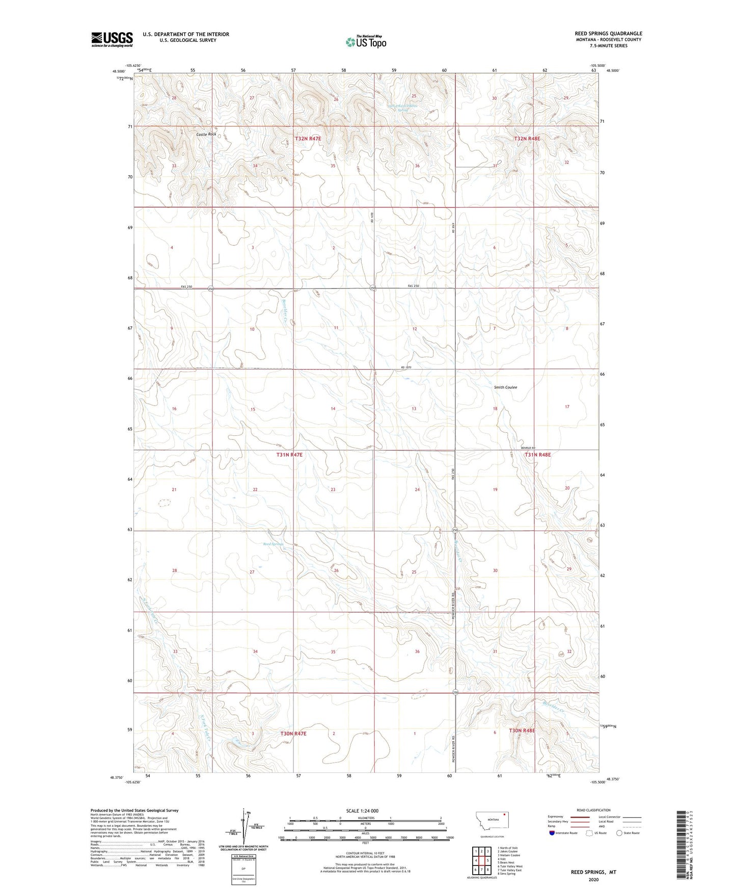
2020 topographic map quadrangle Reed Springs in the state of Montana. Scale: 1:24000. Based on the newly updated USGS 7.5' US Topo map series, this map is in the following counties: Roosevelt. The map contains contour data, water features, and other items you are used to seeing on USGS maps, but also has updated roads and other features. This is the next generation of topographic maps. Printed on high-quality waterproof paper with UV fade-resistant inks.
Quads adjacent to this one:
West: Volt
Northwest: North of Volt
North: Jakes Coulee
Northeast: Nielsen Coulee
East: Bears Nest
Southeast: Sims Spring
South: Tule Valley East
Southwest: Tule Valley West
Contains the following named places: 31N47E02DADD01 Well, 31N47E14AAAC01 Well, 31N47E16BCAA01 Well, 31N47E16BCAA02 Well, 31N47E33AC__01 Well, 31N48E07CBAC01 Well, 31N48E07CBBA01 Well, 31N48E17ABAA01 Well, 31N48E18BCBC01 Well, 31N48E30CBCD01 Well, 31N48E31DCCC01 Well, 32N47E25CDBD01 Spring, Benrud, Benrud Post Office, Castle Rock, Golden Valley School, Highland School Number One, Pershing School, Reed Springs, Westside School