MyTopo
Jakes Coulee Montana US Topo Map
Couldn't load pickup availability
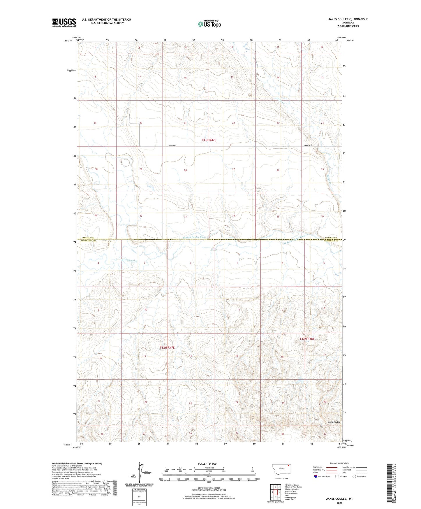
2024 topographic map quadrangle Jakes Coulee in the state of Montana. Scale: 1:24000. Based on the newly updated USGS 7.5' US Topo map series, this map is in the following counties: Roosevelt, Daniels. The map contains contour data, water features, and other items you are used to seeing on USGS maps, but also has updated roads and other features. This is the next generation of topographic maps. Printed on high-quality waterproof paper with UV fade-resistant inks.
Quads adjacent to this one:
West: North of Volt
Northwest: Shipstead Coulee
North: South of Four Buttes
Northeast: Cabarett Coulee
East: Nielsen Coulee
Southeast: Bears Nest
South: Reed Springs
Southwest: Volt
This map covers the same area as the classic USGS quad with code o48105e5.
Contains the following named places: 28N47E26DBAD03 Well, 33N47E01DBDB01 Well, 33N47E20BDBB01 Well, Below Zero Dam, Cottonwood Creek, J B and R Haversland Dam, Longager School