MyTopo
Tule Valley West Montana US Topo Map
Couldn't load pickup availability
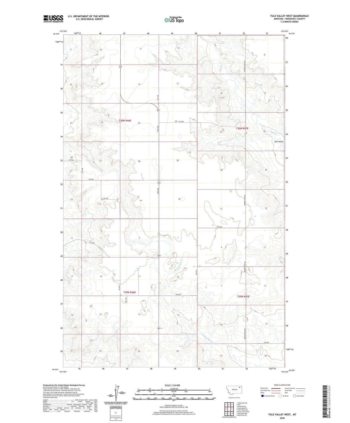
2024 topographic map quadrangle Tule Valley West in the state of Montana. Scale: 1:24000. Based on the newly updated USGS 7.5' US Topo map series, this map is in the following counties: Roosevelt. The map contains contour data, water features, and other items you are used to seeing on USGS maps, but also has updated roads and other features. This is the next generation of topographic maps. Printed on high-quality waterproof paper with UV fade-resistant inks.
Quads adjacent to this one:
West: Todd Lakes SE
Northwest: Todd Lakes NE
North: Volt
Northeast: Reed Springs
East: Tule Valley East
Southeast: Wolf Point NE
South: Wolf Point NW
Southwest: Flynn Creek North
This map covers the same area as the classic USGS quad with code o48105c6.
Contains the following named places: 29N46E01BCDB01 Well, 29N46E01BCDB02 Well, 29N46E01BCDB03 Well, 29N46E02DDAC01 Well, 29N46E02DDDB01 Well, 29N46E10DAAB01 Well, 29N46E10DAAC01 Well, 29N46E11DDAC01 Well, 29N47E06CBCC01 Well, 30N46E10DDDB01 Well, 30N46E10DDDB02 Well, 30N46E10DDDB03 Well, 30N46E13CCCC01 Well, 30N46E14DDAC01 Well, 30N46E14DDDD01 Well, 30N46E15CABD01 Well, 30N46E26DCBC01 Well, 30N46E36DAAB01 Well, 30N47E08DBBA01 Well, 30N47E19BBBC01 Well, 30N47E20BBBB01 Well, 30N47E31BCBC01 Well, 30N47E31BCBC02 Well, 30N47E31BCBC03 Well, Bethel Mennonite Church, Pioneer School, Wide Awake School, Wolf Point District