MyTopo
Volt Montana US Topo Map
Couldn't load pickup availability
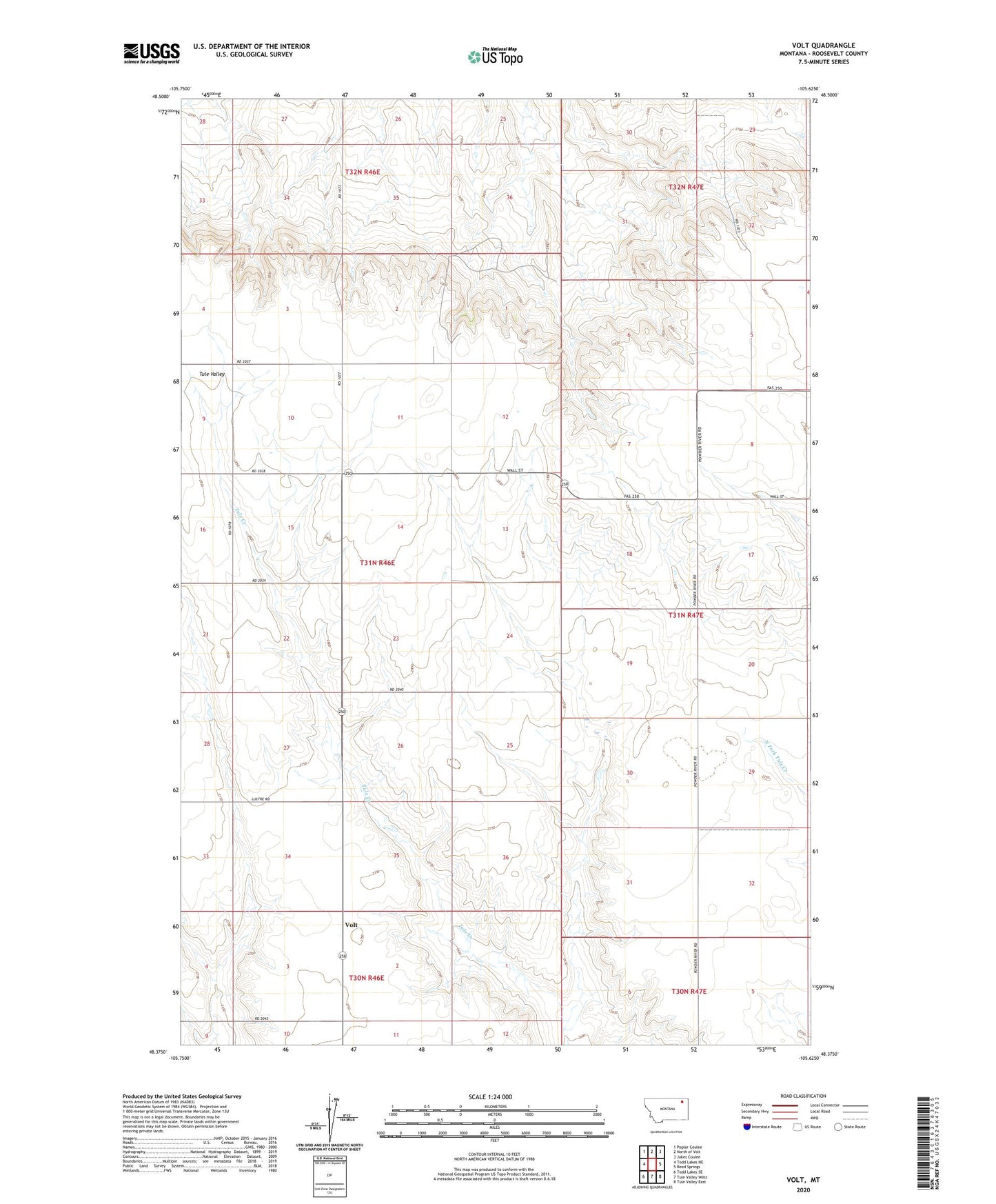
2024 topographic map quadrangle Volt in the state of Montana. Scale: 1:24000. Based on the newly updated USGS 7.5' US Topo map series, this map is in the following counties: Roosevelt. The map contains contour data, water features, and other items you are used to seeing on USGS maps, but also has updated roads and other features. This is the next generation of topographic maps. Printed on high-quality waterproof paper with UV fade-resistant inks.
Quads adjacent to this one:
West: Todd Lakes NE
Northwest: Poplar Coulee
North: North of Volt
Northeast: Jakes Coulee
East: Reed Springs
Southeast: Tule Valley East
South: Tule Valley West
Southwest: Todd Lakes SE
This map covers the same area as the classic USGS quad with code o48105d6.
Contains the following named places: 30N46E02BBCD01 Well, 31N46E01CBCA01 Well, 31N46E02DDBC01 Well, 31N46E11CBBC01 Well, 31N46E11CBBD01 Well, 31N46E15CCCB01 Well, 31N46E24DCDC01 Well, 31N46E24DCDC02 Well, 31N46E26BCCC01 Well, 31N46E28DDCD01 Well, 31N46E33DDAA01 Well, 31N46E33DDAB01 Well, 31N47E06DDDD01 Well, 31N47E06DDDD02 Well, Victory School, Volt, Volt Mennonite Brethren Church, Volt Post Office, Volt School