
MyTopo
Reserve SE Montana US Topo Map
Couldn't load pickup availability
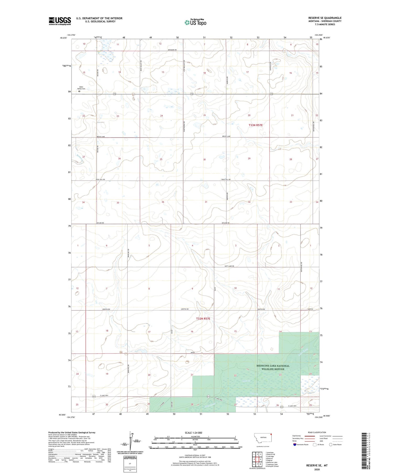
2020 topographic map quadrangle Reserve SE in the state of Montana. Scale: 1:24000. Based on the newly updated USGS 7.5' US Topo map series, this map is in the following counties: Sheridan. The map contains contour data, water features, and other items you are used to seeing on USGS maps, but also has updated roads and other features. This is the next generation of topographic maps. Printed on high-quality waterproof paper with UV fade-resistant inks.
Quads adjacent to this one:
West: Reserve
Northwest: Antelope
North: Reserve NE
Northeast: Coalridge
East: Dagmar
Southeast: Sunnyhill School
South: Capeneys Lake
Southwest: Medicine Lake
Contains the following named places: 32N57E09DCCB01 Well, 32N57E22AAAA01 Well, 32N57E26BBBB01 Well, 33N56E26DDDC01 Well, 33N57E33CDDC01 Well, Black Out Dam, Cottonwood Creek, Dagmar Academy, Dam Number 11, Dam Number 12, Eden Valley Cemetery, Griffin School, Hawthorne School, Medicine Lake Division, Medicine Lake Refuge Number 11 Dam, Medicine Lake Refuge Number 12 Dam, Nathanael Lutheran Church, Richwine School, Sand Creek


