MyTopo
Sunnyhill School Montana US Topo Map
Couldn't load pickup availability
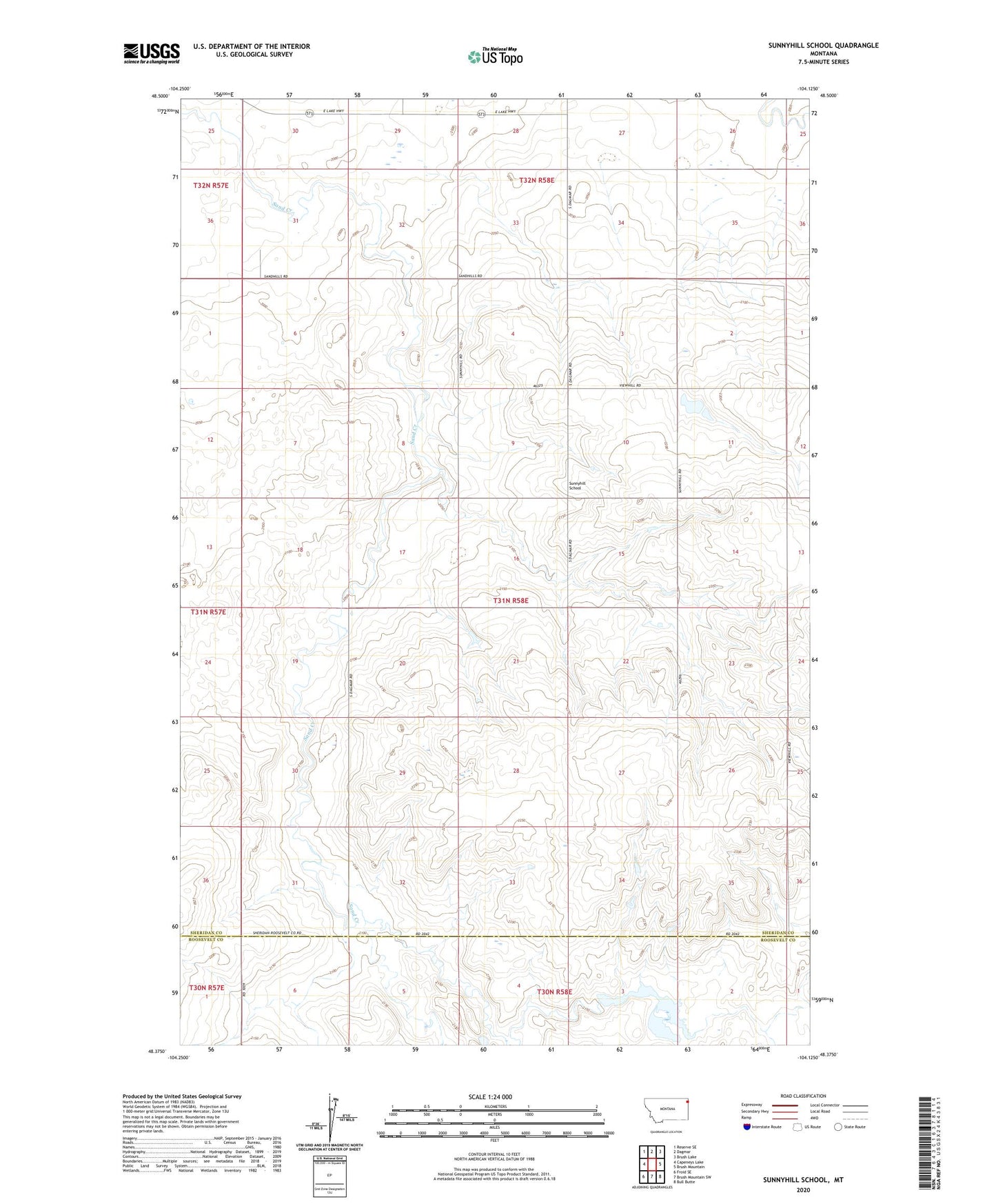
2024 topographic map quadrangle Sunnyhill School in the state of Montana. Scale: 1:24000. Based on the newly updated USGS 7.5' US Topo map series, this map is in the following counties: Sheridan, Roosevelt. The map contains contour data, water features, and other items you are used to seeing on USGS maps, but also has updated roads and other features. This is the next generation of topographic maps. Printed on high-quality waterproof paper with UV fade-resistant inks.
Quads adjacent to this one:
West: Capeneys Lake
Northwest: Reserve SE
North: Dagmar
Northeast: Brush Lake
East: Brush Mountain
Southeast: Bull Butte
South: Brush Mountain SW
Southwest: Froid SE
This map covers the same area as the classic USGS quad with code o48104d2.
Contains the following named places: 31N58E09CBCD01 Well, 31N58E32CBCB01 Well, 32N58E26ADDB01 Well, 32N58E27BCCC01 Well, 32N58E31CBDD01 Well, Portra Reservoir Number 1 Dam, Sunnyhill School