MyTopo
Dagmar Montana US Topo Map
Couldn't load pickup availability
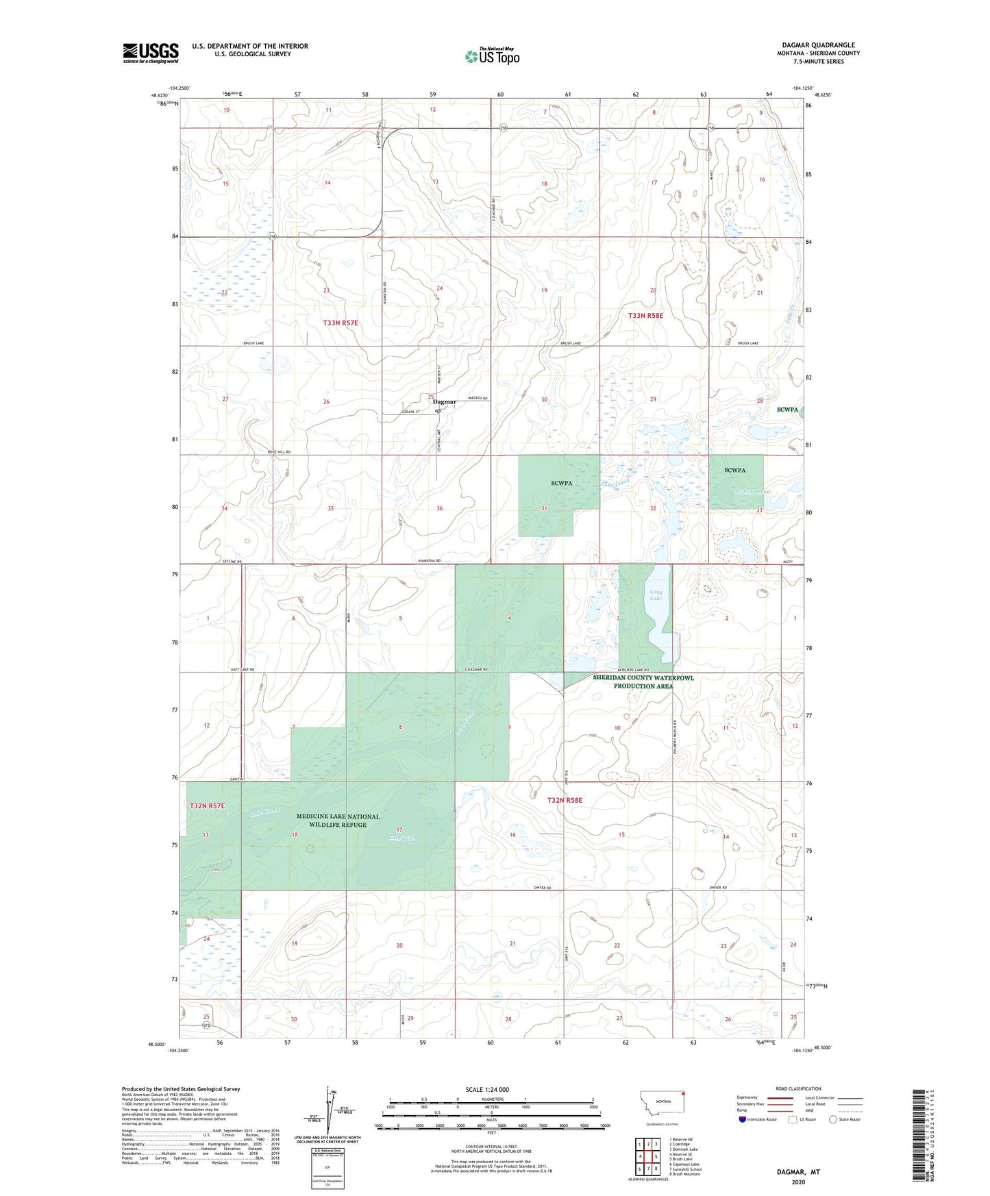
2024 topographic map quadrangle Dagmar in the state of Montana. Scale: 1:24000. Based on the newly updated USGS 7.5' US Topo map series, this map is in the following counties: Sheridan. The map contains contour data, water features, and other items you are used to seeing on USGS maps, but also has updated roads and other features. This is the next generation of topographic maps. Printed on high-quality waterproof paper with UV fade-resistant inks.
Quads adjacent to this one:
West: Reserve SE
Northwest: Reserve NE
North: Coalridge
Northeast: Dominek Lake
East: Brush Lake
Southeast: Brush Mountain
South: Sunnyhill School
Southwest: Capeneys Lake
This map covers the same area as the classic USGS quad with code o48104e2.
Contains the following named places: 32N58E04DBBD01 Well, 32N58E04DBBD02 Well, 32N58E05DDAB01 Well, 32N58E06DCAA01 Well, 32N58E10CCCC01 Well, 32N58E22CBBC01 Well, 33N57E12CDBD01 Well, 33N57E22DCCA01 Well, 33N58E09CDDA01 Well, 33N58E17ABBA01 Well, 33N58E17ADDD01 Well, 33N58E21CCAA01 Well, 33N58E28CBBA01 Well, 33N58E29ADCA01 Well, 33N58E29ADDB01 Well, 33N58E29ADDB02 Well, 33N58E30ACAA01 Well, 33N58E32CCAA01 Well, 33N58E33DACB01 Well, 59219, Dagmar, Dagmar Post Office, Emerson School, Franklin School, Hans Christian Anderson School, Hiawatha School, Katy Lake, Long Lake, Mallard Pond, Medicine Lake Volunteer Fire Department Station 2 Dagmar, Quitmeyer Post Office, Roosevelt School, Volmer, Volmer Lutheran Church