MyTopo
Ringling Montana US Topo Map
Couldn't load pickup availability
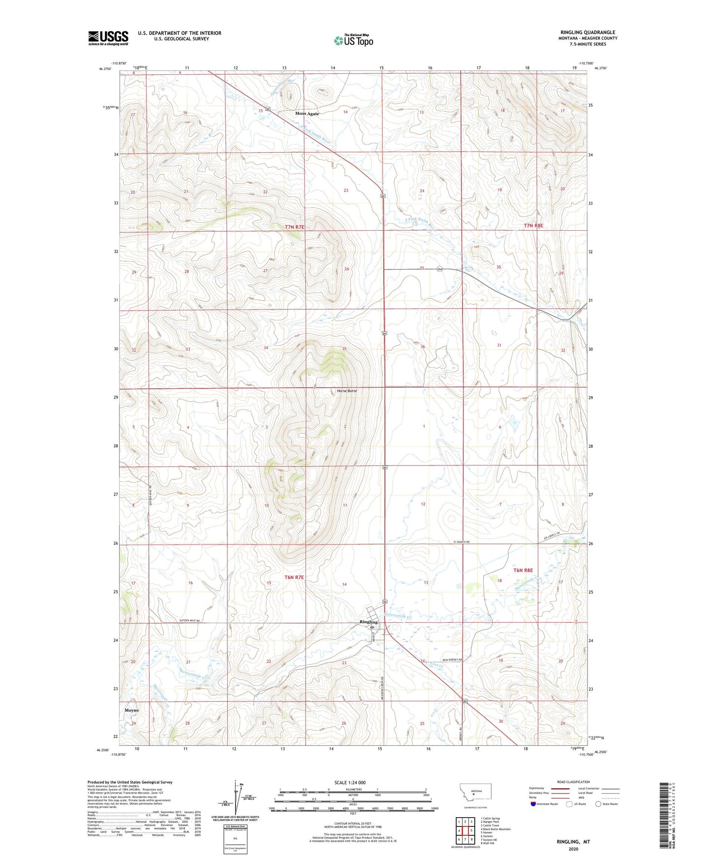
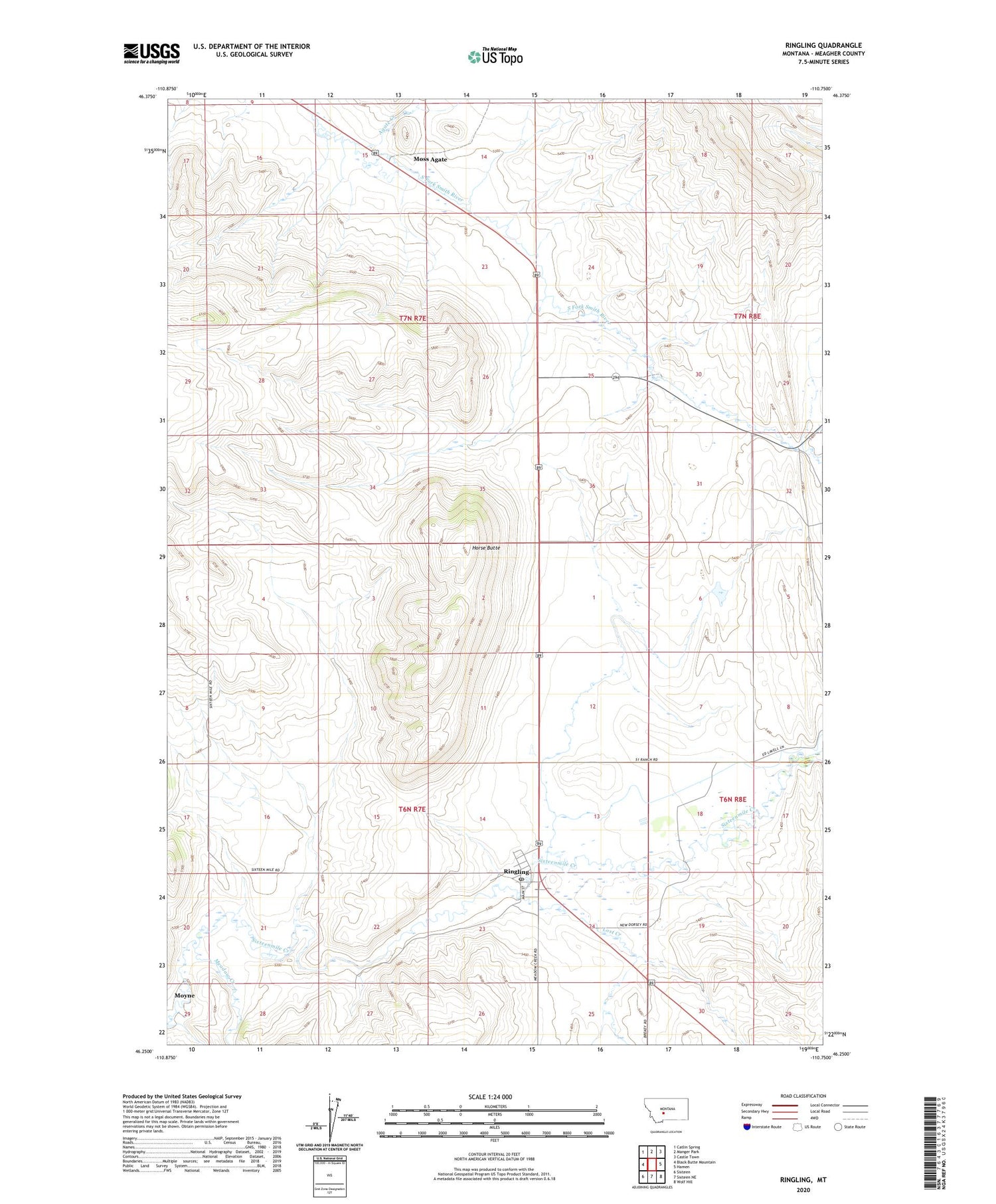
2020 topographic map quadrangle Ringling in the state of Montana. Scale: 1:24000. Based on the newly updated USGS 7.5' US Topo map series, this map is in the following counties: Meagher. The map contains contour data, water features, and other items you are used to seeing on USGS maps, but also has updated roads and other features. This is the next generation of topographic maps. Printed on high-quality waterproof paper with UV fade-resistant inks.
Quads adjacent to this one:
West: Black Butte Mountain
Northwest: Catlin Spring
North: Manger Park
Northeast: Castle Town
East: Hamen
Southeast: Wolf Hill
South: Sixteen NE
Southwest: Sixteen
Contains the following named places: 06N07E02DD__01 Well, 06N07E09BC__01 Well, 06N07E09C___01 Well, 06N07E13DD__01 Well, 06N07E13DD__02 Well, 06N07E16DC__01 Well, 06N07E26A___01 Well, 06N07E27BB__01 Well, 06N08E07CC__01 Well, 06N08E08CB__01 Well, 07N07E25ADCA01 Well, 07N07E36BB__01 Well, Adkison Ranch, Agate Creek, Brewer Ranch, Bruce Place, Dorsey, Ford Place, Higgins Brothers Airport, Higgins Ranch, Horse Butte, Kuhnes Ranch, Lost Creek, Meadow Creek, Moss Agate, Moss Agate School, NW NE Section 15 Mine, Old Dorsey School, Quigley Ranch, Ringling, Ringling Elementary School, Ringling Post Office, Saint Charles, Saint Johns Catholic Church, Turkey Straw Dam