MyTopo
Hamen Montana US Topo Map
Couldn't load pickup availability
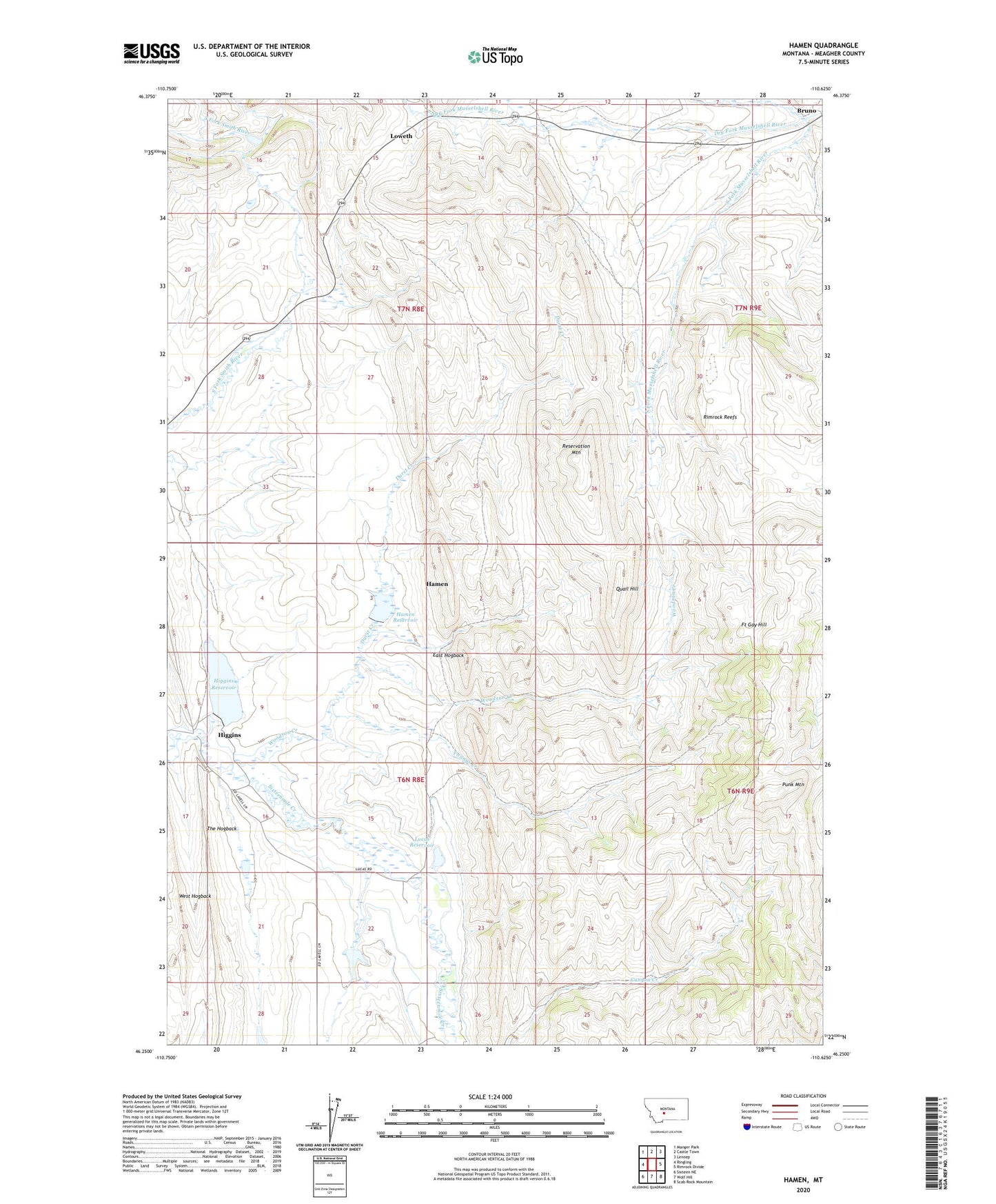
2024 topographic map quadrangle Hamen in the state of Montana. Scale: 1:24000. Based on the newly updated USGS 7.5' US Topo map series, this map is in the following counties: Meagher. The map contains contour data, water features, and other items you are used to seeing on USGS maps, but also has updated roads and other features. This is the next generation of topographic maps. Printed on high-quality waterproof paper with UV fade-resistant inks.
Quads adjacent to this one:
West: Ringling
Northwest: Manger Park
North: Castle Town
Northeast: Lennep
East: Rimrock Divide
Southeast: Scab Rock Mountain
South: Wolf Hill
Southwest: Sixteen NE
This map covers the same area as the classic USGS quad with code o46110c6.
Contains the following named places: 06N08E15DD__01 Well, 06N08E16BB__01 Well, 06N08E22AA__01 Well, 07N08E15B___01 Well, 07N08E23AA__01 Well, 07N08E24BBBC01 Well, 07N08E28A___01 Well, 59642, Brekke Ranch, Bruno, Bruno School, Culver Ranch, Dorsey Post Office, Dry Fork Musselshell River, Durst Creek, East Hogback, Fort Gay Hill, Green Ranch, Hamen, Hamen Ranch, Hamen Reservoir, Hamen Reservoir Dam, Higgins, Higgins Brothers Number 1 Dam, Higgins Homestead, Higgins Ranch, Higgins Reservoir, Kiff Ranch, Loweth, Loweth School, Lucas Cabin, Lucas Number 1 Dam, Lucas Ranch, Lucas Reservoir, New Dorsey, New Dorsey School, Oscar Olson Dam, Petzold Ranch, Punk Mountain, Quail Hill, Reservation Mountain, Rimrock Reefs, Sigfried Ranch, Sourdough Creek, Summit School, Tangan Ranch, The Hogback, Tip Top School, Warm Springs Creek, West Hogback, Woodson Creek, Youngs Creek