MyTopo
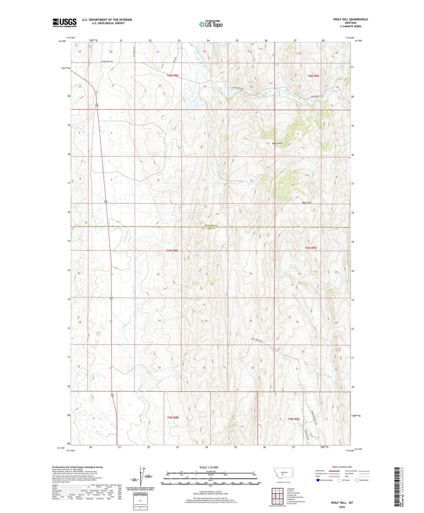
Wolf Hill Montana US Topo Map
Couldn't load pickup availability
2024 topographic map quadrangle Wolf Hill in the state of Montana. Scale: 1:24000. Based on the newly updated USGS 7.5' US Topo map series, this map is in the following counties: Park, Meagher. The map contains contour data, water features, and other items you are used to seeing on USGS maps, but also has updated roads and other features. This is the next generation of topographic maps. Printed on high-quality waterproof paper with UV fade-resistant inks.
Quads adjacent to this one:
West: Sixteen NE
Northwest: Ringling
North: Hamen
Northeast: Rimrock Divide
East: Scab Rock Mountain
Southeast: Lena Creek
South: Cottonwood Reservoir
Southwest: Wallrock
This map covers the same area as the classic USGS quad with code o46110b6.
Contains the following named places: 04N09E06B___01 Well, 05N09E21B___01 Well, 05N09E24D___01 Well, 05N09E26A___01 Well, 05N09E26D___01 Well, 06N08E28CA__01 Well, 06N08E34B___01 Well, Arthun Ranch, Billy Creek, Canyon Creek, Cleora Post Office, Cottonwood Creek, Gjerde Ranch, Kiff Reservoir 1 Dam, Kiff Reservoir 2 Dam, Lucas Number 2 Dam, Lucas Number 3 Dam, Oil Hills, Rees Hills, Staley Place, Tyman Place, Wolf Hill