MyTopo
Rock Island Ranch Montana US Topo Map
Couldn't load pickup availability
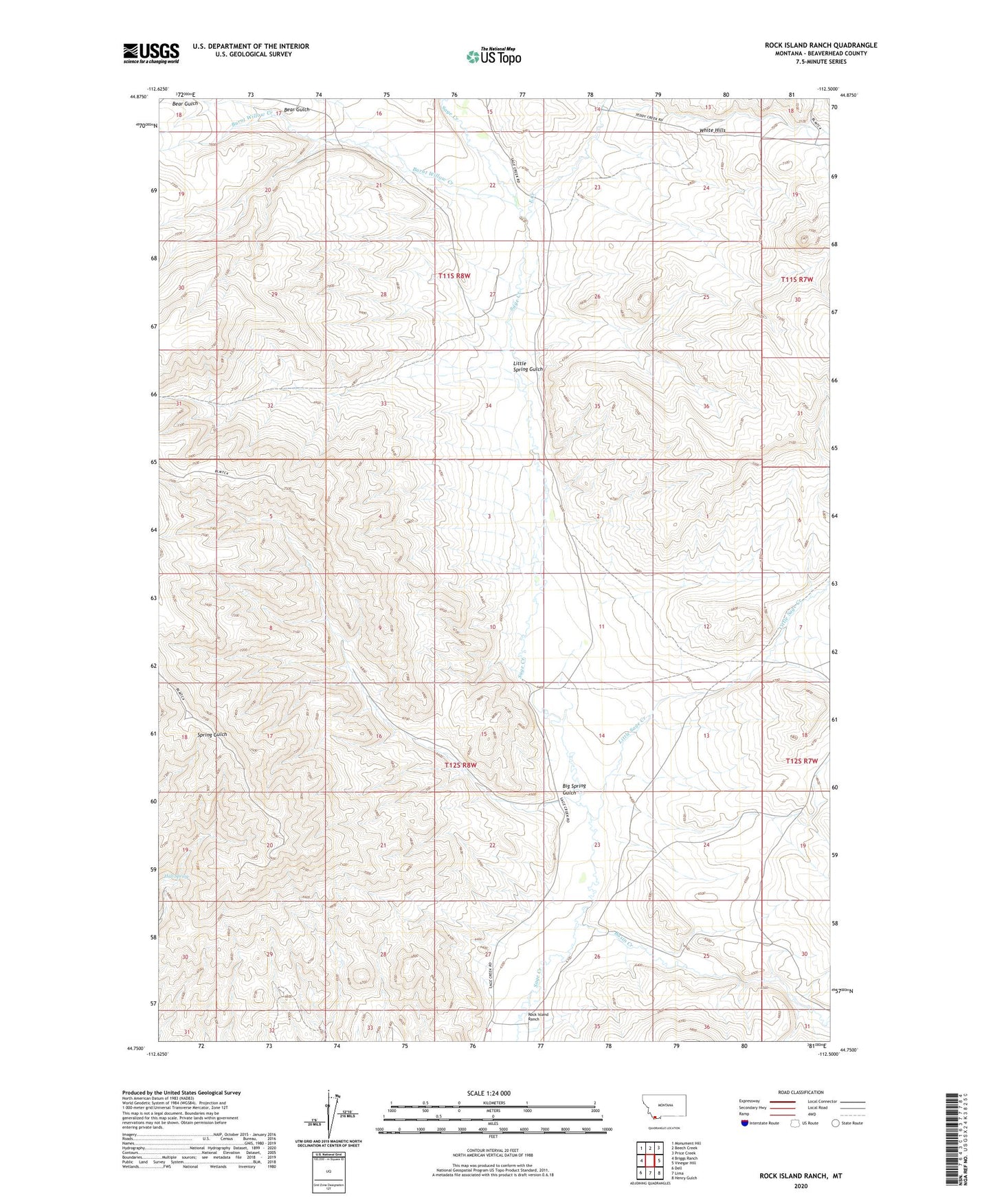
2024 topographic map quadrangle Rock Island Ranch in the state of Montana. Scale: 1:24000. Based on the newly updated USGS 7.5' US Topo map series, this map is in the following counties: Beaverhead. The map contains contour data, water features, and other items you are used to seeing on USGS maps, but also has updated roads and other features. This is the next generation of topographic maps. Printed on high-quality waterproof paper with UV fade-resistant inks.
Quads adjacent to this one:
West: Briggs Ranch
Northwest: Monument Hill
North: Beech Creek
Northeast: Price Creek
East: Vinegar Hill
Southeast: Henry Gulch
South: Lima
Southwest: Dell
This map covers the same area as the classic USGS quad with code o44112g5.
Contains the following named places: 11S08W22ABBD01 Well, 11S08W32ACAC01 Well, 12S08W03CBBD01 Well, 12S08W31ABD_01 Well, 12S08W34AAAC01 Well, Basin Creek, Bear Gulch, Big Spring Gulch, Burnt Willow Creek, East Creek, Hall Spring, Knox Ranch, Little Sage Creek, Little Spring Gulch, Rock Island Ranch, Sage Creek, White Hills