MyTopo
Lima Montana US Topo Map
Couldn't load pickup availability
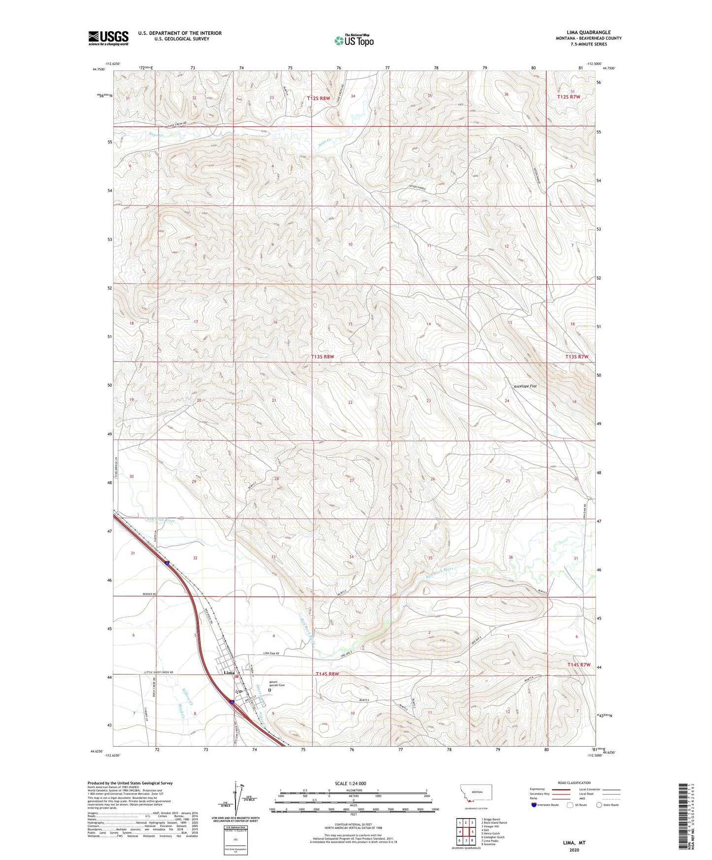
2024 topographic map quadrangle Lima in the state of Montana. Scale: 1:24000. Based on the newly updated USGS 7.5' US Topo map series, this map is in the following counties: Beaverhead. The map contains contour data, water features, and other items you are used to seeing on USGS maps, but also has updated roads and other features. This is the next generation of topographic maps. Printed on high-quality waterproof paper with UV fade-resistant inks.
Quads adjacent to this one:
West: Dell
Northwest: Briggs Ranch
North: Rock Island Ranch
Northeast: Vinegar Hill
East: Henry Gulch
Southeast: Snowline
South: Lima Peaks
Southwest: Gallagher Gulch
This map covers the same area as the classic USGS quad with code o44112f5.
Contains the following named places: 12S08W32DAAA01 Well, 14S08W04CCDA01 Well, 14S08W05ACB_01 Well, Alder Creek, Antelope Flat, Birch Creek, Great Northern Railway Historical Marker, Junction Creek, Lima, Lima City Park, Lima Community Church, Lima Mission, Lima Post Office, Lima Rural Volunteer Fire Department, Lima School, Mount Moriah Cemetery, Red Rock, Sportsman Inn and RV Park, The Church of Jesus Christ of Latter Day Saints, Town of Lima