MyTopo
Rocky Ridge Montana US Topo Map
Couldn't load pickup availability
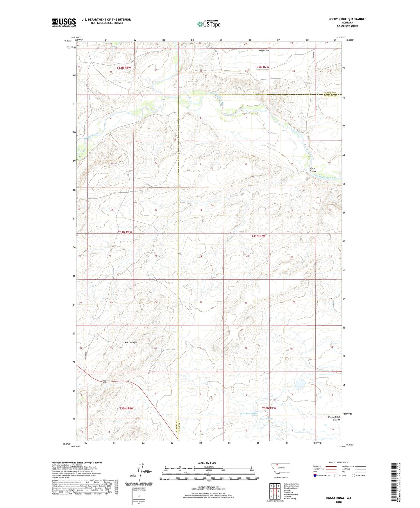
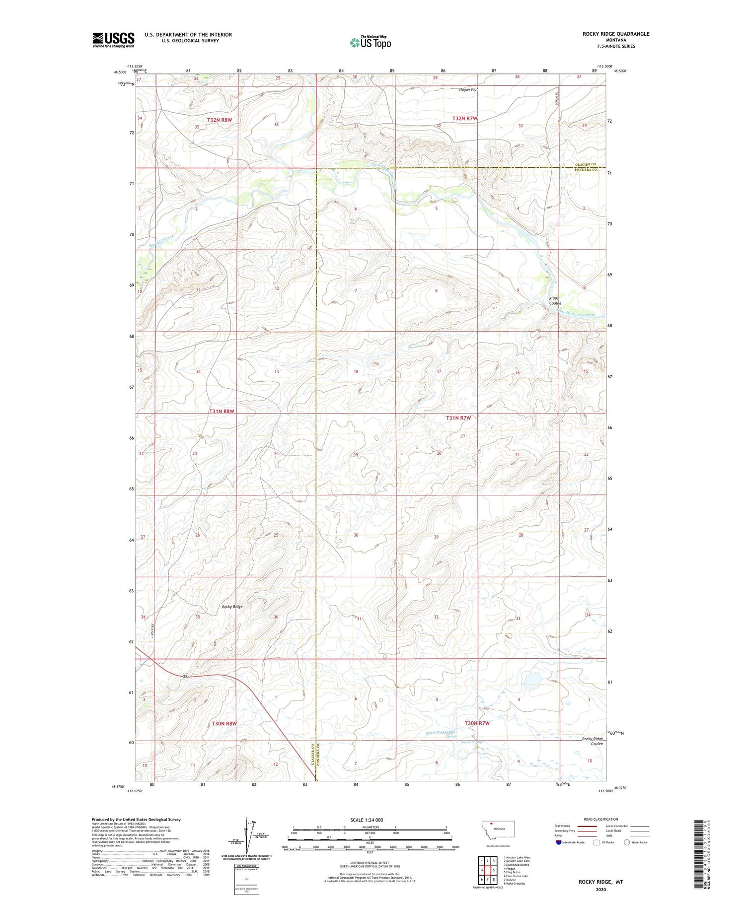
2020 topographic map quadrangle Rocky Ridge in the state of Montana. Scale: 1:24000. Based on the newly updated USGS 7.5' US Topo map series, this map is in the following counties: Pondera, Glacier. The map contains contour data, water features, and other items you are used to seeing on USGS maps, but also has updated roads and other features. This is the next generation of topographic maps. Printed on high-quality waterproof paper with UV fade-resistant inks.
Quads adjacent to this one:
West: Piegan
Northwest: Mission Lake West
North: Mission Lake East
Northeast: Duckhead Buttes
East: Flag Butte
Southeast: Kuka Crossing
South: Robere
Southwest: Four Horns Lake
Contains the following named places: 30N07W08AABB01 Spring, Badger Creek, Fisher Spring, Hagans Crossing, Kipps Coulee, Rocky Ridge