MyTopo
Salmon Prairie Montana US Topo Map
Couldn't load pickup availability
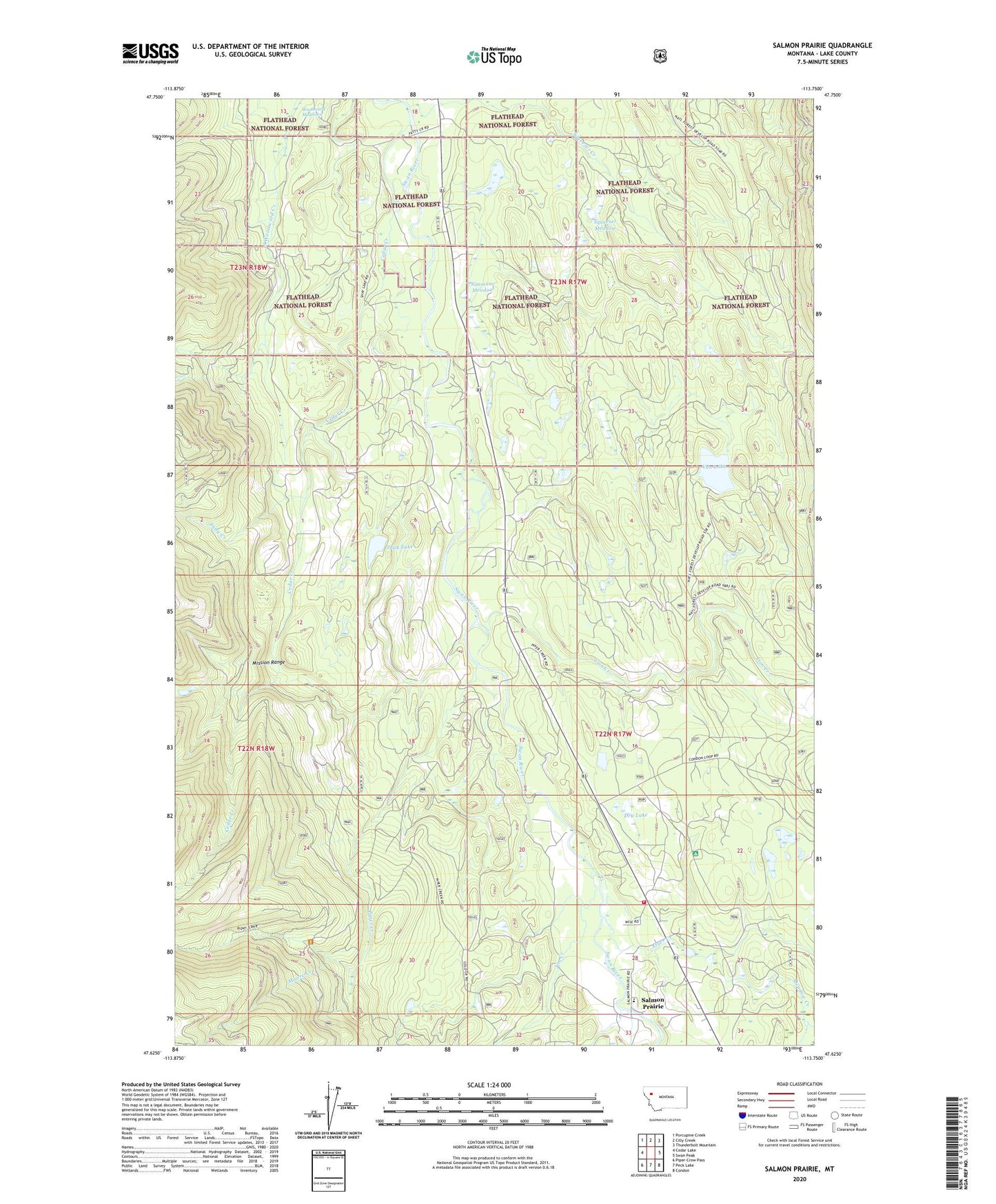
2020 topographic map quadrangle Salmon Prairie in the state of Montana. Scale: 1:24000. Based on the newly updated USGS 7.5' US Topo map series, this map is in the following counties: Lake. The map contains contour data, water features, and other items you are used to seeing on USGS maps, but also has updated roads and other features. This is the next generation of topographic maps. Printed on high-quality waterproof paper with UV fade-resistant inks.
Quads adjacent to this one:
West: Cedar Lake
Northwest: Porcupine Creek
North: Cilly Creek
Northeast: Thunderbolt Mountain
East: Swan Peak
Southeast: Condon
South: Peck Lake
Southwest: Piper-Crow Pass
Contains the following named places: 22N17W08BDBD01 Well, 22N17W21CAAA01 Well, 23N17W18DBDD01 Well, 23N17W31ADDD01 Well, 23N17W31BCCA01 Well, Alder Creek, Cedar Creek, Cedar Creek Campground, Crow Creek Trail, Dry Lake, Fatty Creek, Goat Creek, Jim Creek, Lion Creek, Meadow Creek, Moore Creek, Piper Creek, Salmon Prairie, Salmon Prairie School, Shay Lake, Simmons Meadow, Squeezer Creek, Squeezer Meadow, Swan Valley Emergency Services Station 2, Van Lake, Woodward Meadows