MyTopo
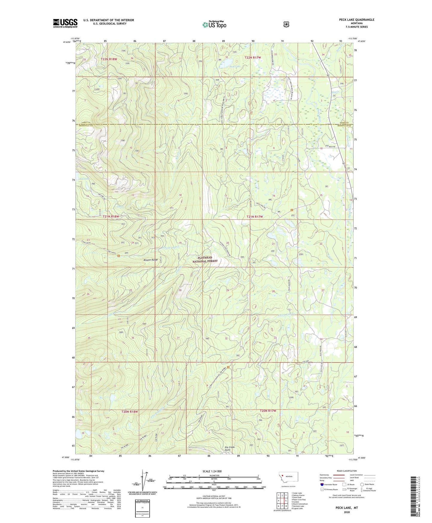
Peck Lake Montana US Topo Map
Couldn't load pickup availability
Also explore the Peck Lake Forest Service Topo of this same quad for updated USFS data
2024 topographic map quadrangle Peck Lake in the state of Montana. Scale: 1:24000. Based on the newly updated USGS 7.5' US Topo map series, this map is in the following counties: Missoula, Lake. The map contains contour data, water features, and other items you are used to seeing on USGS maps, but also has updated roads and other features. This is the next generation of topographic maps. Printed on high-quality waterproof paper with UV fade-resistant inks.
Quads adjacent to this one:
West: Piper-Crow Pass
Northwest: Cedar Lake
North: Salmon Prairie
Northeast: Swan Peak
East: Condon
Southeast: Cygnet Lake
South: Hemlock Lake
Southwest: Mount Calowahcan
This map covers the same area as the classic USGS quad with code o47113e7.
Contains the following named places: 21N17W10ADCB01 Well, 21N17W10DADA01 Well, 21N17W10DDBB01 Well, 21N17W28ADDC01 Well, Cold Creek, Condon Creek, Dog Creek, Jim Creek Lookout Tower, North Fork Cold Creek, Peck Lake, Pony Creek, South Fork Cold Creek