MyTopo
Seymour Reservoir Montana US Topo Map
Couldn't load pickup availability
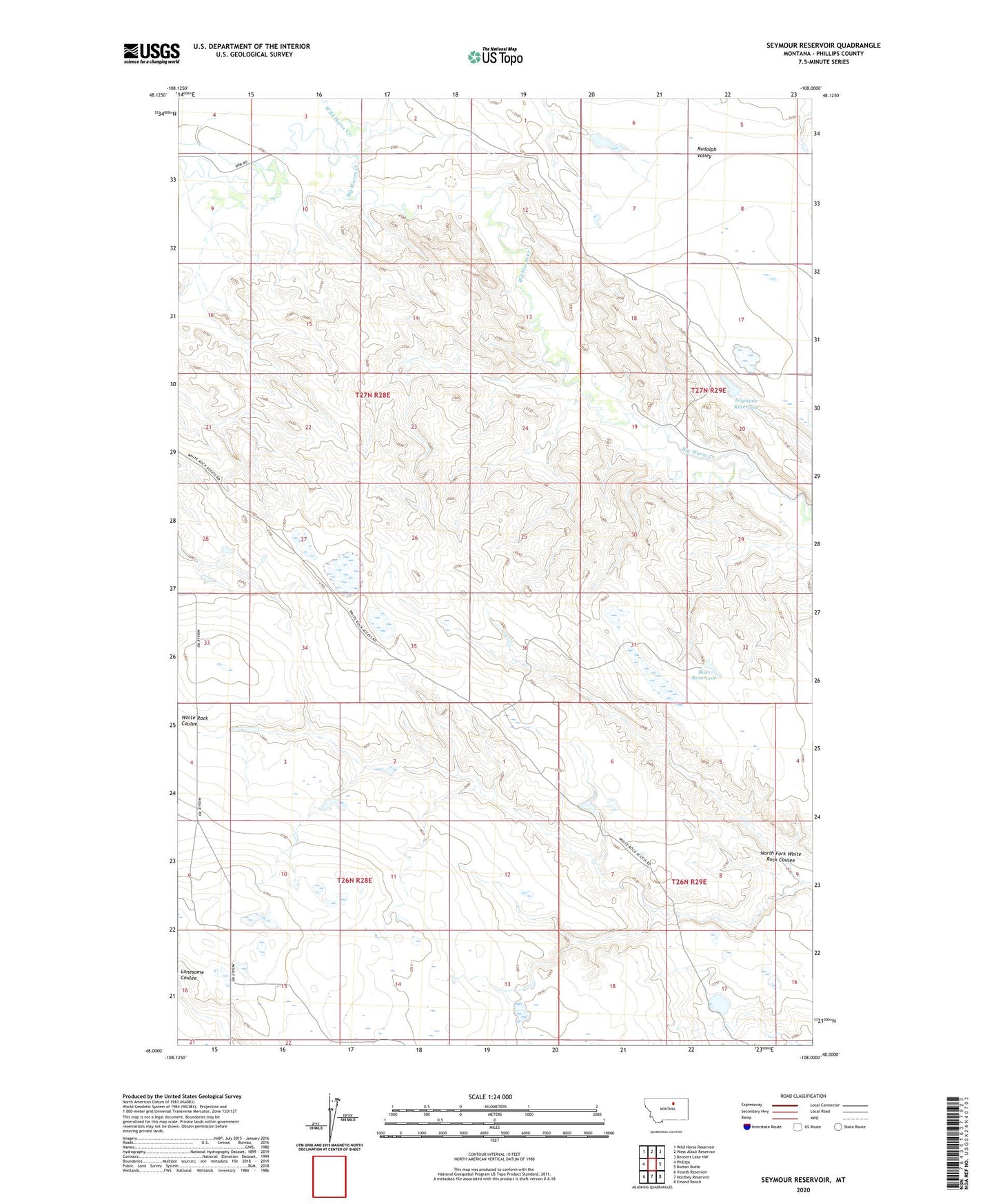
2020 topographic map quadrangle Seymour Reservoir in the state of Montana. Scale: 1:24000. Based on the newly updated USGS 7.5' US Topo map series, this map is in the following counties: Phillips. The map contains contour data, water features, and other items you are used to seeing on USGS maps, but also has updated roads and other features. This is the next generation of topographic maps. Printed on high-quality waterproof paper with UV fade-resistant inks.
Quads adjacent to this one:
West: Phillips
Northwest: Wild Horse Reservoir
North: West Alkali Reservoir
Northeast: Bennett Lake NW
East: Button Butte
Southeast: Emond Ranch
South: Holzhey Reservoir
Southwest: Veseth Reservoir
Contains the following named places: 27N29E19ACC_01 Well, Bass Reservoir, David DRUM Number 1 Dam, Halvor Number 2 Dam, J-5 Ranch Number 2 Dam, J-5 Ranch Number 3 Dam, North Fork White Rock Coulee, Rudolf Valley School, Schoolhouse Number 2 Dam, Seymour Reservoir, Seymour Reservoir Dam, White Rock Dam, White Rock School, Wild Horse Creek