MyTopo
Emond Ranch Montana US Topo Map
Couldn't load pickup availability
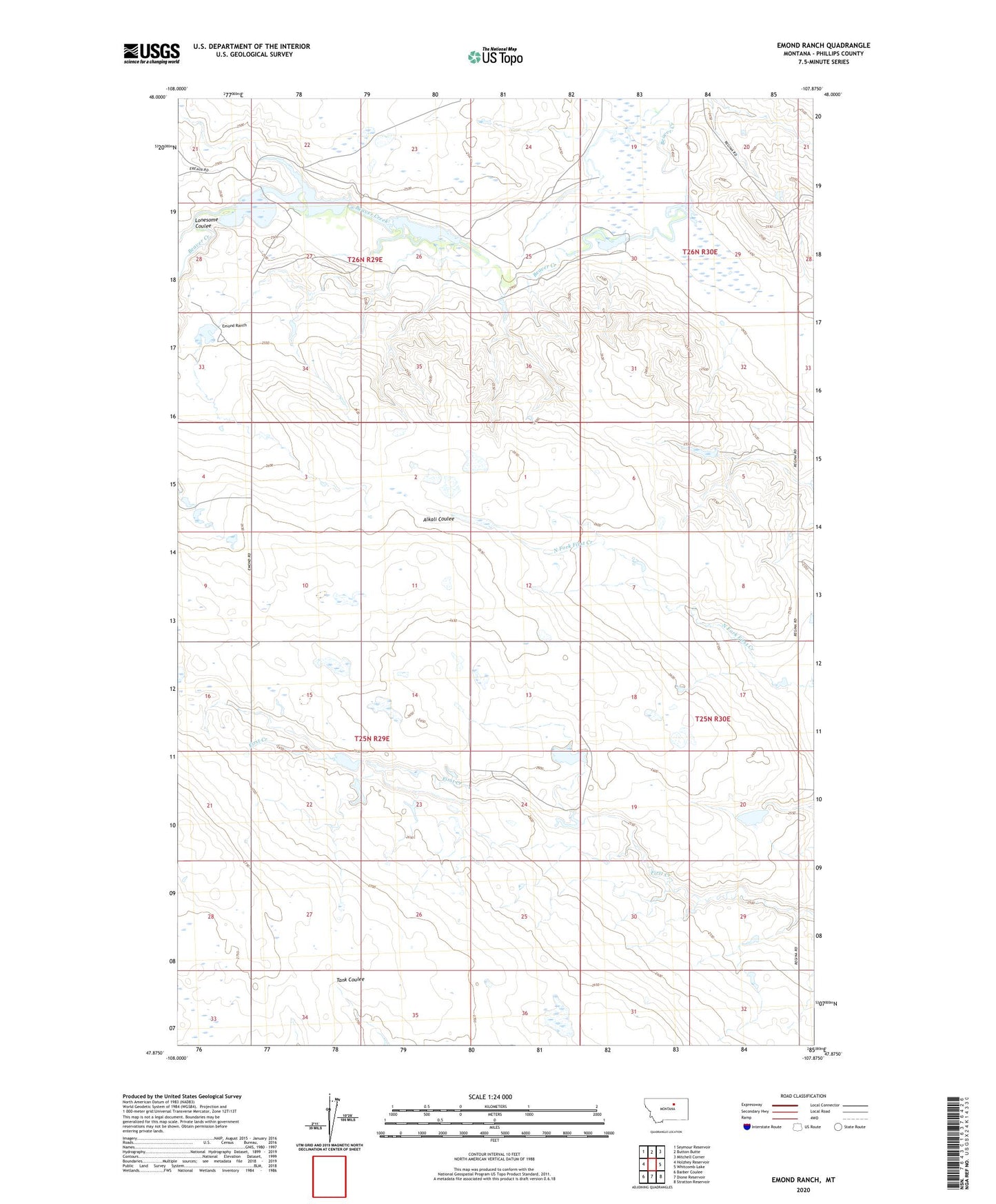
2024 topographic map quadrangle Emond Ranch in the state of Montana. Scale: 1:24000. Based on the newly updated USGS 7.5' US Topo map series, this map is in the following counties: Phillips. The map contains contour data, water features, and other items you are used to seeing on USGS maps, but also has updated roads and other features. This is the next generation of topographic maps. Printed on high-quality waterproof paper with UV fade-resistant inks.
Quads adjacent to this one:
West: Holzhey Reservoir
Northwest: Seymour Reservoir
North: Button Butte
Northeast: Mitchell Corner
East: Whitcomb Lake
Southeast: Stratton Reservoir
South: Dione Reservoir
Southwest: Barber Coulee
This map covers the same area as the classic USGS quad with code o47107h8.
Contains the following named places: 25N29E04CA__01 Well, 25N29E14CD__01 Well, 25N30E32AB__01 Well, 26N29E28DD__01 Well, 26N29E33ABCD01 Well, 26N29E33BD__01 Well, Beauchamp Number 3 Dam, Dahl Dam, David Drum Number 3 Dam, David Drum Number 4 Dam, Emond Ranch, Hand Number 2 Dam, Hand Number 3 Dam, Lonesome Coulee, Noel Number 2 Dam, North First Creek School, Old Whitcomb Place, Ork Dam, Peigneux Dam, Peigneux Ranch, Regina, Regina Post Office, Reina Post Office