MyTopo
Veseth Reservoir Montana US Topo Map
Couldn't load pickup availability
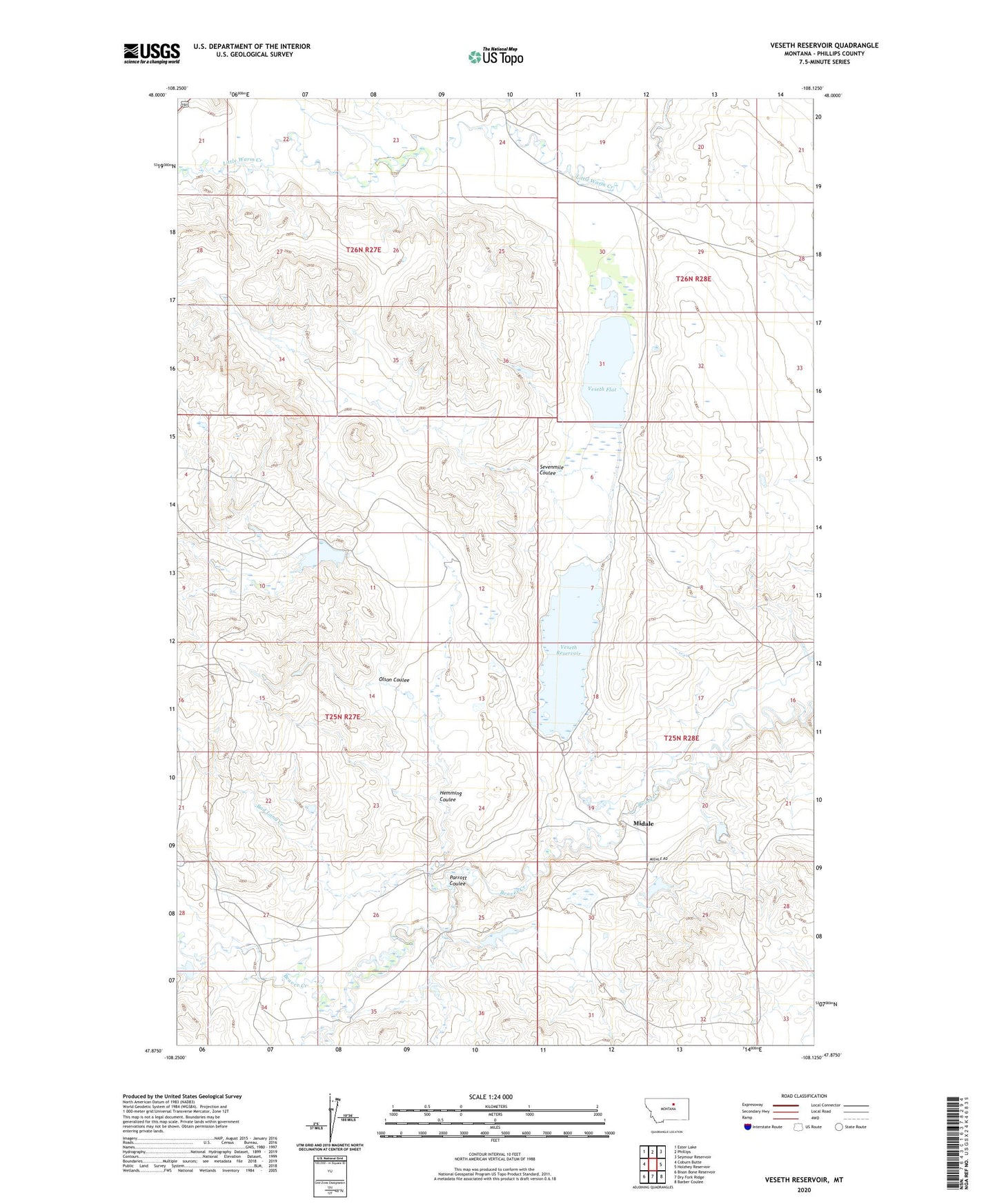
2024 topographic map quadrangle Veseth Reservoir in the state of Montana. Scale: 1:24000. Based on the newly updated USGS 7.5' US Topo map series, this map is in the following counties: Phillips. The map contains contour data, water features, and other items you are used to seeing on USGS maps, but also has updated roads and other features. This is the next generation of topographic maps. Printed on high-quality waterproof paper with UV fade-resistant inks.
Quads adjacent to this one:
West: Coburn Butte
Northwest: Ester Lake
North: Phillips
Northeast: Seymour Reservoir
East: Holzhey Reservoir
Southeast: Barber Coulee
South: Dry Fork Ridge
Southwest: Bison Bone Reservoir
This map covers the same area as the classic USGS quad with code o47108h2.
Contains the following named places: 25N27E11BBD_01 Well, 25N28E20BC__01 Well, 25N28E29BA__01 Well, 25N28E29BBB_01 Well, 25N28E32ADDD01 Well, 26N28E32CD__01 Well, Alley Oop Dam, Bad Land Creek, Hemming Coulee, Isaac Frye Number 3 Dam, Midale, Midale Post Office, Midale School, Olson Coulee, Parrott Coulee, Rocky Mountain Beaver Colony Dam, Sanders School, Sevenmile Coulee, Tree Bark Number 1 Dam, Tree Bark Number 2 Dam, Veseth Flat, Veseth Ranch, Veseth Reservoir, Veseth Reservoir Dam