MyTopo
Si Merrell Slough Montana US Topo Map
Couldn't load pickup availability
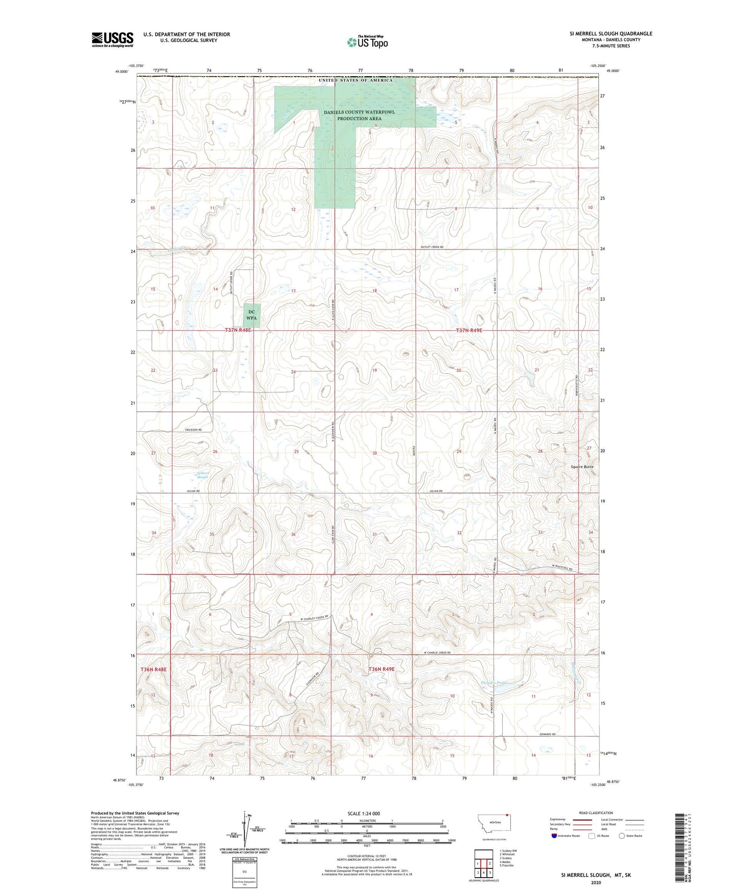
2024 topographic map quadrangle Si Merrell Slough in the state of Montana. Scale: 1:24000. Based on the newly updated USGS 7.5' US Topo map series, this map is in the following counties: Daniels. The map contains contour data, water features, and other items you are used to seeing on USGS maps, but also has updated roads and other features. This is the next generation of topographic maps. Printed on high-quality waterproof paper with UV fade-resistant inks.
Quads adjacent to this one:
West: Scobey NW
East: Whitetail
Southeast: Flaxville
South: Madoc
Southwest: Scobey
This map covers the same area as the classic USGS quad with code o48105h3.
Contains the following named places: 36N49E03CBBD01 Well, 36N49E04CCCD01 Well, 36N49E05CCAD01 Well, 36N49E07ACAC01 Well, 36N49E07DDCB01 Well, 36N49E09BDAA01 Well, 37N48E23BBDC01 Well, 37N48E23CDBB01 Well, 37N48E23CDBB02 Well, 37N48E25CBCD01 Well, 37N48E26CBCA01 Well, 37N48E26DAAC01 Well, 37N48E35CBCD01 Well, 37N49E04CCCB01 Well, 37N49E05AAAA01 Well, 37N49E05AAAB01 Well, 37N49E10BCCC01 Well, 37N49E16CDAA01 Well, 37N49E16DCBB01 Well, 37N49E16DDDD01 Well, 37N49E17DDDD01 Well, 37N49E18ABAD01 Well, 37N49E18ABAD02 Well, 37N49E18BCCC01 Well, 37N49E18BCCC02 Well, 37N49E19BCCC01 Well, 37N49E19DD__01 Well, 37N49E20AAAA01 Well, 37N49E20CCCC01 Well, 37N49E20CCCC02 Well, 37N49E28DDAA01 Well, 37N49E30CCDB01 Well, 37N49E32DBBD01 Well, 37N49E33DCBD01 Well, Baby Blue Dam, Daniels County Waterfowl Production Area, Jagiello Waterfowl Production Area, Julian, Julian Erickson School, Julian Post Office, Outlet Marsh Waterfowl Production Area, Paradis Pond, Si Merrell Slough, Square Butte, Willard Slough