MyTopo
Flaxville Montana US Topo Map
Couldn't load pickup availability
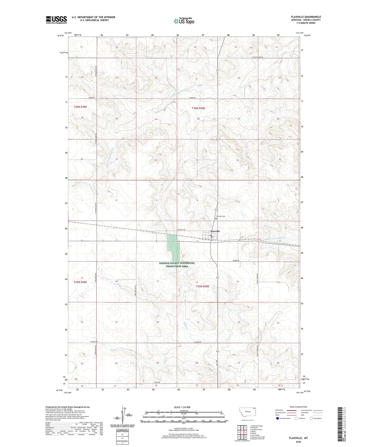
2024 topographic map quadrangle Flaxville in the state of Montana. Scale: 1:24000. Based on the newly updated USGS 7.5' US Topo map series, this map is in the following counties: Daniels. The map contains contour data, water features, and other items you are used to seeing on USGS maps, but also has updated roads and other features. This is the next generation of topographic maps. Printed on high-quality waterproof paper with UV fade-resistant inks.
Quads adjacent to this one:
West: Madoc
Northwest: Si Merrell Slough
North: Whitetail
Northeast: Goodale Coulee
East: Navajo
Southeast: Pleasant Prairie NE
South: Pleasant Prairie NW
Southwest: Line Coulee
This map covers the same area as the classic USGS quad with code o48105g2.
Contains the following named places: 35N49E01ADCD01 Well, 35N49E13BAAD01 Well, 35N49E13DDAB01 Well, 35N50E06BCBD01 Well, 35N50E07ADDB01 Well, 35N50E08BADD01 Well, 35N50E09ACAD01 Well, 35N50E09BADB01 Well, 35N50E10ACBB01 Well, 35N50E14CBBB01 Well, 35N50E14DDBD01 Well, 35N50E15ABBC01 Well, 35N50E15ABBC02 Well, 35N50E15ABCB01 Well, 35N50E16BABC01 Well, 35N50E19CCDA01 Well, 35N50E20DADB01 Well, 35N50E22CBBA01 Well, 35N50E26CCCA01 Well, 35N50E27AADD01 Well, 35N50E28ADCA01 Well, 35N50E28ADCA02 Well, 35N50E28CCBA01 Well, 35N50E29AADD01 Well, 35N50E29DDAB01 Well, 35N50E30BCAA01 Well, 36N49E24DADA01 Well, 36N50E20DDDB01 Well, 36N50E21AAAD01 Well, 36N50E26AACD01 Well, 36N50E28DBBA01 Well, 36N50E31DADD01 Well, Farmers Co-Op Elevator, Farmers Union Grain Terminal Association Elevator, Flaxville, Flaxville Cemetery, Flaxville Community Fire Department, Flaxville Lutheran Parish, Flaxville Methodist Church, Flaxville Post Office, Flaxville School, Flaxville Waterfowl Production Area, Saint Louis Catholic Church, Town of Flaxville