MyTopo
Sims Spring Montana US Topo Map
Couldn't load pickup availability
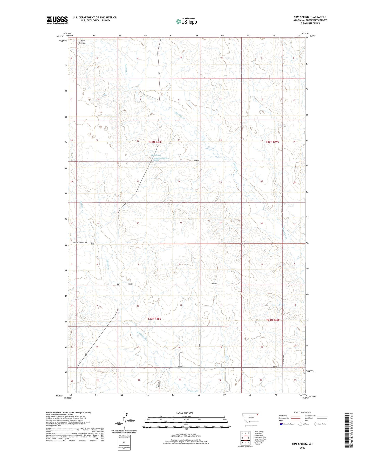
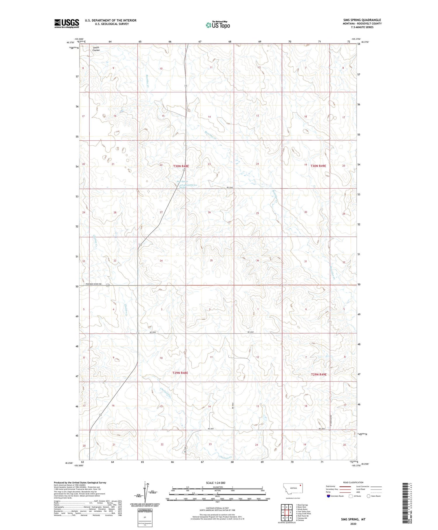
2020 topographic map quadrangle Sims Spring in the state of Montana. Scale: 1:24000. Based on the newly updated USGS 7.5' US Topo map series, this map is in the following counties: Roosevelt. The map contains contour data, water features, and other items you are used to seeing on USGS maps, but also has updated roads and other features. This is the next generation of topographic maps. Printed on high-quality waterproof paper with UV fade-resistant inks.
Quads adjacent to this one:
West: Tule Valley East
Northwest: Reed Springs
North: Bears Nest
Northeast: Windy Butte
East: Long Creek West
Southeast: Chelsea
South: Chelsea NW
Southwest: Wolf Point NE
Contains the following named places: 29N48E09ADDC01 Well, 29N48E11ADDD01 Well, 29N48E14DBCC01 Well, 29N48E14DCAB01 Well, 30N48E13AABB01 Well, 30N48E15ACAC01 Well, 30N48E20DAAB01 Well, 30N48E20DD__01 Well, 30N48E22DDCA01 Spring, 30N48E26BACC01 Well, 30N49E18ACAA01 Well, Box Elder School, Boyd School, Hertino School, Sims Spring, Smith Coulee, Structure Number 149 Dam, Structure Number 149 Reservoir, Trenne School