MyTopo
Sliderock Mountain Montana US Topo Map
Couldn't load pickup availability
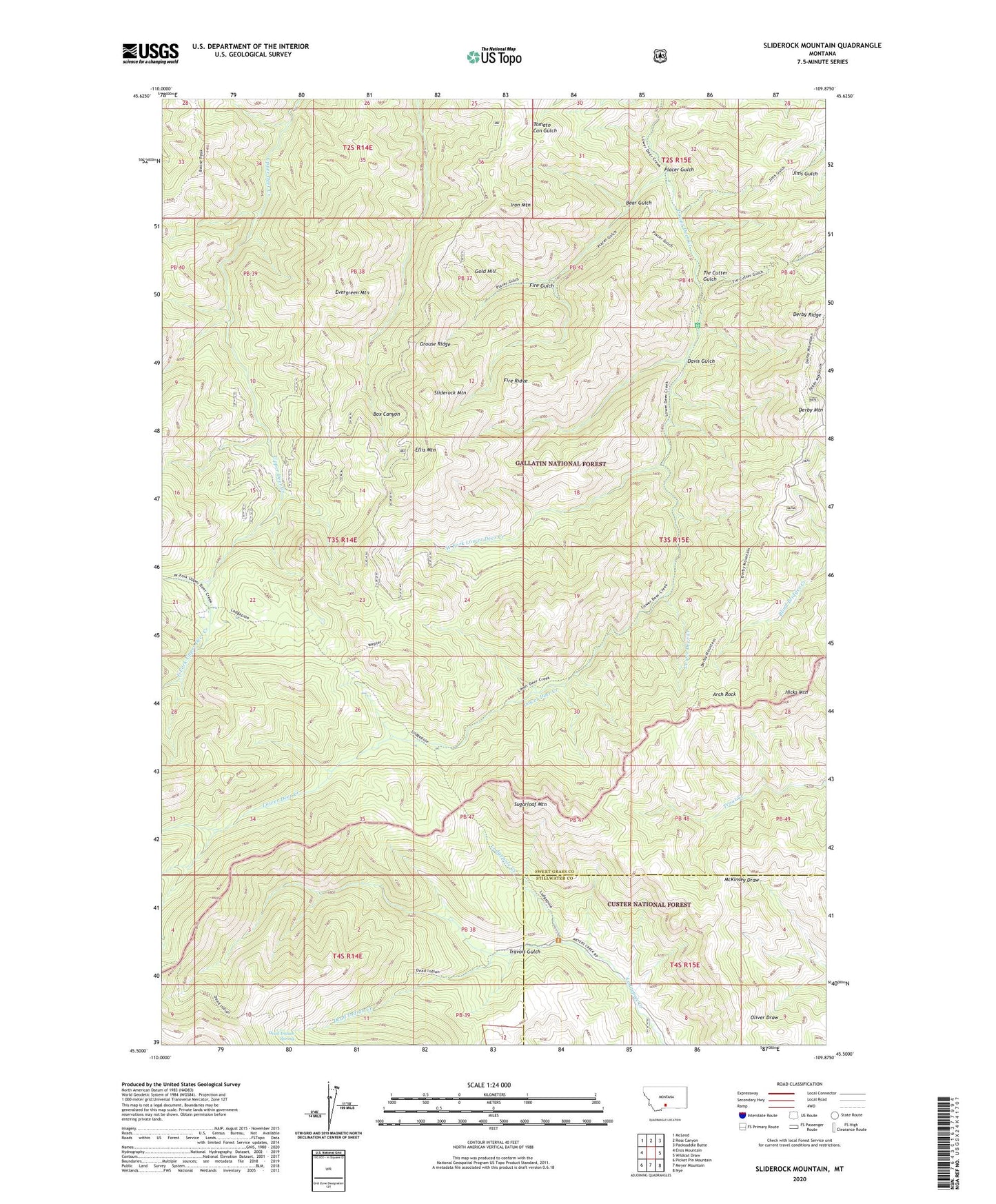
2020 topographic map quadrangle Sliderock Mountain in the state of Montana. Scale: 1:24000. Based on the newly updated USGS 7.5' US Topo map series, this map is in the following counties: Sweet Grass, Stillwater. The map contains contour data, water features, and other items you are used to seeing on USGS maps, but also has updated roads and other features. This is the next generation of topographic maps. Printed on high-quality waterproof paper with UV fade-resistant inks.
Quads adjacent to this one:
West: Enos Mountain
Northwest: McLeod
North: Ross Canyon
Northeast: Packsaddle Butte
East: Wildcat Draw
Southeast: Nye
South: Meyer Mountain
Southwest: Picket Pin Mountain
Contains the following named places: Arch Rock, Bear Gulch, Crow Mine, Davis Gulch, Dead Indian Creek, Dead Indian Spring, Derby Mountain, Derby Ridge, East Fork Upper Deer Creek, Ellis Mountain, Evergreen Mountain, Fire Gulch, Fire Ridge, Gold Hill, Gold Hill Mine, Grouse Ridge, Hicks Mountain, Iron Mountain, Knapp Mine, Lodgepole Trail, Placer Gulch, Placer Gulch Mine, Ross Mine, Silver King Mine, Sliderock Mountain, South of the Yellowstone Division, Sugarloaf Mountain, Surprise Mine, Tie Cutter Gulch, Travois Gulch, Wepler Cabin, West Fork Lower Deer Creek