MyTopo
Snoose Creek Montana US Topo Map
Couldn't load pickup availability
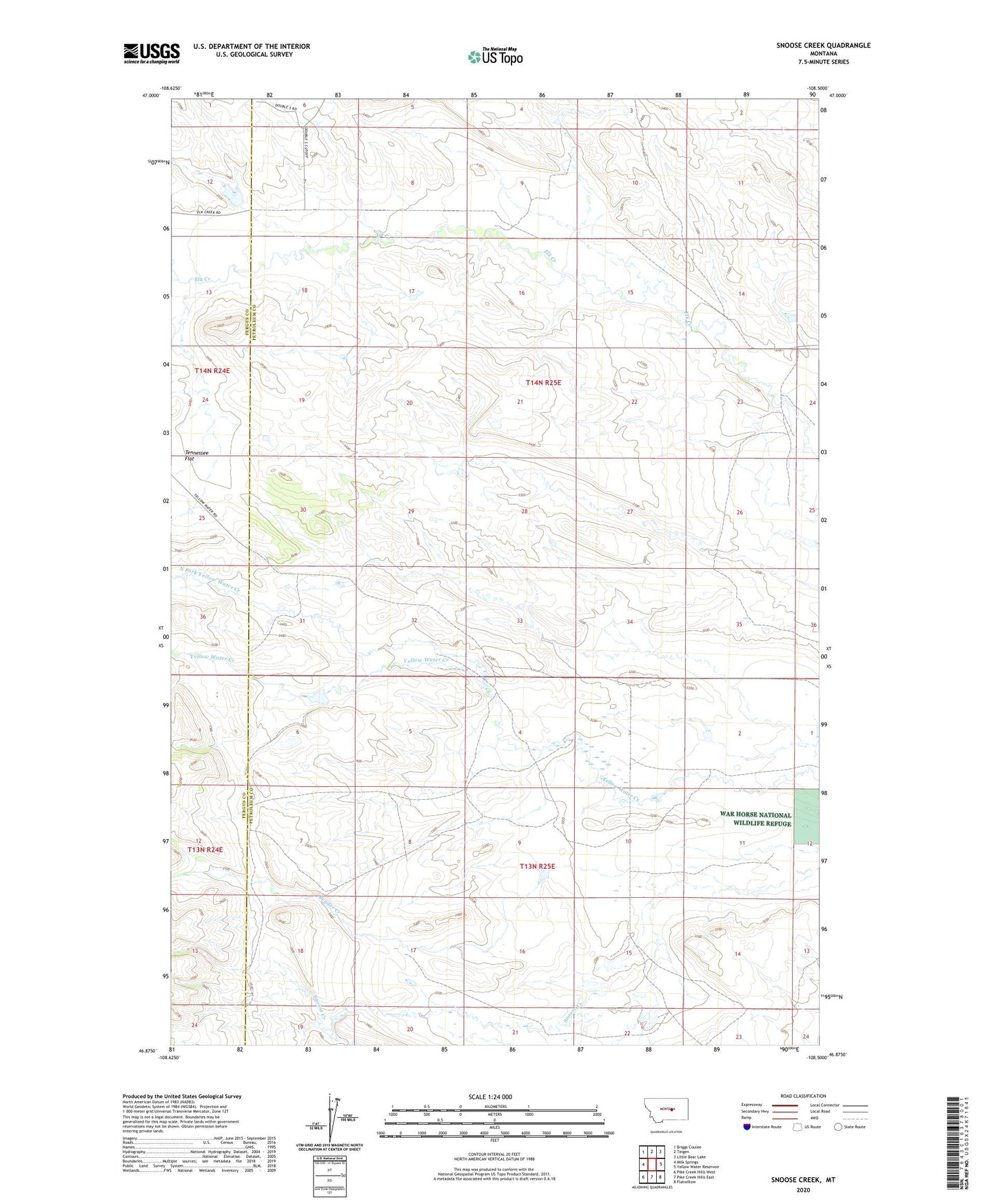
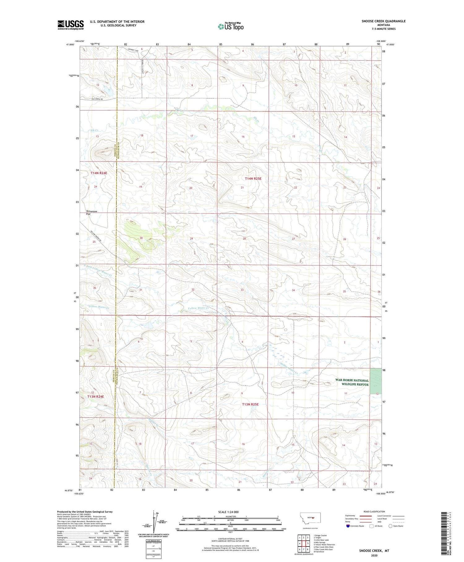
2020 topographic map quadrangle Snoose Creek in the state of Montana. Scale: 1:24000. Based on the newly updated USGS 7.5' US Topo map series, this map is in the following counties: Petroleum, Fergus. The map contains contour data, water features, and other items you are used to seeing on USGS maps, but also has updated roads and other features. This is the next generation of topographic maps. Printed on high-quality waterproof paper with UV fade-resistant inks.
Quads adjacent to this one:
West: Milk Springs
Northwest: Briggs Coulee
North: Teigen
Northeast: Little Bear Lake
East: Yellow Water Reservoir
Southeast: Flatwillow
South: Pike Creek Hills East
Southwest: Pike Creek Hills West
Contains the following named places: 13N24E12DDA_01 Well, 13N25E03DBA_01 Well, 13N25E09CD__01 Well, 13N25E10DCB_01 Well, 13N25E18____01 Well, 14N25E23ACD_01 Well, 14N25E23DD__01 Well, Bender Creek, Carmichael School, J Schultz Number 1 Dam, North Fork Yellow Water Creek, Pineview School, Stroup School, Tennessee Flat, Yellow Water School