
MyTopo
Soda Springs NW Montana US Topo Map
Couldn't load pickup availability
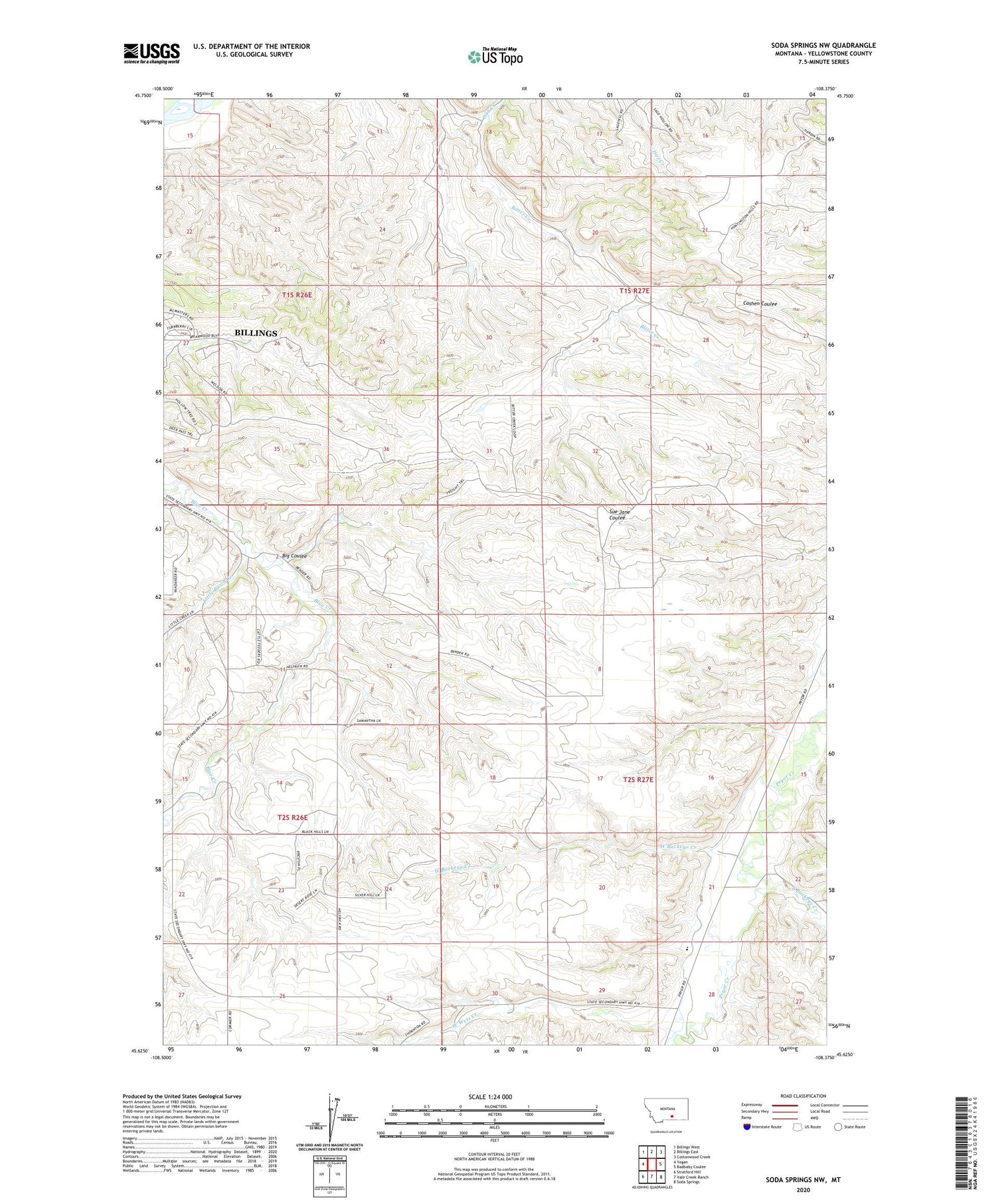
2020 topographic map quadrangle Soda Springs NW in the state of Montana. Scale: 1:24000. Based on the newly updated USGS 7.5' US Topo map series, this map is in the following counties: Yellowstone. The map contains contour data, water features, and other items you are used to seeing on USGS maps, but also has updated roads and other features. This is the next generation of topographic maps. Printed on high-quality waterproof paper with UV fade-resistant inks.
Quads adjacent to this one:
West: Yegen
Northwest: Billings West
North: Billings East
Northeast: Cottonwood Creek
East: Badbaby Coulee
Southeast: Soda Springs
South: Vale Creek Ranch
Southwest: Stratford Hill
Contains the following named places: 01S26E13D___01 Well, 02S26E02BDD_01 Well, B O'Leary Number 2 Dam, Big Coulee, Billings Racetrack, Dirt Creek, East Buckeye Creek, Little Basin Creek, Morin School, Pictograph Cave State Park, South Yellowstone Division, West Buckeye Creek, West Wets Creek


