MyTopo
Yegen Montana US Topo Map
Couldn't load pickup availability
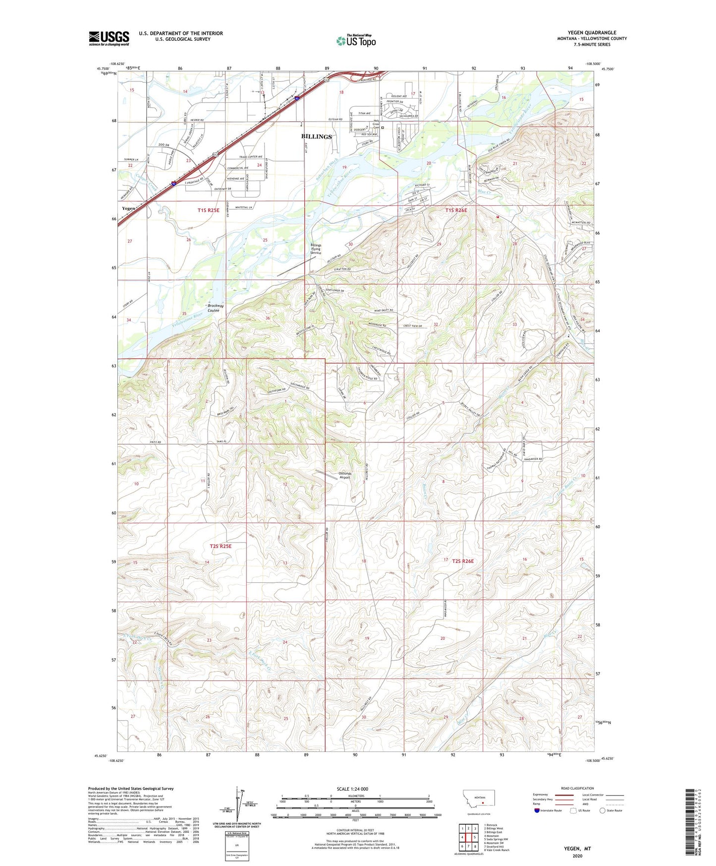
2024 topographic map quadrangle Yegen in the state of Montana. Scale: 1:24000. Based on the newly updated USGS 7.5' US Topo map series, this map is in the following counties: Yellowstone. The map contains contour data, water features, and other items you are used to seeing on USGS maps, but also has updated roads and other features. This is the next generation of topographic maps. Printed on high-quality waterproof paper with UV fade-resistant inks.
Quads adjacent to this one:
West: Mossmain
Northwest: Rimrock
North: Billings West
Northeast: Billings East
East: Soda Springs NW
Southeast: Vale Creek Ranch
South: Stratford Hill
Southwest: Mossmain SW
This map covers the same area as the classic USGS quad with code o45108f5.
Contains the following named places: 01S25E13DACC01 Well, 01S25E22AAAA01 Well, 01S25E23AAAC01 Well, 01S25E26ADDB01 Well, 01S25E26BBAA01 Well, 01S25E35BBBC01 Well, 01S26E16ADDA01 Well, 01S26E17DCAB01 Well, 01S26E18ACCD01 Well, 01S26E19ADAB01 Well, 01S26E19BCBB01 Well, 01S26E20DDDA01 Well, 01S26E28ACAC01 Well, 01S26E28BACD01 Well, 02S26E10BDCA01 Well, Advanced Care Hospital of Montana, Airpark Oscars, Basin Creek, Billings Flying Service, Blue Creek, Blue Creek School, Blue Creek Volunteer Fire Department, Brockway Coulee, Canyon Creek, Hogans Slough, Holy Cross Cemetery, KCTR-AM (Billings), KEMC-FM (Billings), KGHL-AM (Billings), Newman Creek, Ostlunds Airport, Ross Homestead, South Hills Fishing Access Site, Suburban Ditch, Yegen, Yellowstone Baptist College