MyTopo
Badbaby Coulee Montana US Topo Map
Couldn't load pickup availability
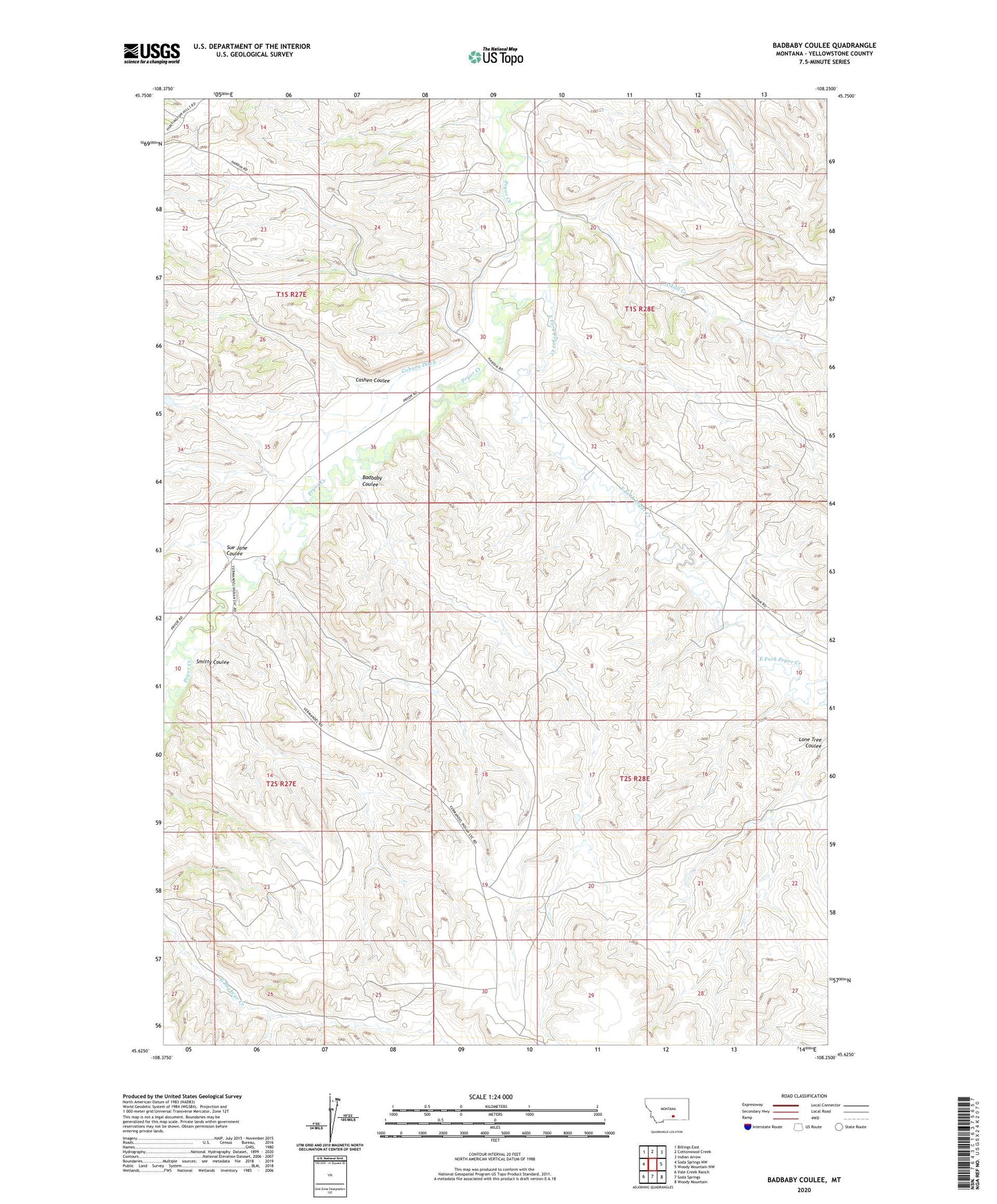
2024 topographic map quadrangle Badbaby Coulee in the state of Montana. Scale: 1:24000. Based on the newly updated USGS 7.5' US Topo map series, this map is in the following counties: Yellowstone. The map contains contour data, water features, and other items you are used to seeing on USGS maps, but also has updated roads and other features. This is the next generation of topographic maps. Printed on high-quality waterproof paper with UV fade-resistant inks.
Quads adjacent to this one:
West: Soda Springs NW
Northwest: Billings East
North: Cottonwood Creek
Northeast: Indian Arrow
East: Woody Mountain NW
Southeast: Woody Mountain
South: Soda Springs
Southwest: Vale Creek Ranch
This map covers the same area as the classic USGS quad with code o45108f3.
Contains the following named places: 01S27E36ADBB01 Well, Alkali Creek, Badbaby Coulee, Cashen Coulee, Coburn Ditch, East Fork Pryor Creek, S and S Kurth Number 1 Dam, Smitty Coulee, Sue Jane Coulee