MyTopo
Springdale Montana US Topo Map
Couldn't load pickup availability
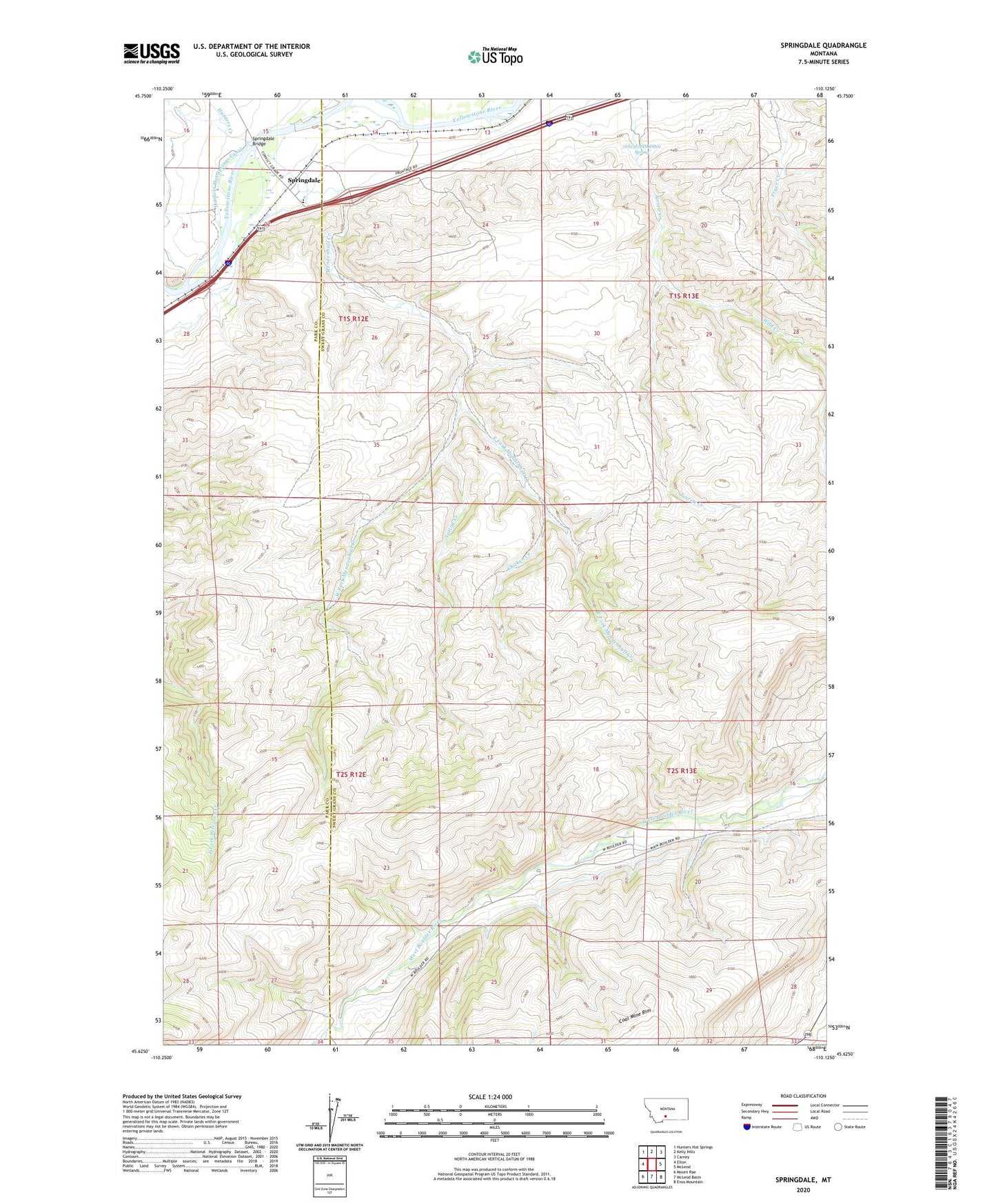
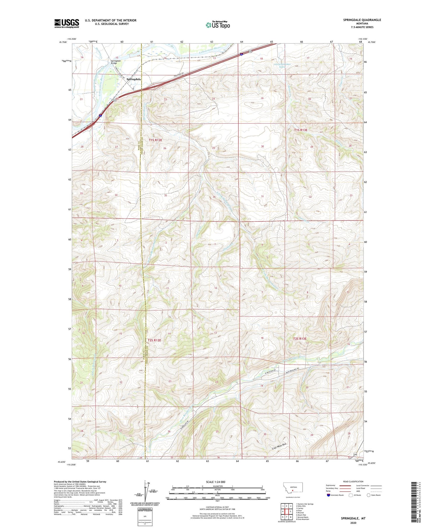
2020 topographic map quadrangle Springdale in the state of Montana. Scale: 1:24000. Based on the newly updated USGS 7.5' US Topo map series, this map is in the following counties: Sweet Grass, Park. The map contains contour data, water features, and other items you are used to seeing on USGS maps, but also has updated roads and other features. This is the next generation of topographic maps. Printed on high-quality waterproof paper with UV fade-resistant inks.
Quads adjacent to this one:
West: Elton
Northwest: Hunters Hot Springs
North: Kelly Hills
Northeast: Carney
East: McLeod
Southeast: Enos Mountain
South: McLeod Basin
Southwest: Mount Rae
Contains the following named places: 01S12E22A___03 Well, 01S12E22C___01 Well, 01S12E23ACBD01 Well, 01S13E18DDDB01 Spring, 02S13E20ABBA01 Well, 59082, Bert Woods Homestead, Bob Woods Homestead, Calcite Mine, Chicken Creek, Clayton Ranch, Currier Ranch, East Fork Mendenhall Creek, Elgas Ranch, Foster Ranch, Hash Homestead, Hunters Creek, Jarrett Ranch, Lone Tree Section, Mason Homestead, Mendenhall Creek, Olson Homestead, Spring Creek, Springdale, Springdale Bridge, Springdale Bridge Fishing Access Site, Springdale Census Designated Place, Springdale Post Office, Springdale Ranch, Springdale School, Swanson Homestead, West Fork Mendenhall Creek, Wild Creek