MyTopo
Stellar Lake Montana US Topo Map
Couldn't load pickup availability
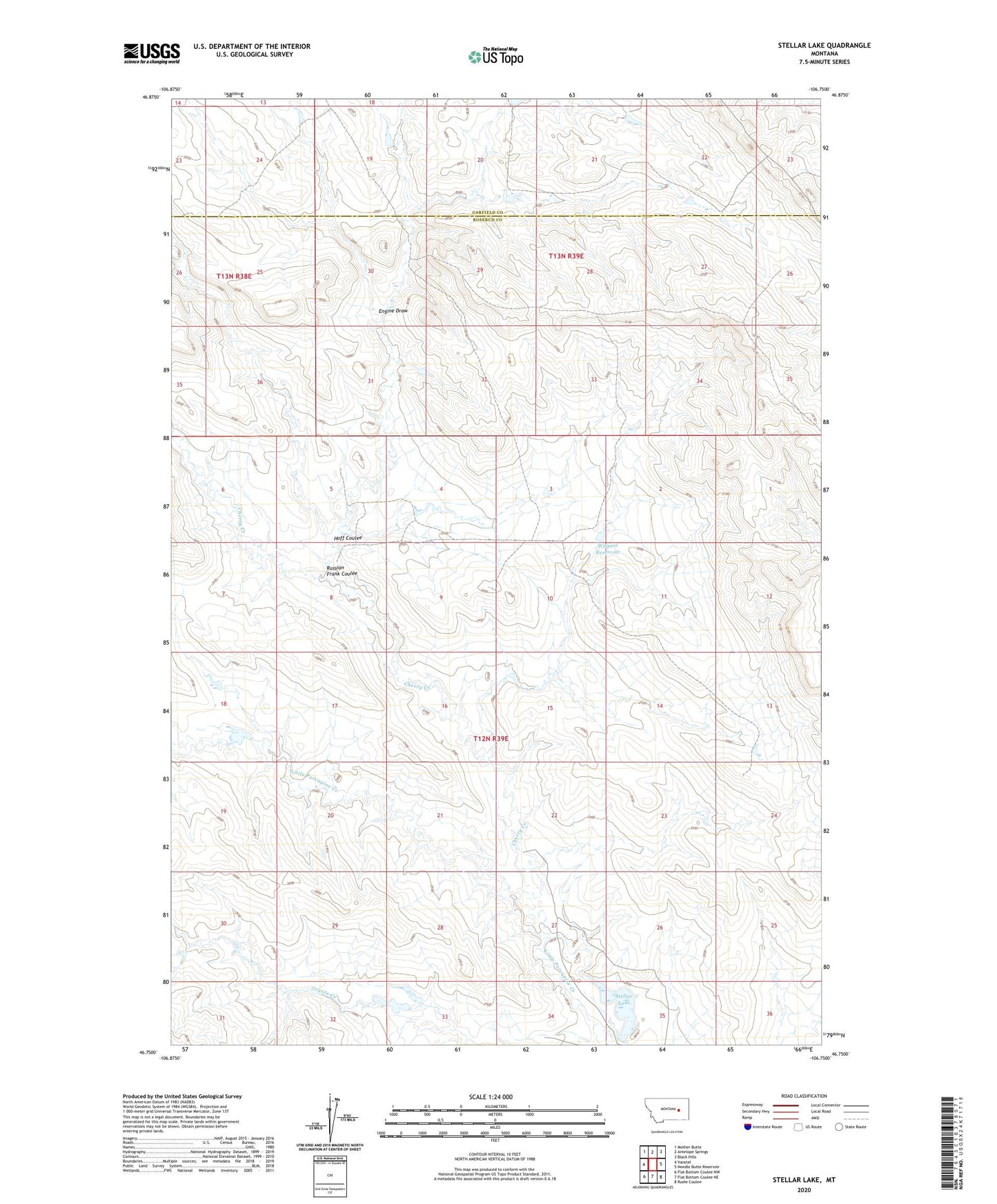
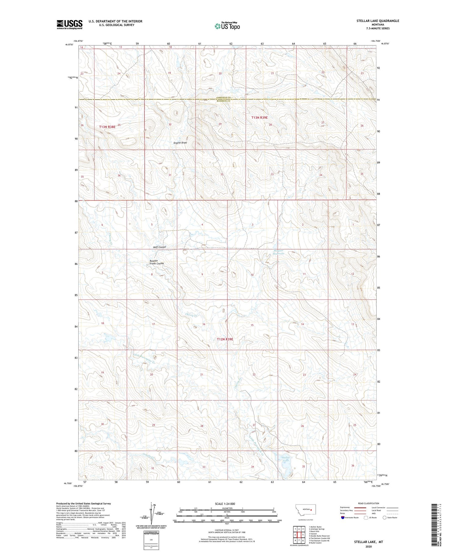
2020 topographic map quadrangle Stellar Lake in the state of Montana. Scale: 1:24000. Based on the newly updated USGS 7.5' US Topo map series, this map is in the following counties: Rosebud, Garfield. The map contains contour data, water features, and other items you are used to seeing on USGS maps, but also has updated roads and other features. This is the next generation of topographic maps. Printed on high-quality waterproof paper with UV fade-resistant inks.
Quads adjacent to this one:
West: Vanstel
Northwest: Mother Butte
North: Antelope Springs
Northeast: Black Hills
East: Needle Butte Reservoir
Southeast: Rudie Coulee
South: Flat Bottom Coulee NE
Southwest: Flat Bottom Coulee NW
Contains the following named places: 12N39E09AA__01 Well, 12N39E09AACA01 Well, Brooks Number 2 Dam, Cherry Creek, Cherry Creek Number 23 Dam, Cherry Creek School, Engine Draw, Hoff Coulee, Russian Frank Coulee, Stellar Lake, Stellar Lake Dam, Twin Dam Number 1, Twin Dam Number 2, Wagner Reservoir