MyTopo
Vanstel Montana US Topo Map
Couldn't load pickup availability
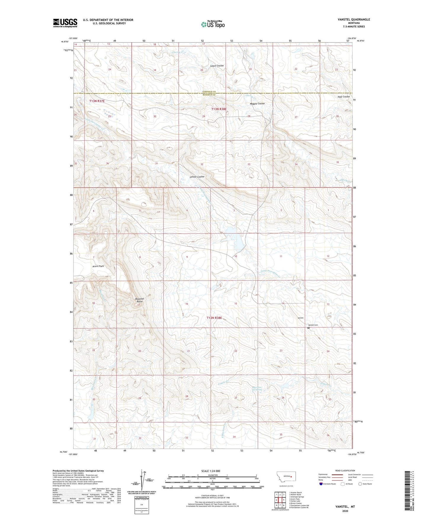
2024 topographic map quadrangle Vanstel in the state of Montana. Scale: 1:24000. Based on the newly updated USGS 7.5' US Topo map series, this map is in the following counties: Rosebud, Garfield. The map contains contour data, water features, and other items you are used to seeing on USGS maps, but also has updated roads and other features. This is the next generation of topographic maps. Printed on high-quality waterproof paper with UV fade-resistant inks.
Quads adjacent to this one:
West: Acorn Flats
Northwest: Kramer Ranch
North: Mother Butte
Northeast: Antelope Springs
East: Stellar Lake
Southeast: Flat Bottom Coulee NE
South: Flat Bottom Coulee NW
Southwest: Brown Coulee
This map covers the same area as the classic USGS quad with code o46106g8.
Contains the following named places: 03N39E08CBBB01 Well, 12N38E27AD__01 Well, Blacktail Butte, Cherry Creek Number 12 Dam, Cherry Creek Number 15 Dam, Cherry Creek Number 17 Dam, Halvorson Hot Spring, Leach Coulee, Lehner Coulee, Magpie Coulee, Schiffer Number 6 Dam, Vanstel, Vanstel Cemetery, Vanstel Post Office, Vanstel School