
MyTopo
Stinking Coulee Montana US Topo Map
Couldn't load pickup availability
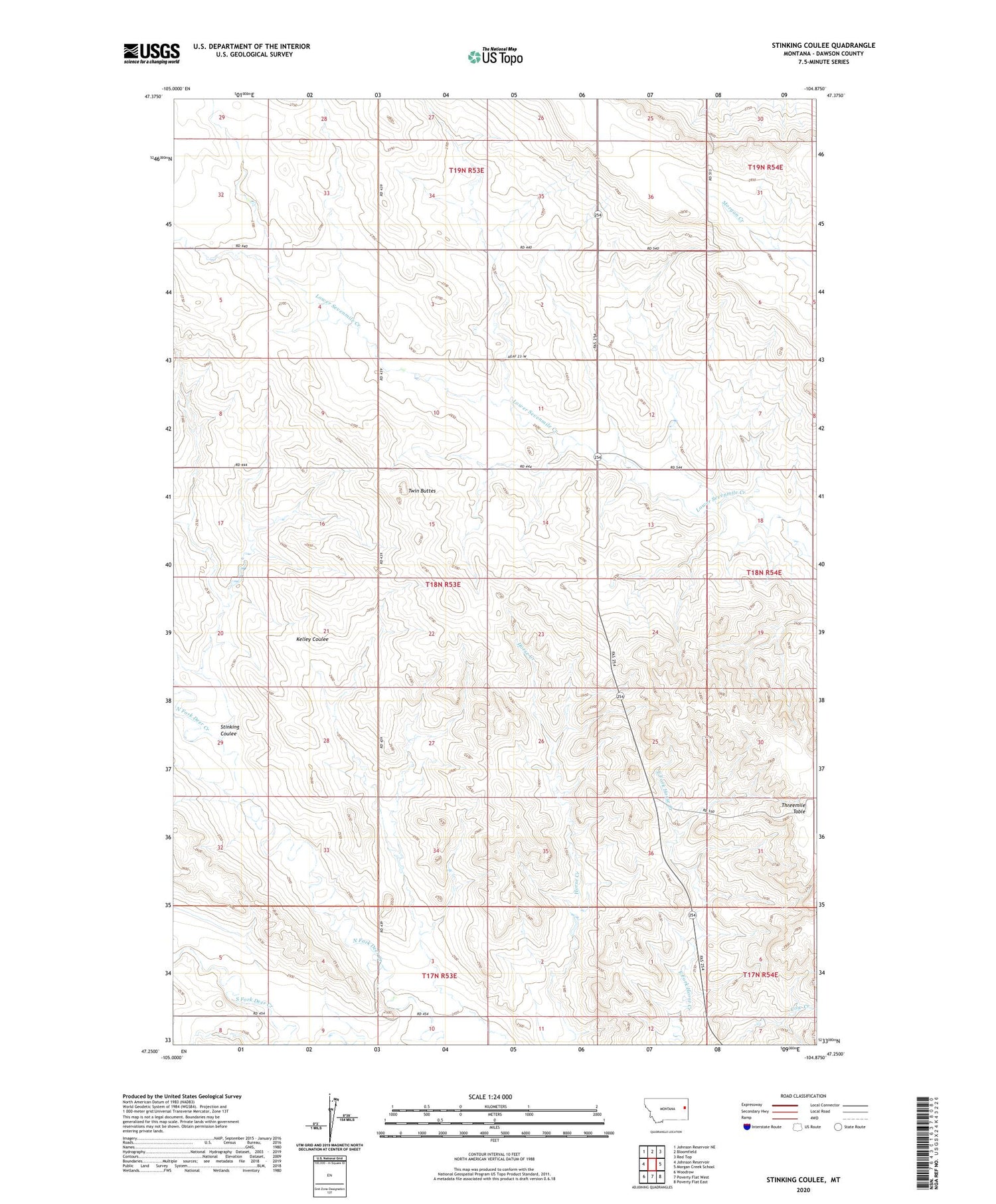
2020 topographic map quadrangle Stinking Coulee in the state of Montana. Scale: 1:24000. Based on the newly updated USGS 7.5' US Topo map series, this map is in the following counties: Dawson. The map contains contour data, water features, and other items you are used to seeing on USGS maps, but also has updated roads and other features. This is the next generation of topographic maps. Printed on high-quality waterproof paper with UV fade-resistant inks.
Quads adjacent to this one:
West: Johnson Reservoir
Northwest: Johnson Reservoir NE
North: Bloomfield
Northeast: Red Top
East: Morgan Creek School
Southeast: Poverty Flat East
South: Poverty Flat West
Southwest: Woodrow
Contains the following named places: 17N53E01CBAD01 Well, 17N53E02DBAC01 Well, 18N53E01DDDA01 Well, 18N53E12CCAC01 Well, 18N53E35CCCB01 Well, 18N54E30DDDB01 Well, 19N53E32DDDD01 Well, Brain Dam, Dahl School, Dawson County, Dickerson Dam, Iehl Dam, Johnson Reservoir Fishing Access Site, Kubesh Dam, North Fork Deer Creek, South Fork Deer Creek, Stinking Coulee, Thomas Post Office, Twin Buttes, Twin Buttes School


