MyTopo
Sunburst Montana US Topo Map
Couldn't load pickup availability
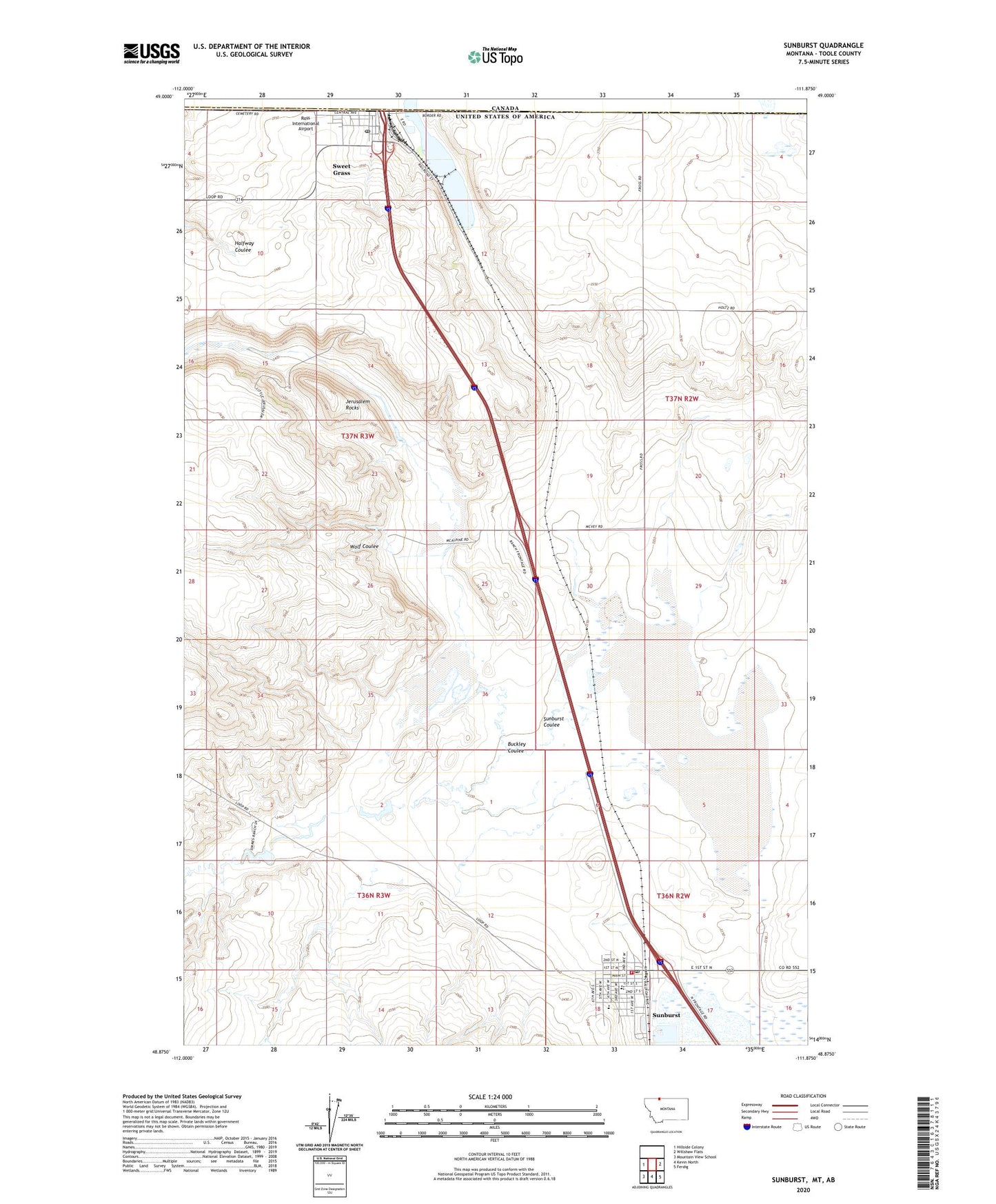
2020 topographic map quadrangle Sunburst in the state of Montana. Scale: 1:24000. Based on the newly updated USGS 7.5' US Topo map series, this map is in the following counties: Toole. The map contains contour data, water features, and other items you are used to seeing on USGS maps, but also has updated roads and other features. This is the next generation of topographic maps. Printed on high-quality waterproof paper with UV fade-resistant inks.
Quads adjacent to this one:
West: Hillside Colony
East: Willshaw Flats
Southeast: Ferdig
South: Kevin North
Southwest: Mountain View School
Contains the following named places: 36N02W08CDC_01 Well, 36N03W03CB__01 Well, 37N03W02AB__01 Well, 37N03W02AC__01 Well, 37N03W02BA__01 Well, 37N03W02BD__01 Well, 37N03W02BD__02 Well, 37N03W02CA__01 Well, 37N03W03CD__01 Well, 37N03W04AD__01 Well, 37N03W04DD__01 Well, 37N03W10BD__01 Well, 37N03W11CB__01 Well, 37N03W12CA__01 Well, 37N03W14AA__01 Well, 37N03W22AC__01 Well, 37N03W22DB__01 Well, 37N03W23AA__01 Well, Buckley Coulee, Engel Memorial Park, Grace Gospel Church, Harvest States Cooperatives Elevator, Hunky Dorie Dam, Jerusalem Rocks, Lutheran Church of Sunburst, Nagy Farms Incorporated Elevator, North Toole County Library, Oilfield Parish - United Methodist Church, Ross Airport, Saint Thomas Catholic Church, Sunburst, Sunburst Airport, Sunburst Coulee, Sunburst Elementary, Sunburst High School, Sunburst Post Office, Sunburst Volunteer Fire Department, Sweet Grass, Sweet Grass Census Designated Place, Sweetgrass Post Office, Sweetgrass Rest Area, Town of Sunburst, United States Customs and Border Protection Sweetgrass Port of Entry, Wolf Coulee