MyTopo
Mountain View School Montana US Topo Map
Couldn't load pickup availability
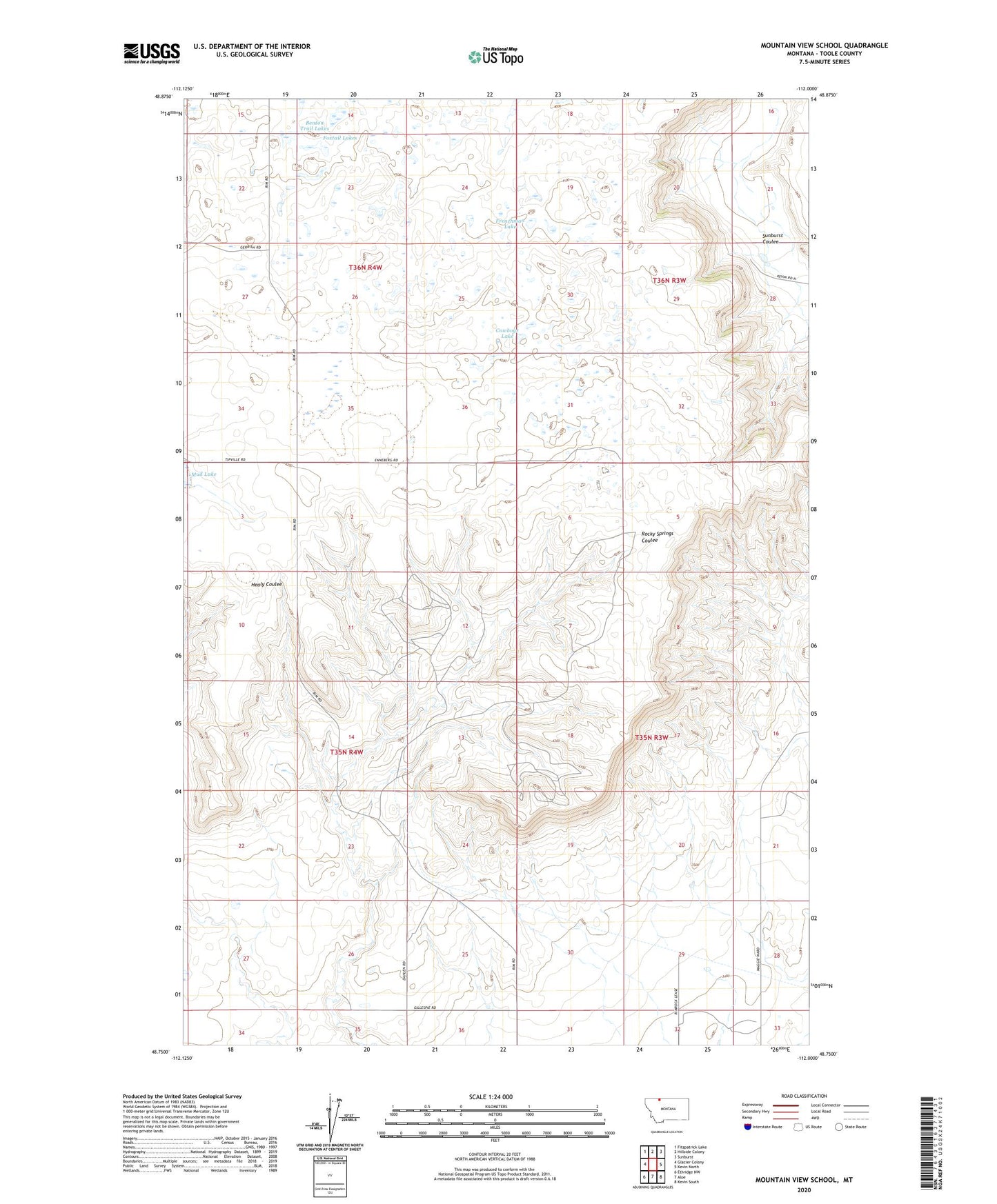
2024 topographic map quadrangle Mountain View School in the state of Montana. Scale: 1:24000. Based on the newly updated USGS 7.5' US Topo map series, this map is in the following counties: Toole. The map contains contour data, water features, and other items you are used to seeing on USGS maps, but also has updated roads and other features. This is the next generation of topographic maps. Printed on high-quality waterproof paper with UV fade-resistant inks.
Quads adjacent to this one:
West: Glacier Colony
Northwest: Fitzpatrick Lake
North: Hillside Colony
Northeast: Sunburst
East: Kevin North
Southeast: Kevin South
South: Aloe
Southwest: Ethridge NW
This map covers the same area as the classic USGS quad with code o48112g1.
Contains the following named places: 35N03W18CA__01 Well, 35N04W01DB__01 Well, 35N04W02CA__01 Well, 35N04W03AA__01 Well, 35N04W03AA__02 Well, 35N04W11AA__01 Well, 35N04W11DC__01 Well, 35N04W11DC__02 Well, 35N04W11DD__01 Well, 35N04W12BB__01 Well, 35N04W12BC__01 Well, 35N04W12BD__01 Well, 35N04W12BD__02 Well, 35N04W12CA__01 Well, 35N04W12CB__01 Well, 35N04W12CB__02 Well, 36N03W19BB__01 Well, 36N03W19CC__01 Well, 36N03W30CB__01 Well, 36N03W30DD__01 Well, 36N03W32CD__01 Well, 36N04W22AD__01 Well, 36N04W22DC__01 Well, 36N04W25AB__01 Well, 36N04W34AD__01 Well, 36N04W35AA__01 Well, 36N04W35AB__01 Well, 36N04W35AD__01 Well, 36N04W35AD__02 Well, 36N04W36DA__01 Well, Benton Trail Lakes, Cowboys Lake, Foxtail Lakes, Frenchman Lake, Kevin Sunburst Oil Field, Mountain View School, Rocky Springs