MyTopo
Sunflower Mountain Montana US Topo Map
Couldn't load pickup availability
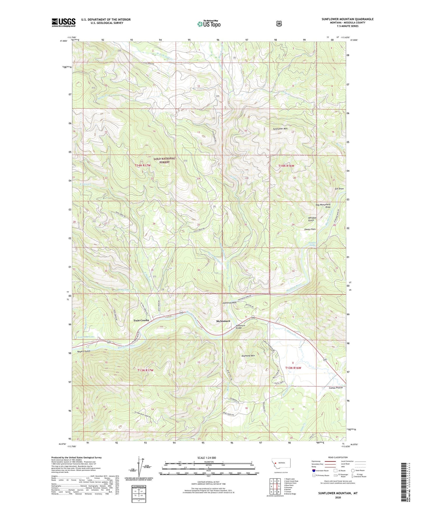
2020 topographic map quadrangle Sunflower Mountain in the state of Montana. Scale: 1:24000. Based on the newly updated USGS 7.5' US Topo map series, this map is in the following counties: Missoula. The map contains contour data, water features, and other items you are used to seeing on USGS maps, but also has updated roads and other features. This is the next generation of topographic maps. Printed on high-quality waterproof paper with UV fade-resistant inks.
Quads adjacent to this one:
West: Blue Point
Northwest: Wapiti Lake
North: Gold Creek Peak
Northeast: Belmont Point
East: Potomac
Southeast: Mineral Ridge
South: Clinton
Southwest: Bonner
Contains the following named places: Bear Creek, Blackfoot Junction, Burnt Bridge Creek, Cow Creek, Daigles Eddy, Daigles Eddy Fishing Access Site, Diamond Mountain, Dog Monument Draw, Douglas, East Twin Creek, Elk Draw, Game Creek, Gold Creek, Gold Creek Guard Station, Heyers Gulch, Johnsrud Park, Johnsrud Park Fishing Access Site, Johnsrud Park Recreation Site, K Ross Toole Fishing Access Site, Lepus Dam, Lockwood, Lockwood Lake, McNamara, McNamara Bridge, McNamara School, Norman Creek, Red Rocks Fishing Access Site, Sheep Flats, Sheep Flats Fishing Access Site, Spring Creek, Sunflower Mountain, Twin Creek Camp, Twin Creeks, Twin Creeks Census Designated Place, Twin Creeks Post Office, Union Creek, Wagner Creek, Warm Springs Creek, West Fork Gold Creek, West Twin Creek, Whiskey Gulch, Wild Horse Creek