MyTopo
The Horse Ranch Montana US Topo Map
Couldn't load pickup availability
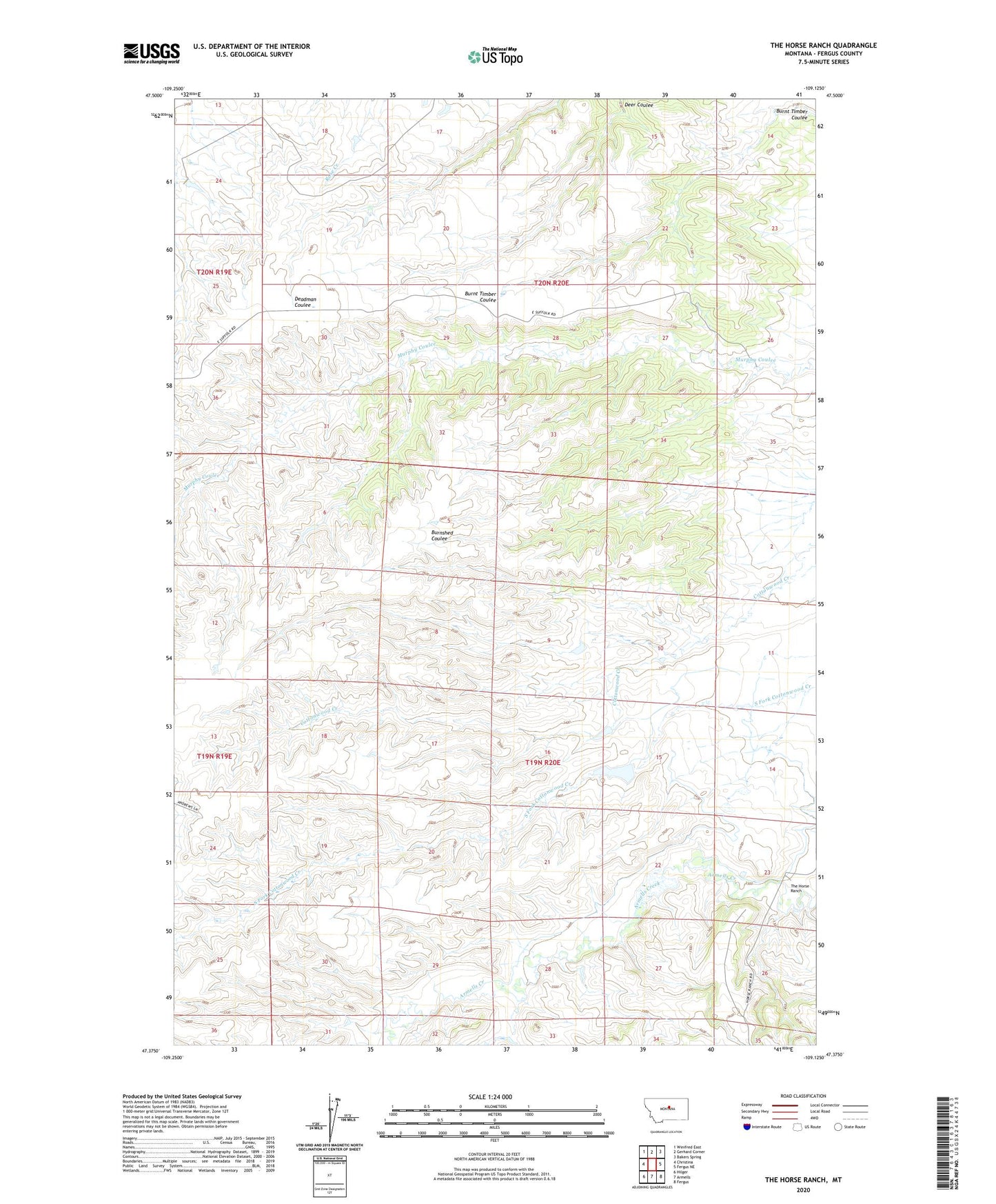
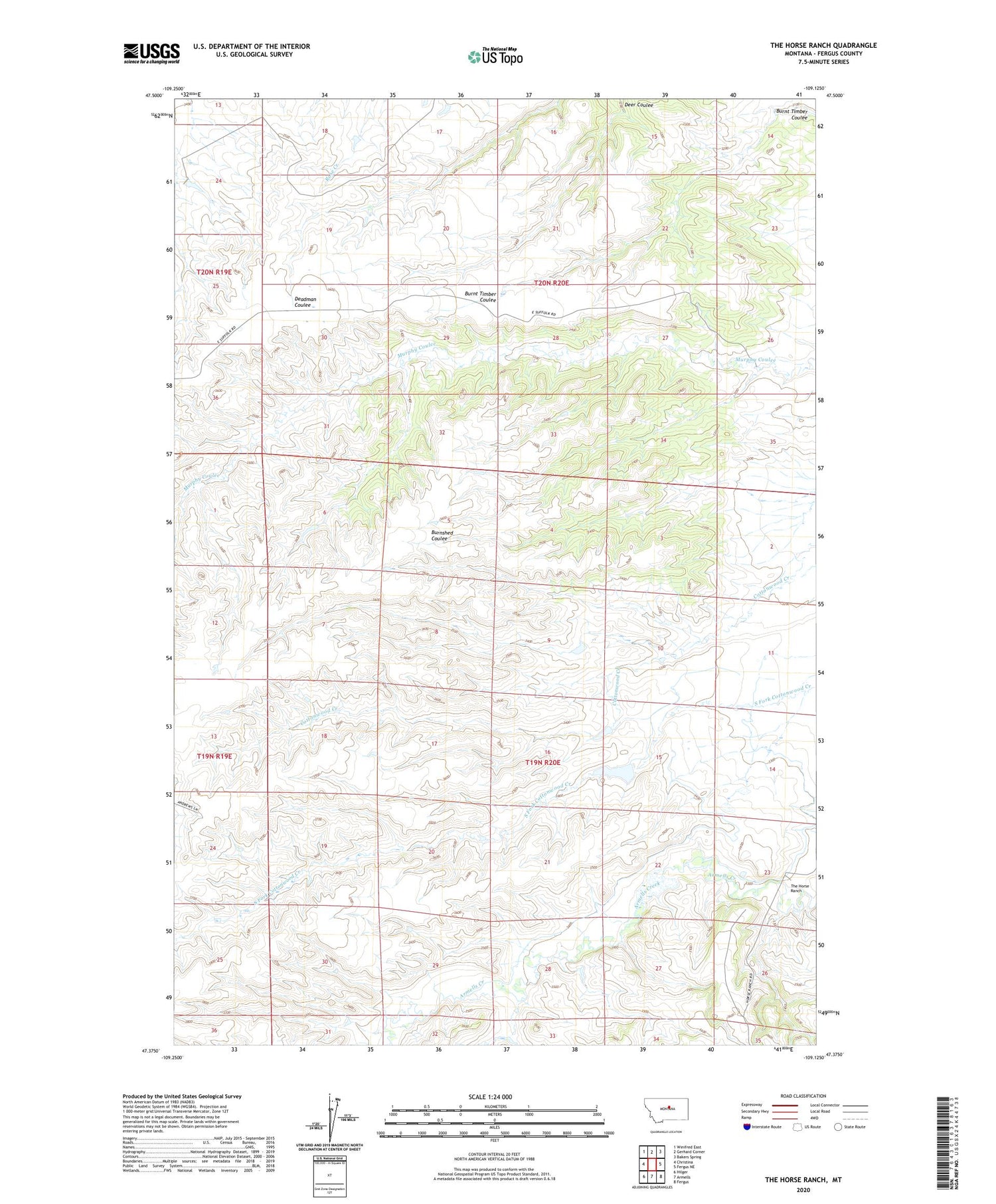
2020 topographic map quadrangle The Horse Ranch in the state of Montana. Scale: 1:24000. Based on the newly updated USGS 7.5' US Topo map series, this map is in the following counties: Fergus. The map contains contour data, water features, and other items you are used to seeing on USGS maps, but also has updated roads and other features. This is the next generation of topographic maps. Printed on high-quality waterproof paper with UV fade-resistant inks.
Quads adjacent to this one:
West: Christina
Northwest: Winifred East
North: Gerhard Corner
Northeast: Bakers Spring
East: Fergus NE
Southeast: Fergus
South: Armells
Southwest: Hilger
Contains the following named places: 19N20E10BC__01 Well, 19N20E11BCC_01 Well, 19N20E15AC__01 Well, 19N20E23BC__01 Well, 19N20E23BCB_01 Well, 19N20E23CD__01 Well, 19N20E23DB__01 Well, 19N20E26BD__01 Well, 20N20E17DCBB01 Well, Armells Reservoir Dam, Brush Creek School, Deer Coulee, Horse Ranch School, Maury School, Morris School, Taylor Fish Dam, Taylor Reservoir Dam, The Horse Ranch