MyTopo
Fergus NE Montana US Topo Map
Couldn't load pickup availability
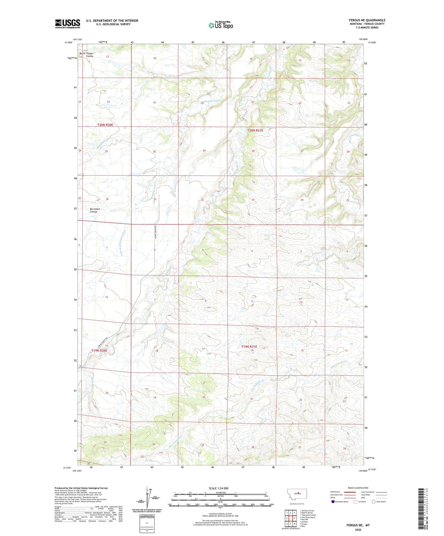
2024 topographic map quadrangle Fergus NE in the state of Montana. Scale: 1:24000. Based on the newly updated USGS 7.5' US Topo map series, this map is in the following counties: Fergus. The map contains contour data, water features, and other items you are used to seeing on USGS maps, but also has updated roads and other features. This is the next generation of topographic maps. Printed on high-quality waterproof paper with UV fade-resistant inks.
Quads adjacent to this one:
West: The Horse Ranch
Northwest: Gerhard Corner
North: Bakers Spring
Northeast: Thompson Coulee
East: Roy NW
Southeast: Roy
South: Fergus
Southwest: Armells
This map covers the same area as the classic USGS quad with code o47109d1.
Contains the following named places: 19N20E13DD__01 Well, 19N20E24DB__01 Well, 19N21E17BBA_01 Well, 20N21E19DA__01 Well, 20N21E26CA__01 Well, 20N21E29BC__01 Well, 20N21E29DA__01 Well, 20N21E32DB__01 Well, Burnshed Coulee, Cottonwood Creek, Petranek Dam, Petranek Reservoir Dam, Satterfield Dam, South Fork Cottonwood Creek